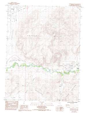
Churchill Butte Topo Map Nevada
To zoom in, hover over the map of Churchill Butte
USGS Topo Quad 39119c3 - 1:24,000 scale
| Topo Map Name: | Churchill Butte |
| USGS Topo Quad ID: | 39119c3 |
| Print Size: | ca. 21 1/4" wide x 27" high |
| Southeast Coordinates: | 39.25° N latitude / 119.25° W longitude |
| Map Center Coordinates: | 39.3125° N latitude / 119.3125° W longitude |
| U.S. State: | NV |
| Filename: | o39119c3.jpg |
| Download Map JPG Image: | Churchill Butte topo map 1:24,000 scale |
| Map Type: | Topographic |
| Topo Series: | 7.5´ |
| Map Scale: | 1:24,000 |
| Source of Map Images: | United States Geological Survey (USGS) |
| Alternate Map Versions: |
Churchill Butte NV 1985, updated 1985 Download PDF Buy paper map Churchill Butte NV 1985, updated 1993 Download PDF Buy paper map Churchill Butte NV 2011 Download PDF Buy paper map Churchill Butte NV 2015 Download PDF Buy paper map |
1:24,000 Topo Quads surrounding Churchill Butte
> Back to 39119a1 at 1:100,000 scale
> Back to 39118a1 at 1:250,000 scale
> Back to U.S. Topo Maps home
Churchill Butte topo map: Gazetteer
Churchill Butte: Canals
Houghman and Howard Ditch elevation 1296m 4251′Churchill Butte: Flats
Clifton Flat elevation 1425m 4675′Churchill Butte: Mines
B H and V Mine elevation 1431m 4694′Ruth Mine elevation 1544m 5065′
Churchill Butte: Parks
Fort Churchill Historic State Monument elevation 1297m 4255′Pony Bob Haslam Group Use Area elevation 1285m 4215′
Churchill Butte: Populated Places
Bucklands Station (historical) elevation 1278m 4192′Churchill elevation 1291m 4235′
Stagecoach elevation 1325m 4347′
Weeks (historical) elevation 1287m 4222′
Churchill Butte: Post Offices
Fort Churchill Post Office (historical) elevation 1297m 4255′Weeks Post Office (historical) elevation 1278m 4192′
Churchill Butte: Springs
Churchill Station Spring elevation 1299m 4261′Churchill Butte: Summits
Churchill Butte elevation 1807m 5928′Churchill Peak elevation 1831m 6007′
Churchill Butte: Trails
California Emigrant Trail elevation 1294m 4245′Churchill Butte: Valleys
Bull Canyon elevation 1369m 4491′Mineral Canyon elevation 1297m 4255′
Churchill Butte: Wells
Pony Express Well elevation 1304m 4278′Churchill Butte digital topo map on disk
Buy this Churchill Butte topo map showing relief, roads, GPS coordinates and other geographical features, as a high-resolution digital map file on DVD:


