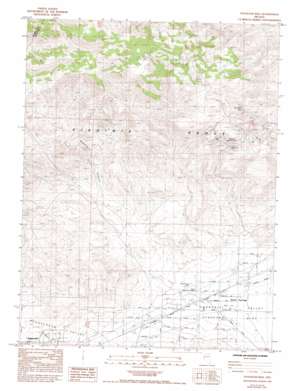
Stockton Well Topo Map Nevada
To zoom in, hover over the map of Stockton Well
USGS Topo Quad 39119d3 - 1:24,000 scale
| Topo Map Name: | Stockton Well |
| USGS Topo Quad ID: | 39119d3 |
| Print Size: | ca. 21 1/4" wide x 27" high |
| Southeast Coordinates: | 39.375° N latitude / 119.25° W longitude |
| Map Center Coordinates: | 39.4375° N latitude / 119.3125° W longitude |
| U.S. State: | NV |
| Filename: | o39119d3.jpg |
| Download Map JPG Image: | Stockton Well topo map 1:24,000 scale |
| Map Type: | Topographic |
| Topo Series: | 7.5´ |
| Map Scale: | 1:24,000 |
| Source of Map Images: | United States Geological Survey (USGS) |
| Alternate Map Versions: |
Stockton Well NV 1985, updated 1985 Download PDF Buy paper map Stockton Well NV 1985, updated 1993 Download PDF Buy paper map Stockton Flat Well NV 2011 Download PDF Buy paper map Stockton Flat Well NV 2015 Download PDF Buy paper map |
1:24,000 Topo Quads surrounding Stockton Well
> Back to 39119a1 at 1:100,000 scale
> Back to 39118a1 at 1:250,000 scale
> Back to U.S. Topo Maps home
Stockton Well topo map: Gazetteer
Stockton Well: Airports
Silver Springs Airport elevation 1291m 4235′Stockton Well: Flats
Stockton Flat elevation 1296m 4251′Stockton Well: Mines
Christianson Shaft elevation 1644m 5393′Dyke Adit elevation 1688m 5538′
Talapoosa Mines elevation 1634m 5360′
Stockton Well: Populated Places
Ramsey Station elevation 1344m 4409′Talapoosa elevation 1652m 5419′
Stockton Well: Springs
Rock Blind Spring elevation 1657m 5436′Stockton Well: Valleys
Ramsey Canyon elevation 1478m 4849′Stockton Well: Wells
Old Stockton Well elevation 1308m 4291′Stockton Flat Well elevation 1337m 4386′
Stockton Well digital topo map on disk
Buy this Stockton Well topo map showing relief, roads, GPS coordinates and other geographical features, as a high-resolution digital map file on DVD:


