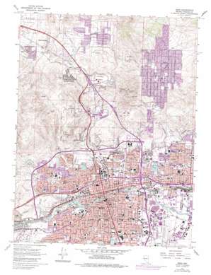
Reno Topo Map Nevada
To zoom in, hover over the map of Reno
USGS Topo Quad 39119e7 - 1:24,000 scale
| Topo Map Name: | Reno |
| USGS Topo Quad ID: | 39119e7 |
| Print Size: | ca. 21 1/4" wide x 27" high |
| Southeast Coordinates: | 39.5° N latitude / 119.75° W longitude |
| Map Center Coordinates: | 39.5625° N latitude / 119.8125° W longitude |
| U.S. State: | NV |
| Filename: | o39119e7.jpg |
| Download Map JPG Image: | Reno topo map 1:24,000 scale |
| Map Type: | Topographic |
| Topo Series: | 7.5´ |
| Map Scale: | 1:24,000 |
| Source of Map Images: | United States Geological Survey (USGS) |
| Alternate Map Versions: |
Reno NV 1967, updated 1971 Download PDF Buy paper map Reno NV 1967, updated 1976 Download PDF Buy paper map Reno NV 1967, updated 1983 Download PDF Buy paper map Reno NV 1967, updated 1983 Download PDF Buy paper map Reno NV 1974, updated 1976 Download PDF Buy paper map Reno NV 2012 Download PDF Buy paper map Reno NV 2015 Download PDF Buy paper map |
| FStopo: | US Forest Service topo Reno is available: Download FStopo PDF Download FStopo TIF |
1:24,000 Topo Quads surrounding Reno
> Back to 39119e1 at 1:100,000 scale
> Back to 39118a1 at 1:250,000 scale
> Back to U.S. Topo Maps home
Reno topo map: Gazetteer
Reno: Airports
Horizon Heliport elevation 1377m 4517′Nevada Department of Wildlife State Headquarters Heliport elevation 1372m 4501′
Saint Marys Hospital Heliport elevation 1378m 4520′
Skyline Airport (historical) elevation 1494m 4901′
Washoe Medical Center Heliport elevation 1363m 4471′
Reno: Bridges
Stoute Bridge (historical) elevation 1396m 4580′Reno: Canals
Highland Ditch elevation 1441m 4727′Lake Ditch elevation 1402m 4599′
Last Chance Ditch elevation 1421m 4662′
Prosser Valley Ditch elevation 1434m 4704′
Reno: Crossings
Keystone Interchange elevation 1391m 4563′North McCarran Interchange elevation 1388m 4553′
Parr Interchange elevation 1491m 4891′
US395B Interchange elevation 1548m 5078′
West McCarran Interchange elevation 1479m 4852′
Reno: Dams
East Wash Diversion Dam elevation 1482m 4862′Highland Reservoir Dam elevation 1426m 4678′
Lower Peavine Creek Dam elevation 1454m 4770′
Upper Peavine Creek Dam elevation 1522m 4993′
West Wash Dam elevation 1452m 4763′
Reno: Gaps
Railroad Pass elevation 1579m 5180′Reno: Islands
Scott Island elevation 1360m 4461′Reno: Mines
Arkell Mine elevation 1404m 4606′Black Panther Mine elevation 1667m 5469′
Emma Mine elevation 1701m 5580′
Recall Mine elevation 1615m 5298′
Reno Mizpah Mine elevation 1534m 5032′
Updike Mine elevation 1494m 4901′
Wedekind Mine elevation 1414m 4639′
Reno: Parks
Ardmore Park elevation 1349m 4425′Baker Park elevation 1365m 4478′
Brodhead Memorial Park elevation 1363m 4471′
Burgess Park elevation 1348m 4422′
Caughlin Park elevation 1391m 4563′
Deer Park elevation 1351m 4432′
Evans Park elevation 1376m 4514′
Fishermans Park elevation 1354m 4442′
Governors Bowl Park elevation 1365m 4478′
Idlewild Park elevation 1378m 4520′
Irving Park elevation 1409m 4622′
Lake Park elevation 1426m 4678′
Newlands Circle elevation 1395m 4576′
Northwest Park elevation 1458m 4783′
Oppio Park elevation 1357m 4452′
Paradise Park elevation 1358m 4455′
Pickett Park elevation 1363m 4471′
Rancho San Rafael Park elevation 1434m 4704′
Riverside Park elevation 1371m 4498′
Rock Park elevation 1345m 4412′
Stewart Park elevation 1369m 4491′
Sun Valley Park elevation 1424m 4671′
Taylor Memorial Park elevation 1380m 4527′
Whitaker Park elevation 1394m 4573′
Wilkinson Park elevation 1358m 4455′
Wingfield Park elevation 1370m 4494′
Reno: Populated Places
Golden Valley elevation 1554m 5098′Grand View Terrace elevation 1575m 5167′
Martin elevation 1608m 5275′
Mayberry-Highland Park elevation 1440m 4724′
North Valley elevation 1402m 4599′
Panther Valley elevation 1538m 5045′
Raleigh Heights elevation 1603m 5259′
Reno elevation 1373m 4504′
Sparks elevation 1345m 4412′
Sun Valley elevation 1440m 4724′
West Reno elevation 1394m 4573′
Reno: Post Offices
Air Mail Field Post Office (historical) elevation 1383m 4537′Auburn Post Office elevation 1363m 4471′
Black Springs Branch Post Office (historical) elevation 1575m 5167′
Galena Station Post Office elevation 1357m 4452′
Peavine Station Post Office (historical) elevation 1366m 4481′
Reno Downtown Station Post Office elevation 1367m 4484′
Reno Main Post Office elevation 1351m 4432′
Sparks Post Office elevation 1346m 4416′
Sun Valley Branch Post Office elevation 1450m 4757′
University Station Post Office elevation 1391m 4563′
Washington Station Post Office elevation 1409m 4622′
Reno: Ranges
Junction House Range elevation 1652m 5419′Reno: Reservoirs
East Wash Reservoir elevation 1482m 4862′Highland Reservoir elevation 1426m 4678′
Lower Peavine Creek Reservoir elevation 1454m 4770′
Manzanita Lake elevation 1386m 4547′
Upper Peavine Creek Reservoir elevation 1522m 4993′
Virginia Lake elevation 1363m 4471′
West Wash Reservoir elevation 1452m 4763′
Reno: Streams
Alum Creek elevation 1391m 4563′Peavine Creek elevation 1462m 4796′
Reno: Valleys
Golden Valley elevation 1537m 5042′Kelly Ravine elevation 1535m 5036′
Lingle Ravine elevation 1531m 5022′
Norton Canyon elevation 1482m 4862′
Panther Valley elevation 1533m 5029′
Sun Valley elevation 1366m 4481′
Reno digital topo map on disk
Buy this Reno topo map showing relief, roads, GPS coordinates and other geographical features, as a high-resolution digital map file on DVD:


