Reno Ne Topo Map Nevada
To zoom in, hover over the map of Reno Ne
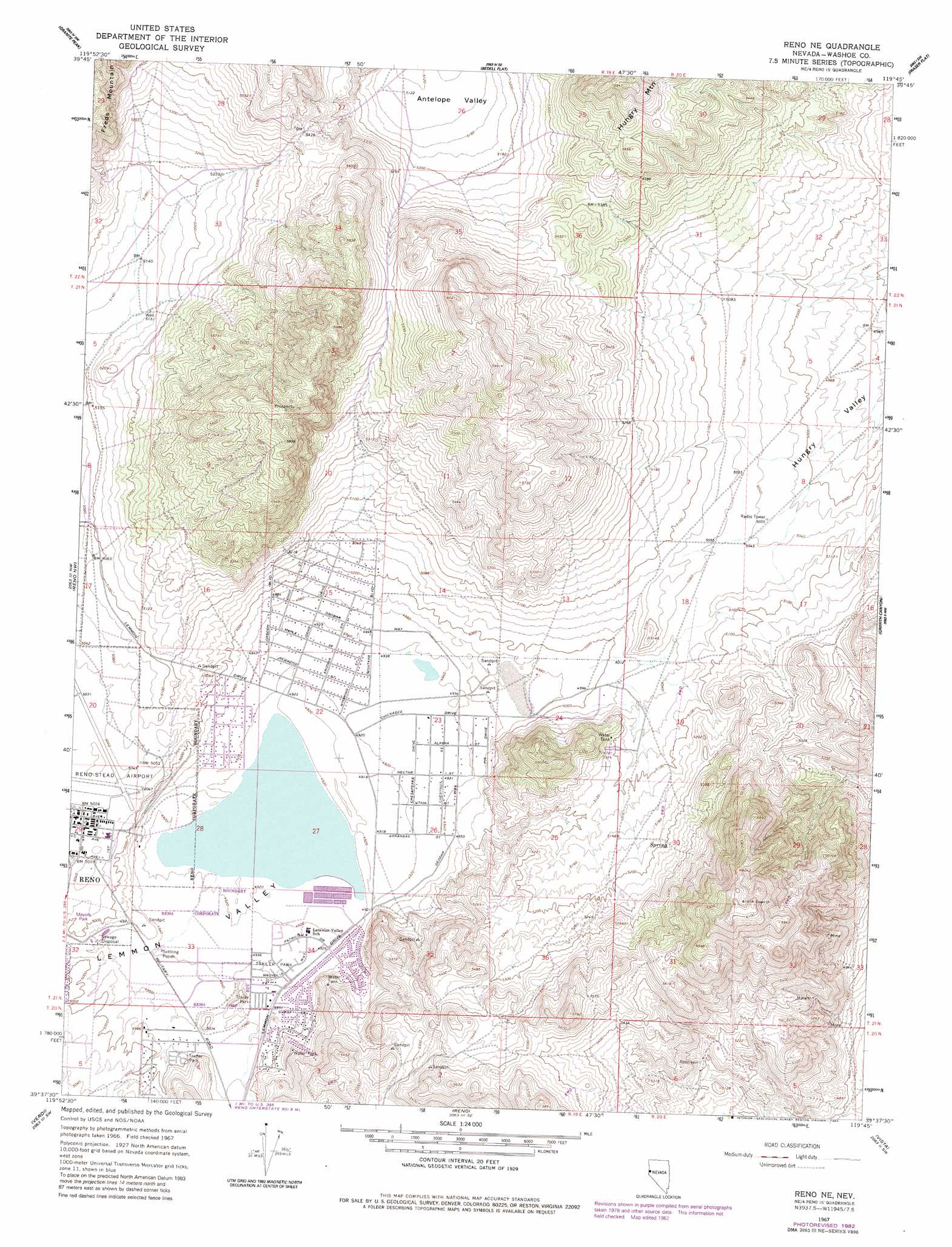
USGS Topo Quad 39119f7 - 1:24,000 scale
| Topo Map Name: | Reno Ne |
| USGS Topo Quad ID: | 39119f7 |
| Print Size: | ca. 21 1/4" wide x 27" high |
| Southeast Coordinates: | 39.625° N latitude / 119.75° W longitude |
| Map Center Coordinates: | 39.6875° N latitude / 119.8125° W longitude |
| U.S. State: | NV |
| Filename: | o39119f7.jpg |
| Download Map JPG Image: | Reno Ne topo map 1:24,000 scale |
| Map Type: | Topographic |
| Topo Series: | 7.5´ |
| Map Scale: | 1:24,000 |
| Source of Map Images: | United States Geological Survey (USGS) |
| Alternate Map Versions: |
Reno NE NV 1967, updated 1970 Download PDF Buy paper map Reno NE NV 1967, updated 1976 Download PDF Buy paper map Reno NE NV 1967, updated 1983 Download PDF Buy paper map Reno NE NV 2011 Download PDF Buy paper map Reno NE NV 2014 Download PDF Buy paper map |
1:24,000 Topo Quads surrounding Reno Ne
Constantia |
Dogskin Mountain |
Tule Peak |
Sutcliffe |
|
Beckwourth Pass |
Granite Peak |
Bedell Flat |
Fraser Flat |
Moses Rock |
Evans Canyon |
Reno Nw |
Reno Ne |
Griffith Canyon |
Spanish Springs Peak |
Dog Valley |
Verdi |
Reno |
Vista |
Patrick |
Boca |
Mount Rose Nw |
Mount Rose Ne |
Steamboat |
Chalk Hills |
> Back to 39119e1 at 1:100,000 scale
> Back to 39118a1 at 1:250,000 scale
> Back to U.S. Topo Maps home
Reno Ne topo map: Gazetteer
Reno Ne: Airports
Youngberg Ranch Airport elevation 1510m 4954′Reno Ne: Lakes
Swan Lake elevation 1498m 4914′Reno Ne: Parks
Mayors Park elevation 1529m 5016′Reno Ne: Populated Places
Lemmon Valley elevation 1512m 4960′Reno Ne: Post Offices
Lemmon Valley Rural Branch Post Office (historical) elevation 1512m 4960′Reno Ne: Ridges
Coyote Ridge elevation 1833m 6013′Juniper Ridge elevation 1838m 6030′
Reno Ne digital topo map on disk
Buy this Reno Ne topo map showing relief, roads, GPS coordinates and other geographical features, as a high-resolution digital map file on DVD: