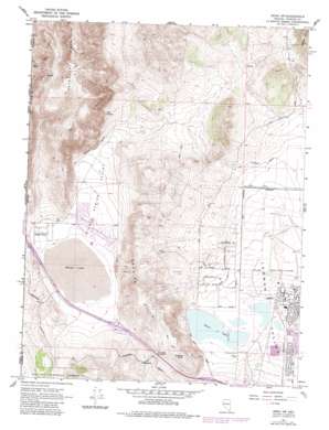
Reno Nw Topo Map Nevada
To zoom in, hover over the map of Reno Nw
USGS Topo Quad 39119f8 - 1:24,000 scale
| Topo Map Name: | Reno Nw |
| USGS Topo Quad ID: | 39119f8 |
| Print Size: | ca. 21 1/4" wide x 27" high |
| Southeast Coordinates: | 39.625° N latitude / 119.875° W longitude |
| Map Center Coordinates: | 39.6875° N latitude / 119.9375° W longitude |
| U.S. States: | NV, CA |
| Filename: | o39119f8.jpg |
| Download Map JPG Image: | Reno Nw topo map 1:24,000 scale |
| Map Type: | Topographic |
| Topo Series: | 7.5´ |
| Map Scale: | 1:24,000 |
| Source of Map Images: | United States Geological Survey (USGS) |
| Alternate Map Versions: |
Reno NW NV 1967, updated 1971 Download PDF Buy paper map Reno NW NV 1967, updated 1976 Download PDF Buy paper map Reno NW NV 1967, updated 1983 Download PDF Buy paper map Reno NW NV 2012 Download PDF Buy paper map Reno NW NV 2015 Download PDF Buy paper map |
| FStopo: | US Forest Service topo Reno NW is available: Download FStopo PDF Download FStopo TIF |
1:24,000 Topo Quads surrounding Reno Nw
> Back to 39119e1 at 1:100,000 scale
> Back to 39118a1 at 1:250,000 scale
> Back to U.S. Topo Maps home
Reno Nw topo map: Gazetteer
Reno Nw: Airports
Reno-Stead Airport elevation 1533m 5029′Reno Nw: Basins
Lemmon Valley elevation 1515m 4970′Reno Nw: Crossings
Border Town Interchange elevation 1545m 5068′Cold Springs Valley Interchange elevation 1560m 5118′
Red Rock Interchange elevation 1547m 5075′
Reno Nw: Flats
White Lake elevation 1533m 5029′Reno Nw: Gaps
Dry Lake Summit elevation 1654m 5426′Reno Nw: Lakes
Silver Lake elevation 1509m 4950′Reno Nw: Mines
Antelope Mine elevation 1814m 5951′Granite Hill Mine elevation 1555m 5101′
Reno Nw: Parks
Cold Spring Park elevation 1542m 5059′Silver Knolls Park elevation 1567m 5141′
Reno Nw: Populated Places
Border Town elevation 1541m 5055′Cold Springs elevation 1542m 5059′
Copperfield elevation 1656m 5433′
Heinz (historical) elevation 1559m 5114′
Reno-Stead elevation 1529m 5016′
Reno Nw: Post Offices
Francis Post Office (historical) elevation 1621m 5318′Heinz Post Office elevation 1559m 5114′
Sierra Station Post Office elevation 1518m 4980′
Stead Air Force Base Branch Post Office (historical) elevation 1532m 5026′
Stead Station Post Office (historical) elevation 1532m 5026′
Reno Nw: Springs
Cold Spring elevation 1720m 5643′Pump Spring elevation 1930m 6332′
Reno Nw: Streams
Jones Creek elevation 1582m 5190′Reno Nw: Summits
Granite Hills elevation 1799m 5902′Granite Peak elevation 1734m 5688′
Reno Nw: Valleys
Cold Spring Valley elevation 1536m 5039′Laughton Valley elevation 1541m 5055′
Reno Nw digital topo map on disk
Buy this Reno Nw topo map showing relief, roads, GPS coordinates and other geographical features, as a high-resolution digital map file on DVD:


