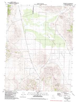
Fraser Flat Topo Map Nevada
To zoom in, hover over the map of Fraser Flat
USGS Topo Quad 39119g6 - 1:24,000 scale
| Topo Map Name: | Fraser Flat |
| USGS Topo Quad ID: | 39119g6 |
| Print Size: | ca. 21 1/4" wide x 27" high |
| Southeast Coordinates: | 39.75° N latitude / 119.625° W longitude |
| Map Center Coordinates: | 39.8125° N latitude / 119.6875° W longitude |
| U.S. State: | NV |
| Filename: | o39119g6.jpg |
| Download Map JPG Image: | Fraser Flat topo map 1:24,000 scale |
| Map Type: | Topographic |
| Topo Series: | 7.5´ |
| Map Scale: | 1:24,000 |
| Source of Map Images: | United States Geological Survey (USGS) |
| Alternate Map Versions: |
Fraser Flat NV 1980, updated 1980 Download PDF Buy paper map Fraser Flat NV 1980, updated 1984 Download PDF Buy paper map Fraser Flat NV 1980, updated 1984 Download PDF Buy paper map Fraser Flat NV 2011 Download PDF Buy paper map Fraser Flat NV 2014 Download PDF Buy paper map |
1:24,000 Topo Quads surrounding Fraser Flat
> Back to 39119e1 at 1:100,000 scale
> Back to 39118a1 at 1:250,000 scale
> Back to U.S. Topo Maps home
Fraser Flat topo map: Gazetteer
Fraser Flat: Airports
Air Sailing Gliderport elevation 1308m 4291′Palomino Airport elevation 1290m 4232′
Fraser Flat: Flats
Bacon Rind Flat elevation 1407m 4616′Fraser Flat elevation 1308m 4291′
Fraser Flat: Mines
Ruth Mine elevation 1368m 4488′Fraser Flat: Springs
Butler Spring elevation 1412m 4632′Coyote Spring elevation 1372m 4501′
Hungry Spring elevation 1477m 4845′
Warm Springs elevation 1291m 4235′
Willow Spring elevation 1409m 4622′
Fraser Flat: Streams
Cottonwood Creek elevation 1285m 4215′Fraser Flat: Summits
Kimberly Hill elevation 1553m 5095′Twentyone Mile Hill elevation 1388m 4553′
Fraser Flat: Valleys
Hungry Valley elevation 1335m 4379′Rattlesnake Canyon elevation 1339m 4393′
Fraser Flat digital topo map on disk
Buy this Fraser Flat topo map showing relief, roads, GPS coordinates and other geographical features, as a high-resolution digital map file on DVD:


