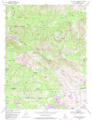
Wentworth Springs Topo Map California
To zoom in, hover over the map of Wentworth Springs
USGS Topo Quad 39120a3 - 1:24,000 scale
| Topo Map Name: | Wentworth Springs |
| USGS Topo Quad ID: | 39120a3 |
| Print Size: | ca. 21 1/4" wide x 27" high |
| Southeast Coordinates: | 39° N latitude / 120.25° W longitude |
| Map Center Coordinates: | 39.0625° N latitude / 120.3125° W longitude |
| U.S. State: | CA |
| Filename: | o39120a3.jpg |
| Download Map JPG Image: | Wentworth Springs topo map 1:24,000 scale |
| Map Type: | Topographic |
| Topo Series: | 7.5´ |
| Map Scale: | 1:24,000 |
| Source of Map Images: | United States Geological Survey (USGS) |
| Alternate Map Versions: |
Wentworth Springs CA 1953, updated 1955 Download PDF Buy paper map Wentworth Springs CA 1953, updated 1959 Download PDF Buy paper map Wentworth Springs CA 1953, updated 1974 Download PDF Buy paper map Wentworth Springs CA 1953, updated 1975 Download PDF Buy paper map Wentworth Springs CA 1953, updated 1985 Download PDF Buy paper map Wentworth Springs CA 2012 Download PDF Buy paper map Wentworth Springs CA 2015 Download PDF Buy paper map |
| FStopo: | US Forest Service topo Wentworth Springs is available: Download FStopo PDF Download FStopo TIF |
1:24,000 Topo Quads surrounding Wentworth Springs
> Back to 39120a1 at 1:100,000 scale
> Back to 39120a1 at 1:250,000 scale
> Back to U.S. Topo Maps home
Wentworth Springs topo map: Gazetteer
Wentworth Springs: Areas
Big Sluice Box elevation 2010m 6594′Little Sluice Box elevation 2032m 6666′
Wentworth Springs: Basins
Laddies Cove elevation 2047m 6715′Upper Hell Hole elevation 1397m 4583′
Wentworth Springs: Cliffs
Red Cliffs elevation 2182m 7158′Wentworth Springs: Crossings
Diamond Crossing elevation 1827m 5994′Wentworth Springs: Dams
Buck Island 1009-008 Dam elevation 1956m 6417′Loon Lake 1009-007 Dam elevation 1938m 6358′
Wentworth Springs: Flats
Buck Meadow elevation 1946m 6384′Buck Meadow (historical) elevation 1397m 4583′
Dellar Meadow elevation 2140m 7020′
Hells Half Acre elevation 1953m 6407′
Little McKinstry Meadow elevation 1930m 6332′
McKinstry Meadow elevation 2112m 6929′
Mountain Meadow elevation 2130m 6988′
Neck Meadow elevation 1790m 5872′
Wentworth Springs: Lakes
Bugle Lake elevation 2104m 6902′Fawn Lake elevation 1935m 6348′
Fern Lake elevation 1910m 6266′
Hidden Lake elevation 2102m 6896′
Lake Winifred elevation 2092m 6863′
Long Lake elevation 1911m 6269′
McKinstry Lake elevation 2106m 6909′
Mud Lake elevation 2110m 6922′
Mud Lake elevation 2036m 6679′
Mud Lakes elevation 2018m 6620′
Spider Lake elevation 2047m 6715′
Wentworth Springs: Reservoirs
Buck Island Lake elevation 1956m 6417′Loon Lake elevation 1938m 6358′
Wentworth Springs: Springs
Hunters Spring elevation 1886m 6187′Joes Spring elevation 2063m 6768′
Mineral Springs elevation 1839m 6033′
Wentworth Springs elevation 1834m 6017′
Wentworth Springs: Streams
Barker Creek elevation 1488m 4881′Bear Pen Creek elevation 1828m 5997′
Buckskin Creek elevation 1778m 5833′
Ellis Creek elevation 1945m 6381′
Five Lakes Creek elevation 1400m 4593′
Grayhorse Creek elevation 1398m 4586′
Jerrett Creek elevation 1793m 5882′
Little Powderhorn Creek elevation 1799m 5902′
Miller Creek elevation 1837m 6026′
Powderhorn Creek elevation 1836m 6023′
West Meadow Creek elevation 1671m 5482′
Willow Creek elevation 1877m 6158′
Wentworth Springs: Summits
Devils Peak elevation 2296m 7532′Guide Peak elevation 2329m 7641′
Jerrett Peak elevation 2287m 7503′
Little Steamboat Mountain elevation 2075m 6807′
McKinstry Peak elevation 2415m 7923′
Red Mountain elevation 2088m 6850′
Steamboat Mountain elevation 2236m 7335′
The Pinnacles elevation 2306m 7565′
Wentworth Springs: Trails
McKinstry Trail elevation 1732m 5682′Steamboat Trail elevation 2136m 7007′
Wentworth Springs: Valleys
Barts Valley elevation 1888m 6194′Bear Den Canyon elevation 1879m 6164′
Grayhorse Valley elevation 1400m 4593′
Steamboat Canyon elevation 1607m 5272′
Wentworth Springs digital topo map on disk
Buy this Wentworth Springs topo map showing relief, roads, GPS coordinates and other geographical features, as a high-resolution digital map file on DVD:


