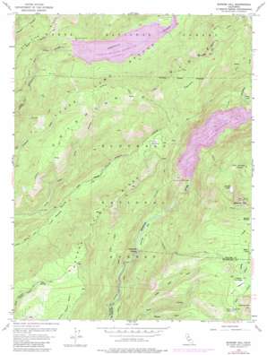
Bunker Hill Topo Map California
To zoom in, hover over the map of Bunker Hill
USGS Topo Quad 39120a4 - 1:24,000 scale
| Topo Map Name: | Bunker Hill |
| USGS Topo Quad ID: | 39120a4 |
| Print Size: | ca. 21 1/4" wide x 27" high |
| Southeast Coordinates: | 39° N latitude / 120.375° W longitude |
| Map Center Coordinates: | 39.0625° N latitude / 120.4375° W longitude |
| U.S. State: | CA |
| Filename: | o39120a4.jpg |
| Download Map JPG Image: | Bunker Hill topo map 1:24,000 scale |
| Map Type: | Topographic |
| Topo Series: | 7.5´ |
| Map Scale: | 1:24,000 |
| Source of Map Images: | United States Geological Survey (USGS) |
| Alternate Map Versions: |
Bunker Hill CA 1953, updated 1955 Download PDF Buy paper map Bunker Hill CA 1953, updated 1962 Download PDF Buy paper map Bunker Hill CA 1953, updated 1975 Download PDF Buy paper map Bunker Hill CA 1953, updated 1975 Download PDF Buy paper map Bunker Hill CA 1953, updated 1984 Download PDF Buy paper map Bunker Hill CA 2012 Download PDF Buy paper map Bunker Hill CA 2015 Download PDF Buy paper map |
| FStopo: | US Forest Service topo Bunker Hill is available: Download FStopo PDF Download FStopo TIF |
1:24,000 Topo Quads surrounding Bunker Hill
> Back to 39120a1 at 1:100,000 scale
> Back to 39120a1 at 1:250,000 scale
> Back to U.S. Topo Maps home
Bunker Hill topo map: Gazetteer
Bunker Hill: Bars
Parsley Bar elevation 1240m 4068′Bunker Hill: Canals
Red Star Mining Ditch (historical) elevation 1536m 5039′Bunker Hill: Crossings
Parsley Bar Crossing elevation 1232m 4041′Bunker Hill: Dams
L L Anderson 1030 Dam elevation 1592m 5223′L L Anderson Dam elevation 1550m 5085′
Lower Hell Hole 1030-002 Dam elevation 1347m 4419′
Red Star Dam (historical) elevation 1536m 5039′
Bunker Hill: Flats
Big Meadow elevation 1629m 5344′Bunker Meadow elevation 1990m 6528′
Gerle Meadow elevation 1786m 5859′
Jacobsen Meadow elevation 1784m 5853′
Little Mountain Meadow elevation 1952m 6404′
Lower Hell Hole (historical) elevation 1397m 4583′
Lower Meadow elevation 1383m 4537′
Bunker Hill: Lakes
Bunker Lake elevation 1995m 6545′Lagoon Lake elevation 1522m 4993′
Bunker Hill: Mines
McGuire Mine (historical) elevation 1592m 5223′Bunker Hill: Populated Places
Gilberts elevation 1725m 5659′Jacobsen (historical) elevation 1786m 5859′
Bunker Hill: Reservoirs
French Meadows Reservoir elevation 1592m 5223′French Meadows Reservoir elevation 1550m 5085′
Hell Hole Reservoir elevation 1347m 4419′
Hell Hole Reservoir elevation 1397m 4583′
Bunker Hill: Ridges
Chipmunk Ridge elevation 1967m 6453′Red Star Ridge elevation 1737m 5698′
Bunker Hill: Springs
Bear Springs elevation 1705m 5593′Big Rock Spring elevation 1803m 5915′
Bunker Hill: Streams
Barts Creek elevation 1783m 5849′Charles Creek elevation 1536m 5039′
Cottonwood Creek elevation 1927m 6322′
Dellar Creek elevation 1779m 5836′
Little Deer Creek elevation 1530m 5019′
Long John Creek elevation 1222m 4009′
Bunker Hill: Summits
Bunker Hill elevation 2300m 7545′Johnnys Hill elevation 1994m 6541′
Wallace Peak elevation 1863m 6112′
Bunker Hill: Trails
Baumann Trail elevation 1646m 5400′Chipmunk Trail elevation 1790m 5872′
Dellar Trail elevation 1711m 5613′
Hunters Trail elevation 1265m 4150′
Lagoon Trail elevation 1820m 5971′
Parsley Bar Trail elevation 1766m 5793′
Rubicon Trail elevation 1255m 4117′
Bunker Hill digital topo map on disk
Buy this Bunker Hill topo map showing relief, roads, GPS coordinates and other geographical features, as a high-resolution digital map file on DVD:


