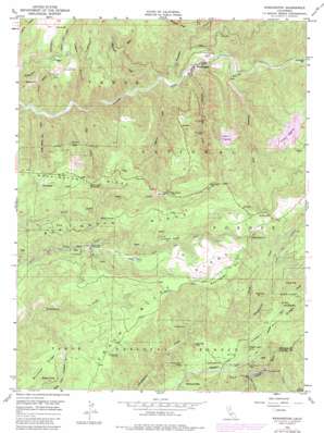
Washington Topo Map California
To zoom in, hover over the map of Washington
USGS Topo Quad 39120c7 - 1:24,000 scale
| Topo Map Name: | Washington |
| USGS Topo Quad ID: | 39120c7 |
| Print Size: | ca. 21 1/4" wide x 27" high |
| Southeast Coordinates: | 39.25° N latitude / 120.75° W longitude |
| Map Center Coordinates: | 39.3125° N latitude / 120.8125° W longitude |
| U.S. State: | CA |
| Filename: | o39120c7.jpg |
| Download Map JPG Image: | Washington topo map 1:24,000 scale |
| Map Type: | Topographic |
| Topo Series: | 7.5´ |
| Map Scale: | 1:24,000 |
| Source of Map Images: | United States Geological Survey (USGS) |
| Alternate Map Versions: |
Washington CA 1950, updated 1960 Download PDF Buy paper map Washington CA 1950, updated 1968 Download PDF Buy paper map Washington CA 1950, updated 1968 Download PDF Buy paper map Washington CA 1950, updated 1980 Download PDF Buy paper map Washington CA 1950, updated 1983 Download PDF Buy paper map Washington CA 1951 Download PDF Buy paper map Washington CA 2000, updated 2003 Download PDF Buy paper map Washington CA 2012 Download PDF Buy paper map Washington CA 2015 Download PDF Buy paper map |
| FStopo: | US Forest Service topo Washington is available: Download FStopo PDF Download FStopo TIF |
1:24,000 Topo Quads surrounding Washington
> Back to 39120a1 at 1:100,000 scale
> Back to 39120a1 at 1:250,000 scale
> Back to U.S. Topo Maps home
Washington topo map: Gazetteer
Washington: Canals
Upper Boardman Canal elevation 1339m 4393′Washington: Cliffs
Excelsior elevation 1223m 4012′Lupine Point elevation 1184m 3884′
Pleasant Point elevation 1110m 3641′
Washington: Dams
New Drum Afterbay 97-128 Dam elevation 1013m 3323′Washington: Flats
Deadmans Flat elevation 1222m 4009′Holbrook Flat elevation 870m 2854′
Skillman Flat elevation 1364m 4475′
Washington: Mines
Alpha Diggings elevation 1204m 3950′Blue Lead Mine elevation 1136m 3727′
Giant King Mine elevation 999m 3277′
King Woolford Mill Site elevation 1301m 4268′
Mammoth Spring Mine elevation 1174m 3851′
Omega Diggings elevation 1231m 4038′
Rose Mountain Mine elevation 1196m 3923′
Swamp Angel Mine elevation 1159m 3802′
Zeibright Mine elevation 1255m 4117′
Washington: Populated Places
Alpha (historical) elevation 1260m 4133′Democrat (historical) elevation 1271m 4169′
Junction House elevation 1330m 4363′
Relief elevation 1203m 3946′
Remington Hill (historical) elevation 1235m 4051′
Washington elevation 805m 2641′
Washington: Ridges
Burlington Ridge elevation 1342m 4402′Chalk Bluff Ridge elevation 1300m 4265′
Washington: Springs
Big Tunnel Spring elevation 1440m 4724′Buckeye Spring elevation 1135m 3723′
Demory Spring elevation 1392m 4566′
Indian Spring elevation 1326m 4350′
Sardine Spring elevation 1511m 4957′
Washington: Streams
Canyon Creek elevation 865m 2837′Deadman Creek elevation 891m 2923′
Fish Creek elevation 729m 2391′
Jefferson Creek elevation 761m 2496′
Little Brown Bear Creek elevation 719m 2358′
McKilligan Creek elevation 761m 2496′
North Fork Steephollow Creek elevation 1069m 3507′
Poorman Creek elevation 772m 2532′
Roscoe Creek elevation 998m 3274′
Scotchman Creek elevation 813m 2667′
Thimbleberry Creek elevation 1082m 3549′
Washington Creek elevation 787m 2582′
Washington: Summits
McGuire Mountain elevation 1352m 4435′Negro Jack Hill elevation 1401m 4596′
Remington Hill elevation 1477m 4845′
Washington: Valleys
Devils Canyon elevation 881m 2890′Logan Canyon elevation 729m 2391′
Union Canyon elevation 711m 2332′
Washington digital topo map on disk
Buy this Washington topo map showing relief, roads, GPS coordinates and other geographical features, as a high-resolution digital map file on DVD:


