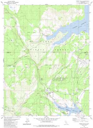
Hobart Mills Topo Map California
To zoom in, hover over the map of Hobart Mills
USGS Topo Quad 39120d2 - 1:24,000 scale
| Topo Map Name: | Hobart Mills |
| USGS Topo Quad ID: | 39120d2 |
| Print Size: | ca. 21 1/4" wide x 27" high |
| Southeast Coordinates: | 39.375° N latitude / 120.125° W longitude |
| Map Center Coordinates: | 39.4375° N latitude / 120.1875° W longitude |
| U.S. State: | CA |
| Filename: | o39120d2.jpg |
| Download Map JPG Image: | Hobart Mills topo map 1:24,000 scale |
| Map Type: | Topographic |
| Topo Series: | 7.5´ |
| Map Scale: | 1:24,000 |
| Source of Map Images: | United States Geological Survey (USGS) |
| Alternate Map Versions: |
Hobart Mills CA 1981, updated 1982 Download PDF Buy paper map Hobart Mills CA 1981, updated 1986 Download PDF Buy paper map Hobart Mills CA 1981, updated 1986 Download PDF Buy paper map Hobart Mills CA 2000, updated 2003 Download PDF Buy paper map Hobart Mills CA 2012 Download PDF Buy paper map Hobart Mills CA 2015 Download PDF Buy paper map |
| FStopo: | US Forest Service topo Hobart Mills is available: Download FStopo PDF Download FStopo TIF |
1:24,000 Topo Quads surrounding Hobart Mills
> Back to 39120a1 at 1:100,000 scale
> Back to 39120a1 at 1:250,000 scale
> Back to U.S. Topo Maps home
Hobart Mills topo map: Gazetteer
Hobart Mills: Dams
Prosser Creek Dam elevation 1751m 5744′Hobart Mills: Populated Places
Hobart Mills elevation 1794m 5885′Hobart Mills: Ranges
Sagehen Hills elevation 2131m 6991′Hobart Mills: Reservoirs
Hobart Reservoir elevation 1872m 6141′Prosser Creek Reservoir elevation 1751m 5744′
Hobart Mills: Springs
Woodchoppers Spring elevation 1788m 5866′Hobart Mills: Streams
Alder Creek elevation 1751m 5744′North Fork Prosser Creek elevation 1861m 6105′
Sagehen Creek elevation 1815m 5954′
South Fork Prosser Creek elevation 1861m 6105′
Hobart Mills: Summits
Billy Hill elevation 2043m 6702′Prosser Hill elevation 2181m 7155′
Hobart Mills digital topo map on disk
Buy this Hobart Mills topo map showing relief, roads, GPS coordinates and other geographical features, as a high-resolution digital map file on DVD:


