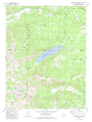
Independence Lake Topo Map California
To zoom in, hover over the map of Independence Lake
USGS Topo Quad 39120d3 - 1:24,000 scale
| Topo Map Name: | Independence Lake |
| USGS Topo Quad ID: | 39120d3 |
| Print Size: | ca. 21 1/4" wide x 27" high |
| Southeast Coordinates: | 39.375° N latitude / 120.25° W longitude |
| Map Center Coordinates: | 39.4375° N latitude / 120.3125° W longitude |
| U.S. State: | CA |
| Filename: | o39120d3.jpg |
| Download Map JPG Image: | Independence Lake topo map 1:24,000 scale |
| Map Type: | Topographic |
| Topo Series: | 7.5´ |
| Map Scale: | 1:24,000 |
| Source of Map Images: | United States Geological Survey (USGS) |
| Alternate Map Versions: |
Independence Lake CA 1981, updated 1987 Download PDF Buy paper map Independence Lake CA 1981, updated 1987 Download PDF Buy paper map Independence Lake CA 2000, updated 2003 Download PDF Buy paper map Independence Lake CA 2012 Download PDF Buy paper map Independence Lake CA 2015 Download PDF Buy paper map |
| FStopo: | US Forest Service topo Independence Lake is available: Download FStopo PDF Download FStopo TIF |
1:24,000 Topo Quads surrounding Independence Lake
> Back to 39120a1 at 1:100,000 scale
> Back to 39120a1 at 1:250,000 scale
> Back to U.S. Topo Maps home
Independence Lake topo map: Gazetteer
Independence Lake: Dams
Independence 105-006 Dam elevation 2119m 6952′Independence Lake: Flats
Anderson Meadow elevation 2024m 6640′Cold Stream Meadow elevation 2350m 7709′
Dry Meadow elevation 2186m 7171′
Meathouse Meadow elevation 2139m 7017′
Perazzo Meadows elevation 1994m 6541′
Saddle Meadow elevation 1981m 6499′
Secret Meadow elevation 2121m 6958′
Independence Lake: Lakes
Devils Oven Lake elevation 2404m 7887′Paradise Lake elevation 2357m 7732′
Warren Lake elevation 2199m 7214′
Independence Lake: Reservoirs
Independence Lake elevation 2119m 6952′Independence Lake: Ridges
Carpenter Ridge elevation 2655m 8710′Independence Lake: Streams
Cold Stream elevation 1974m 6476′Upper Independence Creek elevation 2119m 6952′
Independence Lake: Summits
Basin Peak elevation 2749m 9019′Mount Lola elevation 2774m 9101′
Red Mountain elevation 2404m 7887′
Independence Lake: Trails
Mount Lola Trail elevation 2368m 7769′Warren Lake Trail elevation 2499m 8198′
Independence Lake: Valleys
Carpenter Valley elevation 1895m 6217′Coon Canyon elevation 1975m 6479′
Crabtree Canyon elevation 1988m 6522′
Euer Valley elevation 1978m 6489′
Independence Lake digital topo map on disk
Buy this Independence Lake topo map showing relief, roads, GPS coordinates and other geographical features, as a high-resolution digital map file on DVD:


