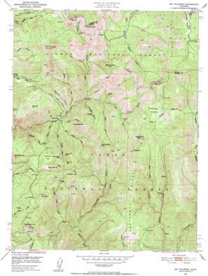
Mount Fillmore Topo Map California
To zoom in, hover over the map of Mount Fillmore
USGS Topo Quad 39120f7 - 1:24,000 scale
| Topo Map Name: | Mount Fillmore |
| USGS Topo Quad ID: | 39120f7 |
| Print Size: | ca. 21 1/4" wide x 27" high |
| Southeast Coordinates: | 39.625° N latitude / 120.75° W longitude |
| Map Center Coordinates: | 39.6875° N latitude / 120.8125° W longitude |
| U.S. State: | CA |
| Filename: | o39120f7.jpg |
| Download Map JPG Image: | Mount Fillmore topo map 1:24,000 scale |
| Map Type: | Topographic |
| Topo Series: | 7.5´ |
| Map Scale: | 1:24,000 |
| Source of Map Images: | United States Geological Survey (USGS) |
| Alternate Map Versions: |
Mt. Fillmore CA 1951, updated 1952 Download PDF Buy paper map Mt. Fillmore CA 1951, updated 1957 Download PDF Buy paper map Mt. Fillmore CA 1951, updated 1957 Download PDF Buy paper map Mount Fillmore CA 2000, updated 2003 Download PDF Buy paper map Mount Fillmore CA 2000, updated 2003 Download PDF Buy paper map Mount Fillmore CA 2012 Download PDF Buy paper map Mount Fillmore CA 2015 Download PDF Buy paper map |
| FStopo: | US Forest Service topo Mount Fillmore is available: Download FStopo PDF Download FStopo TIF |
1:24,000 Topo Quads surrounding Mount Fillmore
> Back to 39120e1 at 1:100,000 scale
> Back to 39120a1 at 1:250,000 scale
> Back to U.S. Topo Maps home
Mount Fillmore topo map: Gazetteer
Mount Fillmore: Flats
Sunnyside Meadow elevation 1922m 6305′Tamarack Flat elevation 1865m 6118′
Mount Fillmore: Mines
Bunker Hill Mine elevation 1840m 6036′Cowell Mine elevation 1944m 6377′
Deadwood Diggings elevation 1737m 5698′
Diamond Mine elevation 1701m 5580′
Gibraltar Mine elevation 1669m 5475′
Golden Scepter Mine elevation 1866m 6122′
Herkimer Mine elevation 1815m 5954′
Nessler Mine elevation 1730m 5675′
Reese Mine elevation 1874m 6148′
Tennessee Mine elevation 1695m 5561′
Wideawake Mine elevation 1669m 5475′
Mount Fillmore: Pillars
Chimney Rock elevation 2023m 6637′Mount Fillmore: Populated Places
Deadwood (historical) elevation 1802m 5912′Poker Flat elevation 1448m 4750′
Mount Fillmore: Ridges
Craycroft Ridge elevation 1785m 5856′McRae Ridge elevation 2210m 7250′
Mount Fillmore: Streams
Big Grizzly Creek elevation 1453m 4767′Deadwood Creek elevation 1398m 4586′
East Fork Canyon Creek elevation 1547m 5075′
Illinois Creek elevation 1478m 4849′
Little Grizzly Creek elevation 1460m 4790′
North Fork Canyon Creek elevation 1547m 5075′
Rattlesnake Creek elevation 1170m 3838′
South Fork Canyon Creek elevation 1569m 5147′
Sunnyside Creek elevation 1589m 5213′
West Branch Canyon Creek elevation 1514m 4967′
West Branch Downie River elevation 1168m 3832′
Mount Fillmore: Summits
Beartrap Mountain elevation 2172m 7125′Bunker Hill elevation 2115m 6938′
Cloud Splitter elevation 1950m 6397′
Deadwood Peak elevation 1967m 6453′
Democrat Peak elevation 2061m 6761′
Gibraltar elevation 2210m 7250′
Mount Alma elevation 1970m 6463′
Mount Etna elevation 2136m 7007′
Mount Fillmore elevation 2344m 7690′
Needle Point elevation 2129m 6984′
Rattlesnake Peak elevation 2168m 7112′
Saddleback Mountain elevation 2018m 6620′
Skyhigh elevation 1966m 6450′
Stafford Mountain elevation 2105m 6906′
Tennessee Mountain elevation 1928m 6325′
Mount Fillmore: Trails
Empire Creek Trail elevation 1813m 5948′Mount Fillmore: Valleys
China Ravine elevation 1461m 4793′Clarks Canyon elevation 1356m 4448′
Cleghorn Ravine elevation 1438m 4717′
Deans Ravine elevation 1640m 5380′
Gold Canyon elevation 1475m 4839′
Hays Ravine elevation 1439m 4721′
Hog Gulch elevation 1566m 5137′
Red Oak Canyon elevation 1348m 4422′
Stafford Ravine elevation 1785m 5856′
Studhorse Ravine elevation 1490m 4888′
Tennessee Ravine elevation 1554m 5098′
Mount Fillmore digital topo map on disk
Buy this Mount Fillmore topo map showing relief, roads, GPS coordinates and other geographical features, as a high-resolution digital map file on DVD:


