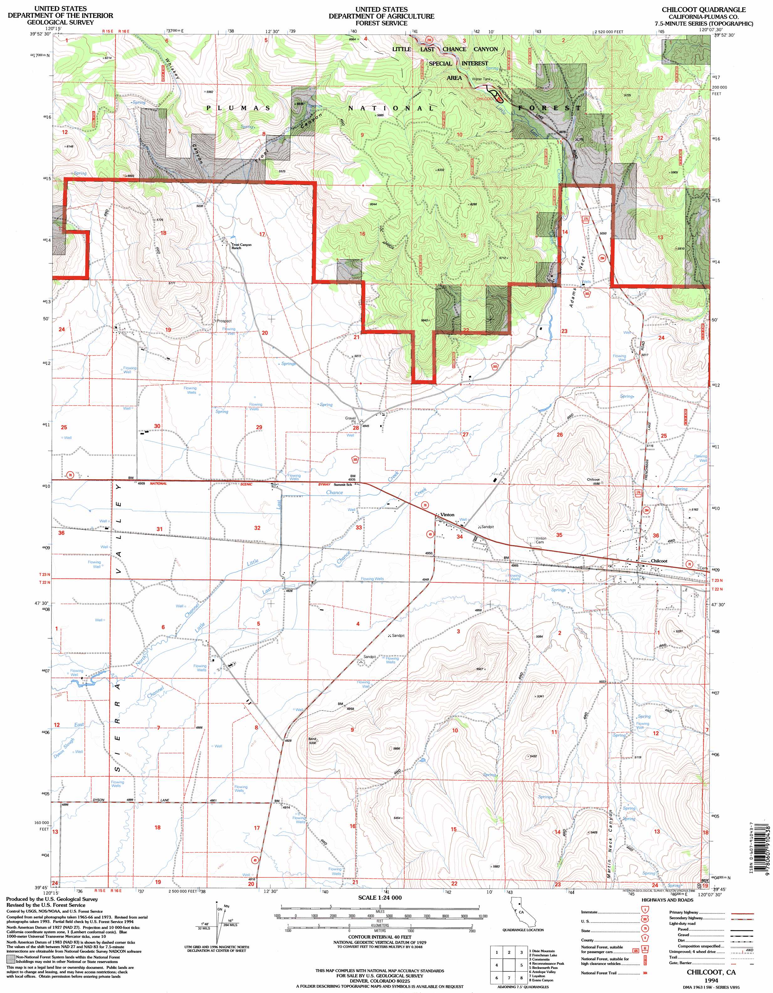
Chilcoot Topo Map California
To zoom in, hover over the map of Chilcoot
USGS Topo Quad 39120g2 - 1:24,000 scale
| Topo Map Name: | Chilcoot |
| USGS Topo Quad ID: | 39120g2 |
| Print Size: | ca. 21 1/4" wide x 27" high |
| Southeast Coordinates: | 39.75° N latitude / 120.125° W longitude |
| Map Center Coordinates: | 39.8125° N latitude / 120.1875° W longitude |
| U.S. State: | CA |
| Filename: | o39120g2.jpg |
| Download Map JPG Image: | Chilcoot topo map 1:24,000 scale |
| Map Type: | Topographic |
| Topo Series: | 7.5´ |
| Map Scale: | 1:24,000 |
| Source of Map Images: | United States Geological Survey (USGS) |
| Alternate Map Versions: |
Chilcoot CA 1979, updated 1979 Download PDF Buy paper map Chilcoot CA 1979, updated 1979 Download PDF Buy paper map Chilcoot CA 1994, updated 1998 Download PDF Buy paper map Chilcoot CA 1994, updated 1998 Download PDF Buy paper map Chilcoot CA 2012 Download PDF Buy paper map Chilcoot CA 2015 Download PDF Buy paper map |
| FStopo: | US Forest Service topo Chilcoot is available: Download FStopo PDF Download FStopo TIF |
1:24,000 Topo Quads surrounding Chilcoot
Squaw Valley Peak |
Ferris Creek |
Mckesick Peak |
Doyle |
State Line Peak |
Crocker Mountain |
Dixie Mountain |
Frenchman Lake |
Constantia |
|
Portola |
Reconnaissance Peak |
Chilcoot |
Beckwourth Pass |
Granite Peak |
Calpine |
Antelope Valley |
Loyalton |
Evans Canyon |
Reno Nw |
Sattley |
Sierraville |
Sardine Peak |
Dog Valley |
Verdi |
> Back to 39120e1 at 1:100,000 scale
> Back to 39120a1 at 1:250,000 scale
> Back to U.S. Topo Maps home
Chilcoot topo map: Gazetteer
Chilcoot: Areas
Little Last Chance Canyon Special Interest Area elevation 1684m 5524′Chilcoot: Capes
Adams Neck elevation 1523m 4996′Chilcoot: Populated Places
Chilcoot elevation 1528m 5013′Vinton elevation 1508m 4947′
Chilcoot: Streams
Dyson Slough elevation 1494m 4901′Little Last Chance Creek elevation 1515m 4970′
Chilcoot: Valleys
Martin Neck Canyon elevation 1527m 5009′Trosi Canyon elevation 1506m 4940′
Whiskey Canyon elevation 1558m 5111′
Chilcoot digital topo map on disk
Buy this Chilcoot topo map showing relief, roads, GPS coordinates and other geographical features, as a high-resolution digital map file on DVD: