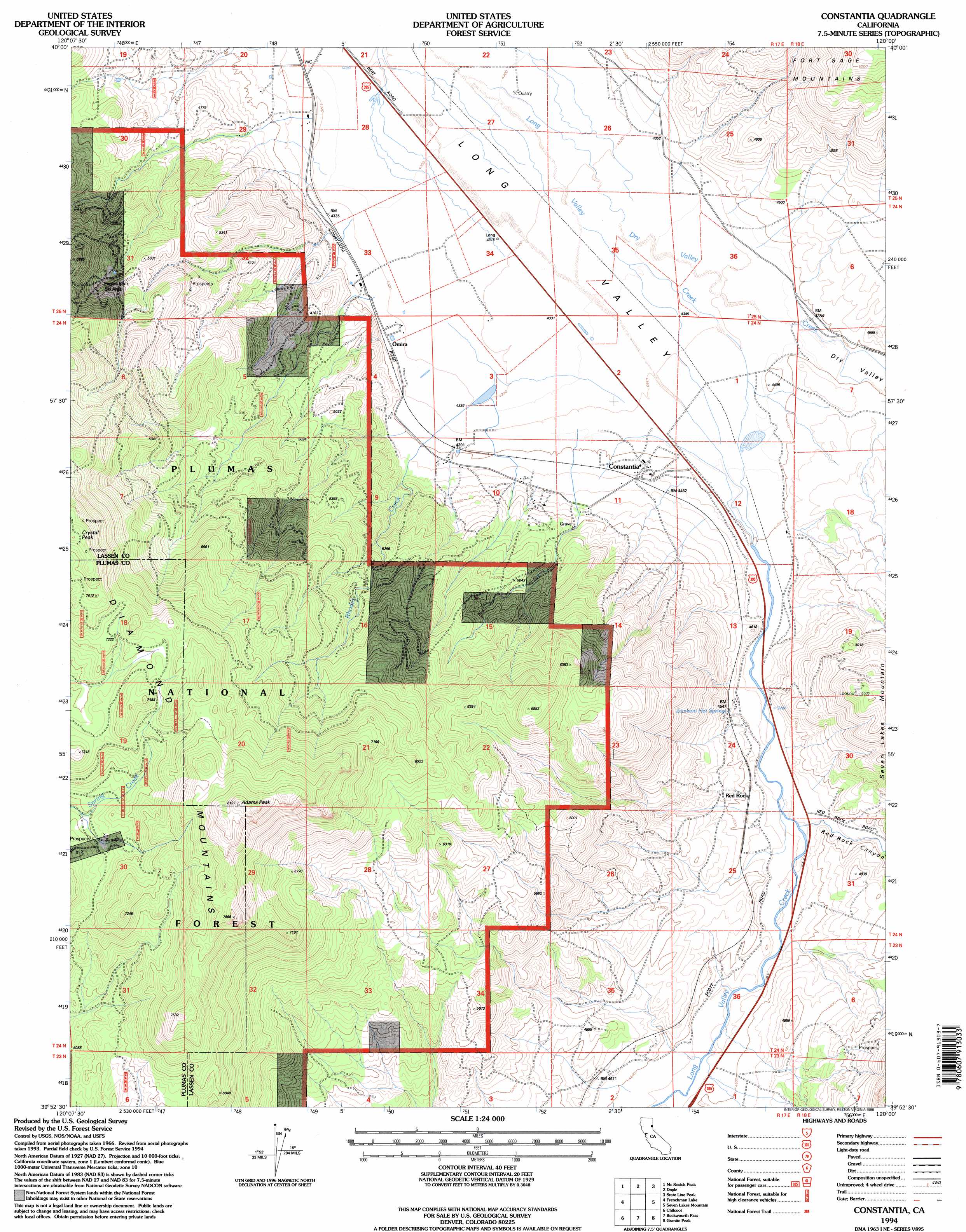
Constantia Topo Map California
To zoom in, hover over the map of Constantia
USGS Topo Quad 39120h1 - 1:24,000 scale
| Topo Map Name: | Constantia |
| USGS Topo Quad ID: | 39120h1 |
| Print Size: | ca. 21 1/4" wide x 27" high |
| Southeast Coordinates: | 39.875° N latitude / 120° W longitude |
| Map Center Coordinates: | 39.9375° N latitude / 120.0625° W longitude |
| U.S. State: | CA |
| Filename: | o39120h1.jpg |
| Download Map JPG Image: | Constantia topo map 1:24,000 scale |
| Map Type: | Topographic |
| Topo Series: | 7.5´ |
| Map Scale: | 1:24,000 |
| Source of Map Images: | United States Geological Survey (USGS) |
| Alternate Map Versions: |
Constantia CA 1977, updated 1978 Download PDF Buy paper map Constantia CA 1977, updated 1978 Download PDF Buy paper map Constantia CA 1994, updated 1998 Download PDF Buy paper map Constantia CA 1994, updated 1998 Download PDF Buy paper map Constantia CA 2012 Download PDF Buy paper map Constantia CA 2015 Download PDF Buy paper map |
| FStopo: | US Forest Service topo Constantia is available: Download FStopo PDF Download FStopo TIF |
1:24,000 Topo Quads surrounding Constantia
Milford |
Herlong |
Calneva |
Flanigan |
Astor Pass |
Ferris Creek |
Mckesick Peak |
Doyle |
State Line Peak |
Spanish Flat |
Dixie Mountain |
Frenchman Lake |
Constantia |
Dogskin Mountain |
|
Reconnaissance Peak |
Chilcoot |
Beckwourth Pass |
Granite Peak |
Bedell Flat |
Antelope Valley |
Loyalton |
Evans Canyon |
Reno Nw |
Reno Ne |
> Back to 39120e1 at 1:100,000 scale
> Back to 39120a1 at 1:250,000 scale
> Back to U.S. Topo Maps home
Constantia topo map: Gazetteer
Constantia: Parks
Eagles Peak Ski Area elevation 1671m 5482′Constantia: Populated Places
Omira elevation 1325m 4347′Constantia: Springs
Zamboni Hot Springs elevation 1377m 4517′Constantia: Streams
Dry Valley Creek elevation 1310m 4297′Rhodes Creek elevation 1317m 4320′
Constantia: Summits
Adams Peak elevation 2494m 8182′Crystal Peak elevation 2375m 7791′
Constantia: Valleys
Dry Valley elevation 1342m 4402′Red Rock Canyon elevation 1366m 4481′
Red Rock Canyon elevation 1366m 4481′
Constantia digital topo map on disk
Buy this Constantia topo map showing relief, roads, GPS coordinates and other geographical features, as a high-resolution digital map file on DVD: