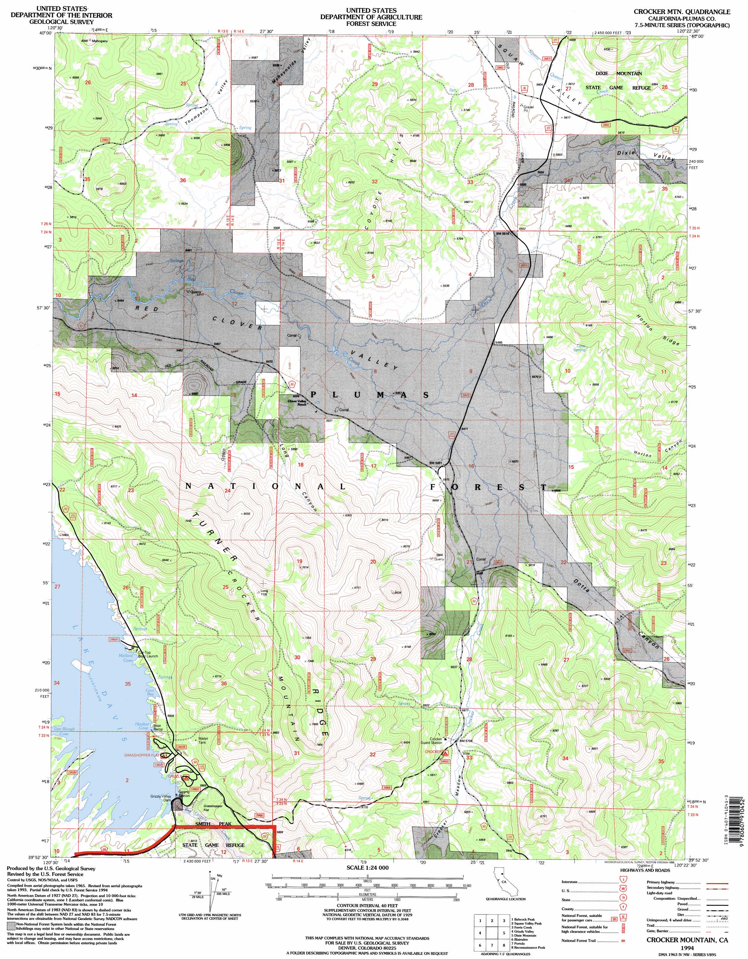
Crocker Mountain Topo Map California
To zoom in, hover over the map of Crocker Mountain
USGS Topo Quad 39120h4 - 1:24,000 scale
| Topo Map Name: | Crocker Mountain |
| USGS Topo Quad ID: | 39120h4 |
| Print Size: | ca. 21 1/4" wide x 27" high |
| Southeast Coordinates: | 39.875° N latitude / 120.375° W longitude |
| Map Center Coordinates: | 39.9375° N latitude / 120.4375° W longitude |
| U.S. State: | CA |
| Filename: | o39120h4.jpg |
| Download Map JPG Image: | Crocker Mountain topo map 1:24,000 scale |
| Map Type: | Topographic |
| Topo Series: | 7.5´ |
| Map Scale: | 1:24,000 |
| Source of Map Images: | United States Geological Survey (USGS) |
| Alternate Map Versions: |
Crocker Mtn CA 1972, updated 1973 Download PDF Buy paper map Crocker Mtn CA 1972, updated 1974 Download PDF Buy paper map Crocker Mountain CA 1994, updated 1998 Download PDF Buy paper map Crocker Mountain CA 2012 Download PDF Buy paper map Crocker Mountain CA 2015 Download PDF Buy paper map |
| FStopo: | US Forest Service topo Crocker Mountain is available: Download FStopo PDF Download FStopo TIF |
1:24,000 Topo Quads surrounding Crocker Mountain
Kettle Rock |
Antelope Lake |
Stony Ridge |
Milford |
Herlong |
Genesee Valley |
Babcock Peak |
Squaw Valley Peak |
Ferris Creek |
Mckesick Peak |
Mount Ingalls |
Grizzly Valley |
Crocker Mountain |
Dixie Mountain |
Frenchman Lake |
Johnsville |
Blairsden |
Portola |
Reconnaissance Peak |
Chilcoot |
Gold Lake |
Clio |
Calpine |
Antelope Valley |
Loyalton |
> Back to 39120e1 at 1:100,000 scale
> Back to 39120a1 at 1:250,000 scale
> Back to U.S. Topo Maps home
Crocker Mountain topo map: Gazetteer
Crocker Mountain: Bays
Dan Blough Cove elevation 1761m 5777′Crocker Mountain: Dams
Grizzly Valley 1-052 Dam elevation 1768m 5800′Grizzly Valley Dam elevation 1760m 5774′
Crocker Mountain: Flats
Crocker Meadow elevation 1747m 5731′Grasshopper Flat elevation 1793m 5882′
Crocker Mountain: Populated Places
Crow (historical) elevation 1683m 5521′Crocker Mountain: Ranges
Coyote Hills elevation 1784m 5853′Crocker Mountain: Reservoirs
Lake Davis elevation 1756m 5761′Crocker Mountain: Springs
Lava Spring elevation 1762m 5780′Crocker Mountain: Streams
Crocker Creek elevation 1668m 5472′Dixie Creek elevation 1662m 5452′
Crocker Mountain: Summits
Crocker Mountain elevation 2269m 7444′Crocker Mountain: Valleys
Dixie Valley elevation 1670m 5479′Dotta Canyon elevation 1671m 5482′
Grizzly Valley elevation 1761m 5777′
Horton Canyon elevation 1701m 5580′
Long Canyon elevation 1706m 5597′
McReynolds Valley elevation 1666m 5465′
Thompson Valley elevation 1665m 5462′
Crocker Mountain digital topo map on disk
Buy this Crocker Mountain topo map showing relief, roads, GPS coordinates and other geographical features, as a high-resolution digital map file on DVD: