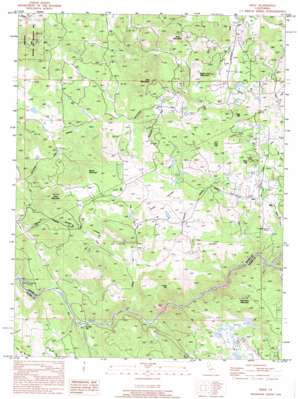
Wolf Topo Map California
To zoom in, hover over the map of Wolf
USGS Topo Quad 39121a2 - 1:24,000 scale
| Topo Map Name: | Wolf |
| USGS Topo Quad ID: | 39121a2 |
| Print Size: | ca. 21 1/4" wide x 27" high |
| Southeast Coordinates: | 39° N latitude / 121.125° W longitude |
| Map Center Coordinates: | 39.0625° N latitude / 121.1875° W longitude |
| U.S. State: | CA |
| Filename: | o39121a2.jpg |
| Download Map JPG Image: | Wolf topo map 1:24,000 scale |
| Map Type: | Topographic |
| Topo Series: | 7.5´ |
| Map Scale: | 1:24,000 |
| Source of Map Images: | United States Geological Survey (USGS) |
| Alternate Map Versions: |
Wolf CA 1949, updated 1954 Download PDF Buy paper map Wolf CA 1949, updated 1977 Download PDF Buy paper map Wolf CA 1950 Download PDF Buy paper map Wolf CA 1995, updated 1995 Download PDF Buy paper map Wolf CA 1998, updated 2002 Download PDF Buy paper map Wolf CA 2012 Download PDF Buy paper map Wolf CA 2015 Download PDF Buy paper map |
1:24,000 Topo Quads surrounding Wolf
> Back to 39121a1 at 1:100,000 scale
> Back to 39120a1 at 1:250,000 scale
> Back to U.S. Topo Maps home
Wolf topo map: Gazetteer
Wolf: Canals
Cole Ditch elevation 451m 1479′Redinger Ditch elevation 377m 1236′
Wolf Ditch elevation 405m 1328′
Wolf: Flats
Austin Flat elevation 158m 518′Wolf: Mines
Pine Hill Mine elevation 535m 1755′Wolf: Populated Places
Wolf elevation 481m 1578′Wolf: Streams
Alderman Creek elevation 107m 351′Indian Springs Creek elevation 296m 971′
Little Wolf Creek elevation 98m 321′
Wolf Creek elevation 290m 951′
Wolf: Summits
Bald Mountain elevation 446m 1463′Bald Rock Mountain elevation 513m 1683′
Bushy Mountain elevation 401m 1315′
Cole Hill elevation 551m 1807′
Hog Hill elevation 501m 1643′
Iron Mountain elevation 472m 1548′
Lucas Hill elevation 454m 1489′
Pine Hill elevation 555m 1820′
Rock Mountain elevation 426m 1397′
Sugar Loaf Mountain elevation 441m 1446′
Wolf: Valleys
Rab Ravine elevation 298m 977′Wolf digital topo map on disk
Buy this Wolf topo map showing relief, roads, GPS coordinates and other geographical features, as a high-resolution digital map file on DVD:


