Bangor Topo Map California
To zoom in, hover over the map of Bangor
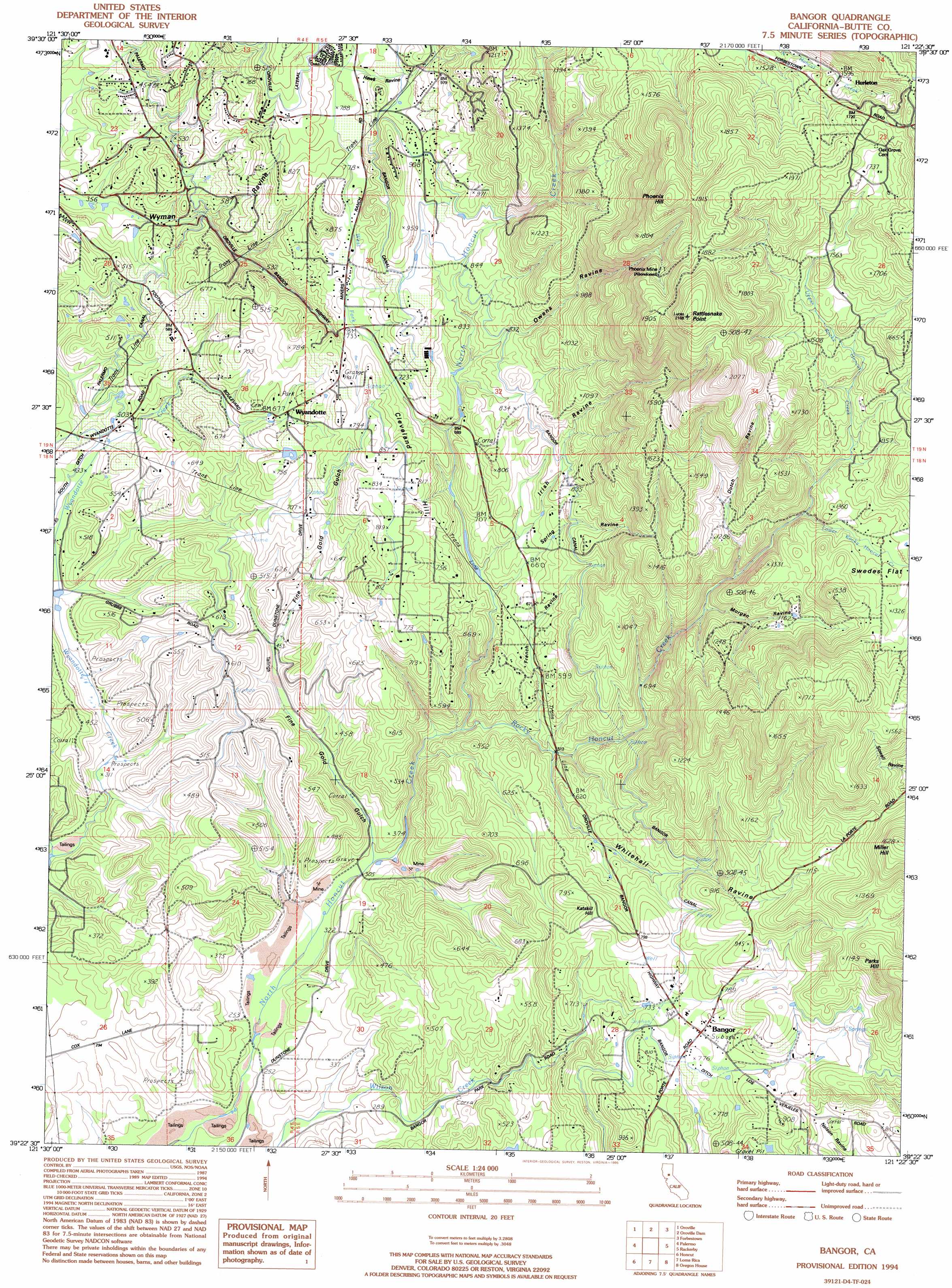
USGS Topo Quad 39121d4 - 1:24,000 scale
| Topo Map Name: | Bangor |
| USGS Topo Quad ID: | 39121d4 |
| Print Size: | ca. 21 1/4" wide x 27" high |
| Southeast Coordinates: | 39.375° N latitude / 121.375° W longitude |
| Map Center Coordinates: | 39.4375° N latitude / 121.4375° W longitude |
| U.S. State: | CA |
| Filename: | o39121d4.jpg |
| Download Map JPG Image: | Bangor topo map 1:24,000 scale |
| Map Type: | Topographic |
| Topo Series: | 7.5´ |
| Map Scale: | 1:24,000 |
| Source of Map Images: | United States Geological Survey (USGS) |
| Alternate Map Versions: |
Bangor CA 1947, updated 1956 Download PDF Buy paper map Bangor CA 1947, updated 1971 Download PDF Buy paper map Bangor CA 1947, updated 1971 Download PDF Buy paper map Bangor CA 1947, updated 1975 Download PDF Buy paper map Bangor CA 1949 Download PDF Buy paper map Bangor CA 1994, updated 1995 Download PDF Buy paper map Bangor CA 2012 Download PDF Buy paper map Bangor CA 2015 Download PDF Buy paper map |
1:24,000 Topo Quads surrounding Bangor
Hamlin Canyon |
Cherokee |
Berry Creek |
Brush Creek |
Cascade |
Shippee |
Oroville |
Oroville Dam |
Forbestown |
Clipper Mills |
Biggs |
Palermo |
Bangor |
Rackerby |
Challenge |
Gridley |
Honcut |
Loma Rica |
Oregon House |
French Corral |
Sutter |
Yuba City |
Browns Valley |
Smartville |
Rough And Ready |
> Back to 39121a1 at 1:100,000 scale
> Back to 39120a1 at 1:250,000 scale
> Back to U.S. Topo Maps home
Bangor topo map: Gazetteer
Bangor: Canals
Bangor Ditch elevation 232m 761′Bangor: Capes
Rattlesnake Point elevation 652m 2139′Bangor: Mines
Blue Lead Mine elevation 123m 403′Phoenix Mine elevation 530m 1738′
Bangor: Populated Places
Bangor elevation 232m 761′Hurleton elevation 487m 1597′
Wyandotte elevation 204m 669′
Bangor: Ridges
Cleveland Hill elevation 250m 820′Bangor: Streams
Lower Rocky Honcut Creek elevation 352m 1154′Rocky Honcut Creek elevation 117m 383′
Upper Rocky Honcut Creek elevation 354m 1161′
West Fork North Honcut Creek elevation 212m 695′
Bangor: Summits
Katskill Hill elevation 253m 830′Miller Hill elevation 496m 1627′
Phoenix Hill elevation 611m 2004′
Bangor: Valleys
Dutch Ravine elevation 360m 1181′Fine Gold Gulch elevation 88m 288′
French Ravine elevation 142m 465′
Hawk Ravine elevation 244m 800′
Irish Ravine elevation 182m 597′
Morgan Ravine elevation 299m 980′
Owens Ravine elevation 246m 807′
Spring Ravine elevation 179m 587′
Whitehall Ravine elevation 156m 511′
Bangor digital topo map on disk
Buy this Bangor topo map showing relief, roads, GPS coordinates and other geographical features, as a high-resolution digital map file on DVD: