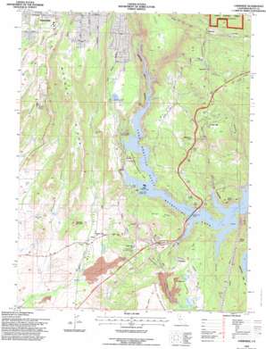
Cherokee Topo Map California
To zoom in, hover over the map of Cherokee
USGS Topo Quad 39121f5 - 1:24,000 scale
| Topo Map Name: | Cherokee |
| USGS Topo Quad ID: | 39121f5 |
| Print Size: | ca. 21 1/4" wide x 27" high |
| Southeast Coordinates: | 39.625° N latitude / 121.5° W longitude |
| Map Center Coordinates: | 39.6875° N latitude / 121.5625° W longitude |
| U.S. State: | CA |
| Filename: | o39121f5.jpg |
| Download Map JPG Image: | Cherokee topo map 1:24,000 scale |
| Map Type: | Topographic |
| Topo Series: | 7.5´ |
| Map Scale: | 1:24,000 |
| Source of Map Images: | United States Geological Survey (USGS) |
| Alternate Map Versions: |
Cherokee CA 1947, updated 1961 Download PDF Buy paper map Cherokee CA 1947, updated 1966 Download PDF Buy paper map Cherokee CA 1947, updated 1966 Download PDF Buy paper map Cherokee CA 1949 Download PDF Buy paper map Cherokee CA 1949 Download PDF Buy paper map Cherokee CA 1970, updated 1973 Download PDF Buy paper map Cherokee CA 1994, updated 1997 Download PDF Buy paper map Cherokee CA 2012 Download PDF Buy paper map Cherokee CA 2015 Download PDF Buy paper map |
| FStopo: | US Forest Service topo Cherokee is available: Download FStopo PDF Download FStopo TIF |
1:24,000 Topo Quads surrounding Cherokee
> Back to 39121e1 at 1:100,000 scale
> Back to 39120a1 at 1:250,000 scale
> Back to U.S. Topo Maps home
Cherokee topo map: Gazetteer
Cherokee: Airports
Paradise Skypark elevation 398m 1305′Cherokee: Bridges
West Branch Bridge elevation 275m 902′Cherokee: Canals
Upper Miocene Canal elevation 353m 1158′Wilenor Ditch elevation 564m 1850′
Cherokee: Capes
Goat Point elevation 289m 948′Cherokee: Cliffs
Cape Horn elevation 410m 1345′Cherokee: Dams
Grub Flat 344-002 Dam elevation 428m 1404′Kunkle 97-007 Dam elevation 440m 1443′
Littlefield 1341 Dam elevation 422m 1384′
Parish Camp Saddle Dam elevation 275m 902′
Cherokee: Flats
Campbell Flat elevation 422m 1384′Gold Flat elevation 447m 1466′
Cherokee: Gaps
Lime Saddle elevation 312m 1023′Cherokee: Mines
Cherokee Placer Mine elevation 323m 1059′New Era Mine elevation 276m 905′
Cherokee: Parks
Lime Saddle Memorial Park elevation 322m 1056′Rotary Grove Park elevation 515m 1689′
Cherokee: Populated Places
Cherokee elevation 398m 1305′Concow elevation 536m 1758′
Deadwood elevation 524m 1719′
James elevation 273m 895′
Nelson Bar (historical) elevation 297m 974′
Pentz elevation 134m 439′
Yankee Hill elevation 604m 1981′
Cherokee: Post Offices
Yankee Hill Post Office (historical) elevation 489m 1604′Cherokee: Reservoirs
Grub Flat Reservoir elevation 415m 1361′Kunkle Reservoir elevation 440m 1443′
Littlefield Reservoir elevation 415m 1361′
Morgan Reservoir elevation 418m 1371′
Tom Jones Reservoir elevation 412m 1351′
Wilson Reservoir elevation 418m 1371′
Cherokee: Ridges
Clements Ridge elevation 412m 1351′Glover Ridge elevation 458m 1502′
Morgan Ridge elevation 458m 1502′
White Spring Ridge elevation 436m 1430′
Cherokee: Streams
Concow Creek elevation 275m 902′Deadwood Creek elevation 411m 1348′
Hodapp Creek elevation 311m 1020′
Trickling Creek elevation 454m 1489′
West Branch Feather River elevation 275m 902′
Cherokee: Summits
Deer Peak elevation 391m 1282′Hump Hill elevation 557m 1827′
Jordan Hill elevation 587m 1925′
North Table Mountain elevation 477m 1564′
Patton Peak elevation 439m 1440′
Red Hill elevation 457m 1499′
Rocky Peak elevation 496m 1627′
Sausage Mountain elevation 275m 902′
Serpentine Point elevation 549m 1801′
Sugarloaf elevation 488m 1601′
Cherokee: Valleys
Blair Ravine elevation 388m 1272′Horsethief Canyon elevation 132m 433′
Messilla Valley elevation 110m 360′
Pinkston Canyon elevation 474m 1555′
Rich Gulch elevation 277m 908′
Sawmill Ravine elevation 161m 528′
Spring Valley Gulch elevation 285m 935′
Vinton Gulch elevation 277m 908′
Cherokee digital topo map on disk
Buy this Cherokee topo map showing relief, roads, GPS coordinates and other geographical features, as a high-resolution digital map file on DVD:


