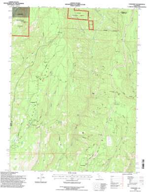
Cohasset Topo Map California
To zoom in, hover over the map of Cohasset
USGS Topo Quad 39121h6 - 1:24,000 scale
| Topo Map Name: | Cohasset |
| USGS Topo Quad ID: | 39121h6 |
| Print Size: | ca. 21 1/4" wide x 27" high |
| Southeast Coordinates: | 39.875° N latitude / 121.625° W longitude |
| Map Center Coordinates: | 39.9375° N latitude / 121.6875° W longitude |
| U.S. State: | CA |
| Filename: | o39121h6.jpg |
| Download Map JPG Image: | Cohasset topo map 1:24,000 scale |
| Map Type: | Topographic |
| Topo Series: | 7.5´ |
| Map Scale: | 1:24,000 |
| Source of Map Images: | United States Geological Survey (USGS) |
| Alternate Map Versions: |
Cohasset CA 1979, updated 1980 Download PDF Buy paper map Cohasset CA 1979, updated 1980 Download PDF Buy paper map Cohasset CA 1979, updated 1985 Download PDF Buy paper map Cohasset CA 1979, updated 1995 Download PDF Buy paper map Cohasset CA 1995, updated 1998 Download PDF Buy paper map Cohasset CA 2012 Download PDF Buy paper map Cohasset CA 2015 Download PDF Buy paper map |
| FStopo: | US Forest Service topo Cohasset is available: Download FStopo PDF Download FStopo TIF |
1:24,000 Topo Quads surrounding Cohasset
> Back to 39121e1 at 1:100,000 scale
> Back to 39120a1 at 1:250,000 scale
> Back to U.S. Topo Maps home
Cohasset topo map: Gazetteer
Cohasset: Lakes
Bear Lake elevation 451m 1479′Cohasset: Populated Places
Cohasset elevation 862m 2828′Dodge Place elevation 571m 1873′
Forest Ranch elevation 736m 2414′
Cohasset: Ridges
Cohasset Ridge elevation 1026m 3366′Cohasset: Springs
Durbin Spring elevation 727m 2385′Cohasset: Streams
Campbell Creek elevation 689m 2260′East Branch Mud Creek elevation 713m 2339′
Middle Branch Mud Creek elevation 713m 2339′
Webb Creek elevation 667m 2188′
West Branch Mud Creek elevation 656m 2152′
Cohasset: Summits
Platte Mountain elevation 1075m 3526′Promontory Point elevation 1094m 3589′
Cohasset: Valleys
Nelson Ravine elevation 879m 2883′Platte Ravine elevation 711m 2332′
Web Hollow elevation 661m 2168′
Cohasset digital topo map on disk
Buy this Cohasset topo map showing relief, roads, GPS coordinates and other geographical features, as a high-resolution digital map file on DVD:


