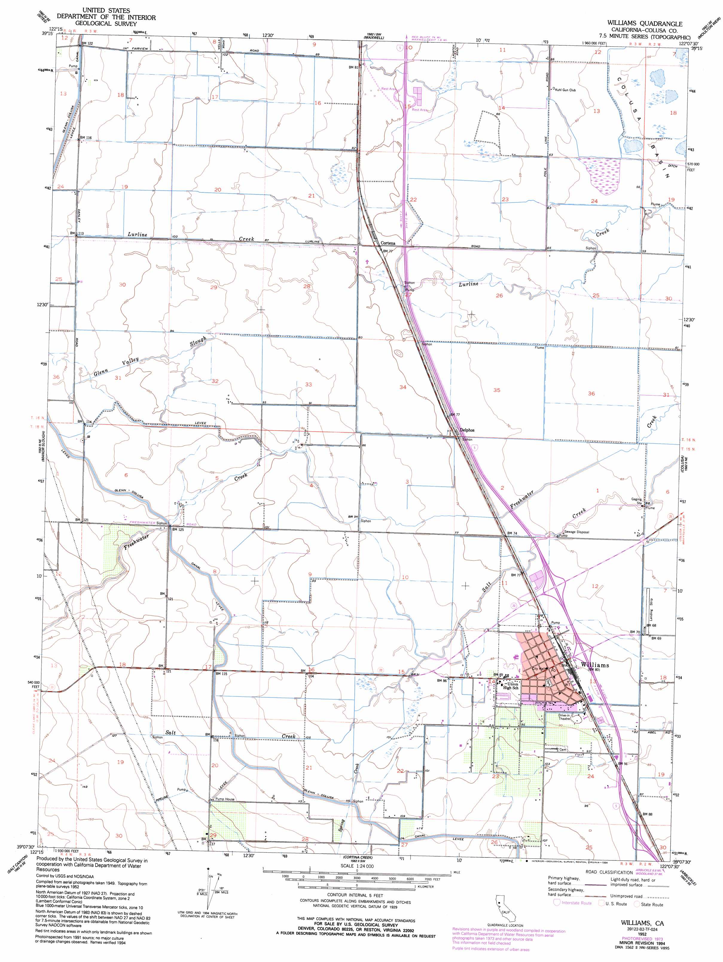
Williams Topo Map California
To zoom in, hover over the map of Williams
USGS Topo Quad 39122b2 - 1:24,000 scale
| Topo Map Name: | Williams |
| USGS Topo Quad ID: | 39122b2 |
| Print Size: | ca. 21 1/4" wide x 27" high |
| Southeast Coordinates: | 39.125° N latitude / 122.125° W longitude |
| Map Center Coordinates: | 39.1875° N latitude / 122.1875° W longitude |
| U.S. State: | CA |
| Filename: | o39122b2.jpg |
| Download Map JPG Image: | Williams topo map 1:24,000 scale |
| Map Type: | Topographic |
| Topo Series: | 7.5´ |
| Map Scale: | 1:24,000 |
| Source of Map Images: | United States Geological Survey (USGS) |
| Alternate Map Versions: |
Williams CA 1952, updated 1953 Download PDF Buy paper map Williams CA 1952, updated 1974 Download PDF Buy paper map Williams CA 1952, updated 1994 Download PDF Buy paper map Williams CA 2012 Download PDF Buy paper map Williams CA 2015 Download PDF Buy paper map |
1:24,000 Topo Quads surrounding Williams
Rail Canyon |
Logan Ridge |
Logandale |
Princeton |
Butte City |
Lodoga |
Sites |
Maxwell |
Moulton Weir |
Sanborn Slough |
Leesville |
Manor Slough |
Williams |
Colusa |
Meridian |
Wilbur Springs |
Salt Canyon |
Cortina Creek |
Arbuckle |
Grimes |
Wilson Valley |
Glascock Mountain |
Rumsey |
Wildwood School |
Dunnigan |
> Back to 39122a1 at 1:100,000 scale
> Back to 39122a1 at 1:250,000 scale
> Back to U.S. Topo Maps home
Williams topo map: Gazetteer
Williams: Airports
Williams Airport elevation 21m 68′Williams: Populated Places
Cortena elevation 24m 78′Delphos elevation 23m 75′
Lurline (historical) elevation 34m 111′
Williams elevation 25m 82′
Williams: Post Offices
Williams Post Office elevation 26m 85′Williams: Streams
Glenn Valley Slough elevation 28m 91′Spring Creek elevation 27m 88′
Williams digital topo map on disk
Buy this Williams topo map showing relief, roads, GPS coordinates and other geographical features, as a high-resolution digital map file on DVD: