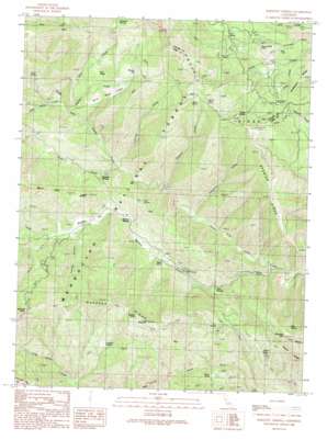
Bartlett Springs Topo Map California
To zoom in, hover over the map of Bartlett Springs
USGS Topo Quad 39122b6 - 1:24,000 scale
| Topo Map Name: | Bartlett Springs |
| USGS Topo Quad ID: | 39122b6 |
| Print Size: | ca. 21 1/4" wide x 27" high |
| Southeast Coordinates: | 39.125° N latitude / 122.625° W longitude |
| Map Center Coordinates: | 39.1875° N latitude / 122.6875° W longitude |
| U.S. State: | CA |
| Filename: | o39122b6.jpg |
| Download Map JPG Image: | Bartlett Springs topo map 1:24,000 scale |
| Map Type: | Topographic |
| Topo Series: | 7.5´ |
| Map Scale: | 1:24,000 |
| Source of Map Images: | United States Geological Survey (USGS) |
| Alternate Map Versions: |
Bartlett Springs CA 1989, updated 1989 Download PDF Buy paper map Bartlett Springs CA 1989, updated 1994 Download PDF Buy paper map Bartlett Springs CA 1996, updated 2001 Download PDF Buy paper map Bartlett Springs CA 2012 Download PDF Buy paper map Bartlett Springs CA 2015 Download PDF Buy paper map |
| FStopo: | US Forest Service topo Bartlett Springs is available: Download FStopo PDF Download FStopo TIF |
1:24,000 Topo Quads surrounding Bartlett Springs
> Back to 39122a1 at 1:100,000 scale
> Back to 39122a1 at 1:250,000 scale
> Back to U.S. Topo Maps home
Bartlett Springs topo map: Gazetteer
Bartlett Springs: Bridges
Reister Bridge elevation 606m 1988′Bartlett Springs: Cliffs
Pine Needle Point elevation 800m 2624′Bartlett Springs: Flats
Bartlett Flat elevation 640m 2099′Evans Glade elevation 953m 3126′
Horse Hollow elevation 1231m 4038′
Johnson Glades elevation 736m 2414′
Root Glades elevation 1075m 3526′
White Ranch Glades elevation 952m 3123′
Wyman Flat elevation 1164m 3818′
Bartlett Springs: Lakes
Tule Pond elevation 779m 2555′Bartlett Springs: Pillars
Goat Rock elevation 1672m 5485′Horse Rock elevation 1428m 4685′
Summit Rock elevation 1113m 3651′
Bartlett Springs: Populated Places
Bartlett Springs elevation 654m 2145′Newman Springs elevation 658m 2158′
Pole Garden elevation 1047m 3435′
Bartlett Springs: Ridges
Gold Point elevation 703m 2306′Pacific Ridge elevation 1338m 4389′
Pine Ridge elevation 855m 2805′
Rocky Ridge elevation 1041m 3415′
Ruppert Ridge elevation 1308m 4291′
Soapstone Ridge elevation 806m 2644′
Spanish Ridge elevation 1106m 3628′
Bartlett Springs: Springs
Able Spring elevation 924m 3031′Addington Springs elevation 1379m 4524′
Allen Springs elevation 583m 1912′
Ellen Spring elevation 1059m 3474′
Gas Spring elevation 756m 2480′
Jesse Spring elevation 1332m 4370′
Royal Spring elevation 676m 2217′
Bartlett Springs: Streams
Bartlett Creek elevation 493m 1617′Cold Creek elevation 679m 2227′
Grapevine Creek elevation 523m 1715′
Hospital Creek elevation 532m 1745′
Ladybug Creek elevation 560m 1837′
North Fork Bartlett Creek elevation 647m 2122′
North Fork Wolf Creek elevation 635m 2083′
Perrington Creek elevation 596m 1955′
Root Creek elevation 656m 2152′
Soap Creek elevation 563m 1847′
South Fork Bartlett Creek elevation 647m 2122′
South Fork Wolf Creek elevation 635m 2083′
Twin Valley Creek elevation 605m 1984′
Wyman Creek elevation 606m 1988′
Bartlett Springs: Summits
Chocolate Peak elevation 1092m 3582′Pine Mountain elevation 1293m 4242′
Reister Rock elevation 967m 3172′
Ruppert Point elevation 1286m 4219′
Bartlett Springs: Valleys
Franklin Canyon elevation 643m 2109′Bartlett Springs digital topo map on disk
Buy this Bartlett Springs topo map showing relief, roads, GPS coordinates and other geographical features, as a high-resolution digital map file on DVD:


