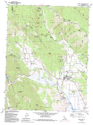
Upper Lake Topo Map California
To zoom in, hover over the map of Upper Lake
USGS Topo Quad 39122b8 - 1:24,000 scale
| Topo Map Name: | Upper Lake |
| USGS Topo Quad ID: | 39122b8 |
| Print Size: | ca. 21 1/4" wide x 27" high |
| Southeast Coordinates: | 39.125° N latitude / 122.875° W longitude |
| Map Center Coordinates: | 39.1875° N latitude / 122.9375° W longitude |
| U.S. State: | CA |
| Filename: | o39122b8.jpg |
| Download Map JPG Image: | Upper Lake topo map 1:24,000 scale |
| Map Type: | Topographic |
| Topo Series: | 7.5´ |
| Map Scale: | 1:24,000 |
| Source of Map Images: | United States Geological Survey (USGS) |
| Alternate Map Versions: |
Upper Lake CA 1958, updated 1961 Download PDF Buy paper map Upper Lake CA 1958, updated 1965 Download PDF Buy paper map Upper Lake CA 1958, updated 1978 Download PDF Buy paper map Upper Lake CA 1977, updated 1980 Download PDF Buy paper map Upper Lake CA 1991, updated 1995 Download PDF Buy paper map Upper Lake CA 1996, updated 2001 Download PDF Buy paper map Upper Lake CA 2012 Download PDF Buy paper map Upper Lake CA 2015 Download PDF Buy paper map |
| FStopo: | US Forest Service topo Upper Lake is available: Download FStopo PDF Download FStopo TIF |
1:24,000 Topo Quads surrounding Upper Lake
> Back to 39122a1 at 1:100,000 scale
> Back to 39122a1 at 1:250,000 scale
> Back to U.S. Topo Maps home
Upper Lake topo map: Gazetteer
Upper Lake: Areas
Upper Lake elevation 460m 1509′Upper Lake: Flats
Salt Flat elevation 860m 2821′Upper Lake: Lakes
Lower Blue Lake elevation 412m 1351′Upper Lake: Parks
Bloody Island Massacre Historical Marker elevation 406m 1332′Upper Lake: Populated Places
Saratoga Springs elevation 435m 1427′Upper Lake elevation 410m 1345′
Witter Springs (historical) elevation 507m 1663′
Upper Lake: Post Offices
Upper Lake Post Office elevation 410m 1345′Witter Springs Post Office elevation 412m 1351′
Upper Lake: Reservoirs
Tule Lake elevation 406m 1332′Upper Lake: Ridges
Dave Phelps Ridge elevation 900m 2952′John Alley Ridge elevation 916m 3005′
McCabe Ridge elevation 776m 2545′
Pitney Ridge elevation 988m 3241′
Upper Lake: Springs
Madrone Spring elevation 1027m 3369′Plank Cabin Spring elevation 448m 1469′
Witter Springs elevation 463m 1519′
Upper Lake: Streams
Alley Creek elevation 415m 1361′Chair Creek elevation 446m 1463′
Clover Creek elevation 408m 1338′
Cooper Creek elevation 406m 1332′
Dayle Creek elevation 409m 1341′
Kirkpatrick Creek elevation 437m 1433′
Middle Creek elevation 405m 1328′
Poge Creek elevation 418m 1371′
Robinson Creek elevation 405m 1328′
Salt Flat Creek elevation 440m 1443′
Scotts Creek elevation 406m 1332′
Upper Lake: Summits
Bloody Island elevation 435m 1427′Griner Peak elevation 709m 2326′
Hells Peak elevation 694m 2276′
Hog Point elevation 924m 3031′
Hunter Point elevation 896m 2939′
McCabe Point elevation 1060m 3477′
Poe Mountain elevation 731m 2398′
Sleeper Peak elevation 851m 2791′
Twin Knobs elevation 610m 2001′
White Rock Mountain elevation 814m 2670′
Youngs Peak elevation 1101m 3612′
Upper Lake: Trails
Middle Mountain Firebreak elevation 1114m 3654′Upper Lake: Valleys
Bachelor Valley elevation 407m 1335′Clover Valley elevation 418m 1371′
Decy Canyon elevation 428m 1404′
Elk Canyon elevation 452m 1482′
Fall Canyon elevation 422m 1384′
Middle Creek Valley elevation 409m 1341′
Smith Canyon elevation 427m 1400′
White Rock Canyon elevation 439m 1440′
Upper Lake digital topo map on disk
Buy this Upper Lake topo map showing relief, roads, GPS coordinates and other geographical features, as a high-resolution digital map file on DVD:


