Logan Ridge Topo Map California
To zoom in, hover over the map of Logan Ridge
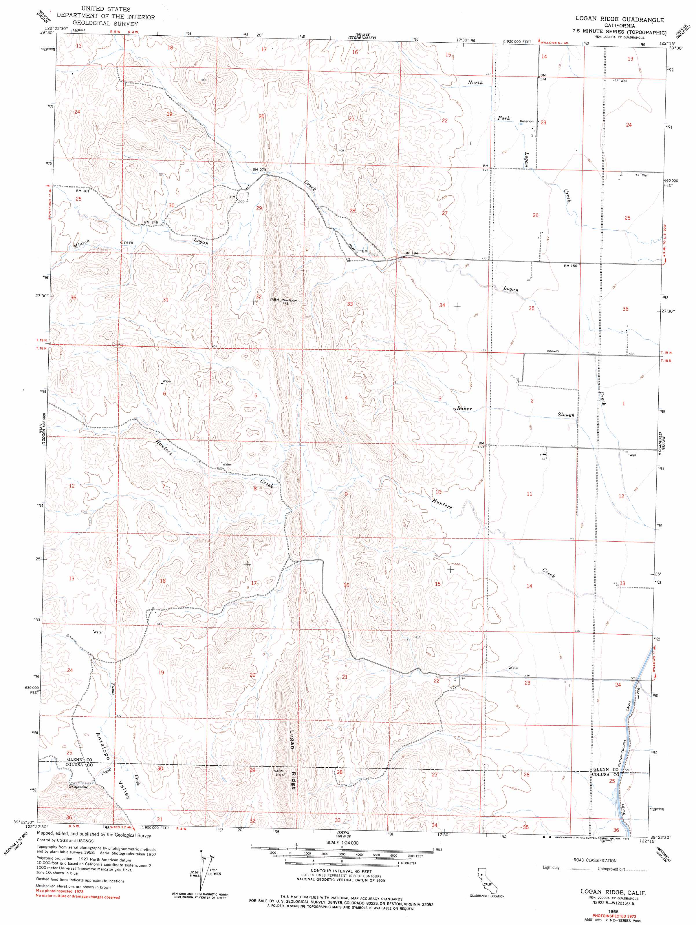
USGS Topo Quad 39122d3 - 1:24,000 scale
| Topo Map Name: | Logan Ridge |
| USGS Topo Quad ID: | 39122d3 |
| Print Size: | ca. 21 1/4" wide x 27" high |
| Southeast Coordinates: | 39.375° N latitude / 122.25° W longitude |
| Map Center Coordinates: | 39.4375° N latitude / 122.3125° W longitude |
| U.S. State: | CA |
| Filename: | o39122d3.jpg |
| Download Map JPG Image: | Logan Ridge topo map 1:24,000 scale |
| Map Type: | Topographic |
| Topo Series: | 7.5´ |
| Map Scale: | 1:24,000 |
| Source of Map Images: | United States Geological Survey (USGS) |
| Alternate Map Versions: |
Logan Creek CA 1904, updated 1957 Download PDF Buy paper map Logan Ridge CA 1958, updated 1960 Download PDF Buy paper map Logan Ridge CA 1958, updated 1978 Download PDF Buy paper map Logan Ridge CA 2012 Download PDF Buy paper map Logan Ridge CA 2015 Download PDF Buy paper map |
1:24,000 Topo Quads surrounding Logan Ridge
Chrome |
Julian Rocks |
Fruto Ne |
Orland |
Hamilton City |
Elk Creek |
Fruto |
Stone Valley |
Willows |
Glenn |
Stonyford |
Rail Canyon |
Logan Ridge |
Logandale |
Princeton |
Gilmore Peak |
Lodoga |
Sites |
Maxwell |
Moulton Weir |
Hough Springs |
Leesville |
Manor Slough |
Williams |
Colusa |
> Back to 39122a1 at 1:100,000 scale
> Back to 39122a1 at 1:250,000 scale
> Back to U.S. Topo Maps home
Logan Ridge topo map: Gazetteer
Logan Ridge: Ridges
Logan Ridge elevation 310m 1017′Logan Ridge: Streams
Baker Slough elevation 39m 127′Grapevine Creek elevation 106m 347′
Minton Creek elevation 105m 344′
Logan Ridge: Valleys
Antelope Valley elevation 111m 364′Logan Ridge digital topo map on disk
Buy this Logan Ridge topo map showing relief, roads, GPS coordinates and other geographical features, as a high-resolution digital map file on DVD: