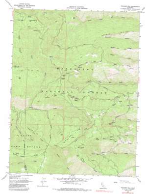
Felkner Hill Topo Map California
To zoom in, hover over the map of Felkner Hill
USGS Topo Quad 39122e6 - 1:24,000 scale
| Topo Map Name: | Felkner Hill |
| USGS Topo Quad ID: | 39122e6 |
| Print Size: | ca. 21 1/4" wide x 27" high |
| Southeast Coordinates: | 39.5° N latitude / 122.625° W longitude |
| Map Center Coordinates: | 39.5625° N latitude / 122.6875° W longitude |
| U.S. State: | CA |
| Filename: | o39122e6.jpg |
| Download Map JPG Image: | Felkner Hill topo map 1:24,000 scale |
| Map Type: | Topographic |
| Topo Series: | 7.5´ |
| Map Scale: | 1:24,000 |
| Source of Map Images: | United States Geological Survey (USGS) |
| Alternate Map Versions: |
Felkner Hill CA 1968, updated 1969 Download PDF Buy paper map Felkner Hill CA 1968, updated 1986 Download PDF Buy paper map Felkner Hill CA 1996, updated 2001 Download PDF Buy paper map Felkner Hill CA 2012 Download PDF Buy paper map Felkner Hill CA 2015 Download PDF Buy paper map |
| FStopo: | US Forest Service topo Felkner Hill is available: Download FStopo PDF Download FStopo TIF |
1:24,000 Topo Quads surrounding Felkner Hill
> Back to 39122e1 at 1:100,000 scale
> Back to 39122a1 at 1:250,000 scale
> Back to U.S. Topo Maps home
Felkner Hill topo map: Gazetteer
Felkner Hill: Gaps
Ivory Mill Saddle elevation 1385m 4543′Felkner Hill: Populated Places
Dogtown elevation 1493m 4898′Meyers Place elevation 851m 2791′
Felkner Hill: Ridges
Bowman Ridge elevation 929m 3047′Cedar Ridge elevation 1676m 5498′
Felkner Ridge elevation 1488m 4881′
Happy Camp Ridge elevation 1503m 4931′
Kern Ridge elevation 1364m 4475′
Lost Camp Ridge elevation 1652m 5419′
McGill Ridge elevation 977m 3205′
Noel Spring Ridge elevation 1192m 3910′
Self Ridge elevation 1013m 3323′
Tool Cache Ridge elevation 1336m 4383′
Felkner Hill: Springs
Foreman Spring elevation 1558m 5111′Hayward Spring elevation 1649m 5410′
Jerusalem Spring elevation 1415m 4642′
Jumbo Spring elevation 1675m 5495′
Noel Spring elevation 1556m 5104′
Summit Springs elevation 1705m 5593′
Felkner Hill: Streams
Dutch Oven Creek elevation 988m 3241′North Fork Corbin Creek elevation 1000m 3280′
Felkner Hill: Summits
Felkner Hill elevation 1719m 5639′Kern Point elevation 1541m 5055′
Pine Kop elevation 1562m 5124′
Summit Springs Hill elevation 1811m 5941′
Felkner Hill digital topo map on disk
Buy this Felkner Hill topo map showing relief, roads, GPS coordinates and other geographical features, as a high-resolution digital map file on DVD:


