Hamilton City Topo Map California
To zoom in, hover over the map of Hamilton City
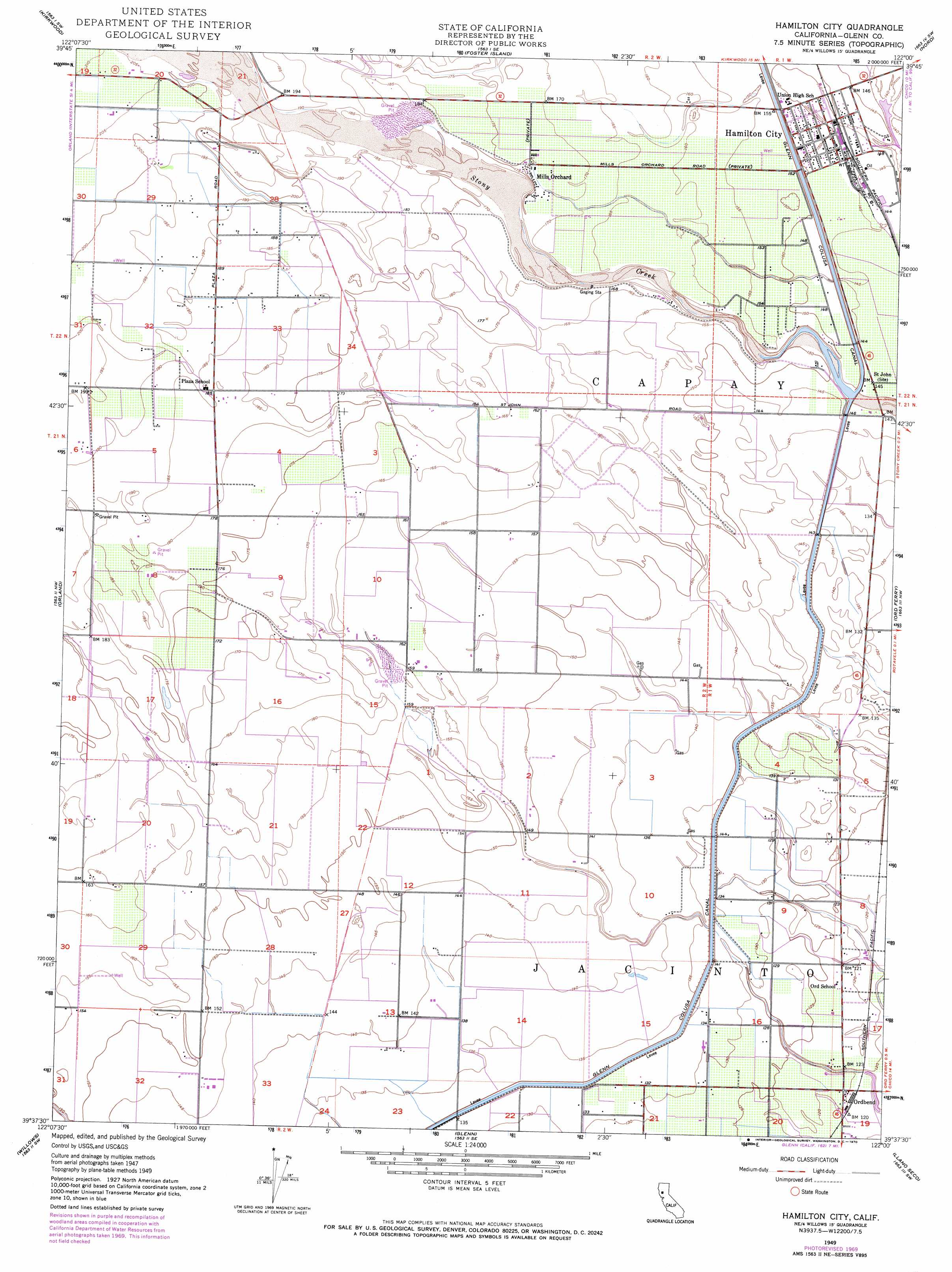
USGS Topo Quad 39122f1 - 1:24,000 scale
| Topo Map Name: | Hamilton City |
| USGS Topo Quad ID: | 39122f1 |
| Print Size: | ca. 21 1/4" wide x 27" high |
| Southeast Coordinates: | 39.625° N latitude / 122° W longitude |
| Map Center Coordinates: | 39.6875° N latitude / 122.0625° W longitude |
| U.S. State: | CA |
| Filename: | o39122f1.jpg |
| Download Map JPG Image: | Hamilton City topo map 1:24,000 scale |
| Map Type: | Topographic |
| Topo Series: | 7.5´ |
| Map Scale: | 1:24,000 |
| Source of Map Images: | United States Geological Survey (USGS) |
| Alternate Map Versions: |
Hamilton City CA 1949, updated 1958 Download PDF Buy paper map Hamilton City CA 1949, updated 1970 Download PDF Buy paper map Hamilton City CA 1949, updated 1979 Download PDF Buy paper map Hamilton City CA 1950 Download PDF Buy paper map Hamilton City CA 2012 Download PDF Buy paper map Hamilton City CA 2015 Download PDF Buy paper map |
1:24,000 Topo Quads surrounding Hamilton City
Henleyville |
Corning |
Vina |
Richardson Springs Nw |
Campbell Mound |
Black Butte Dam |
Kirkwood |
Foster Island |
Nord |
Richardson Springs |
Fruto Ne |
Orland |
Hamilton City |
Ord Ferry |
Chico |
Stone Valley |
Willows |
Glenn |
Llano Seco |
Nelson |
Logan Ridge |
Logandale |
Princeton |
Butte City |
West Of Biggs |
> Back to 39122e1 at 1:100,000 scale
> Back to 39122a1 at 1:250,000 scale
> Back to U.S. Topo Maps home
Hamilton City topo map: Gazetteer
Hamilton City: Canals
Glenn-Colusa Canal elevation 44m 144′Hamilton City: Dams
Stony Creek Gravel 2005 Dam elevation 44m 144′Hamilton City: Parks
Bidwell-Sacramento River State Park elevation 43m 141′Hamilton City: Populated Places
Hamilton City elevation 46m 150′Ideal Mobile Home Park elevation 45m 147′
Mills Orchard elevation 54m 177′
Ordbend elevation 37m 121′
Rotavele elevation 40m 131′
Hamilton City: Post Offices
Hamilton City Post Office elevation 46m 150′Hamilton City digital topo map on disk
Buy this Hamilton City topo map showing relief, roads, GPS coordinates and other geographical features, as a high-resolution digital map file on DVD: