Foster Island Topo Map California
To zoom in, hover over the map of Foster Island
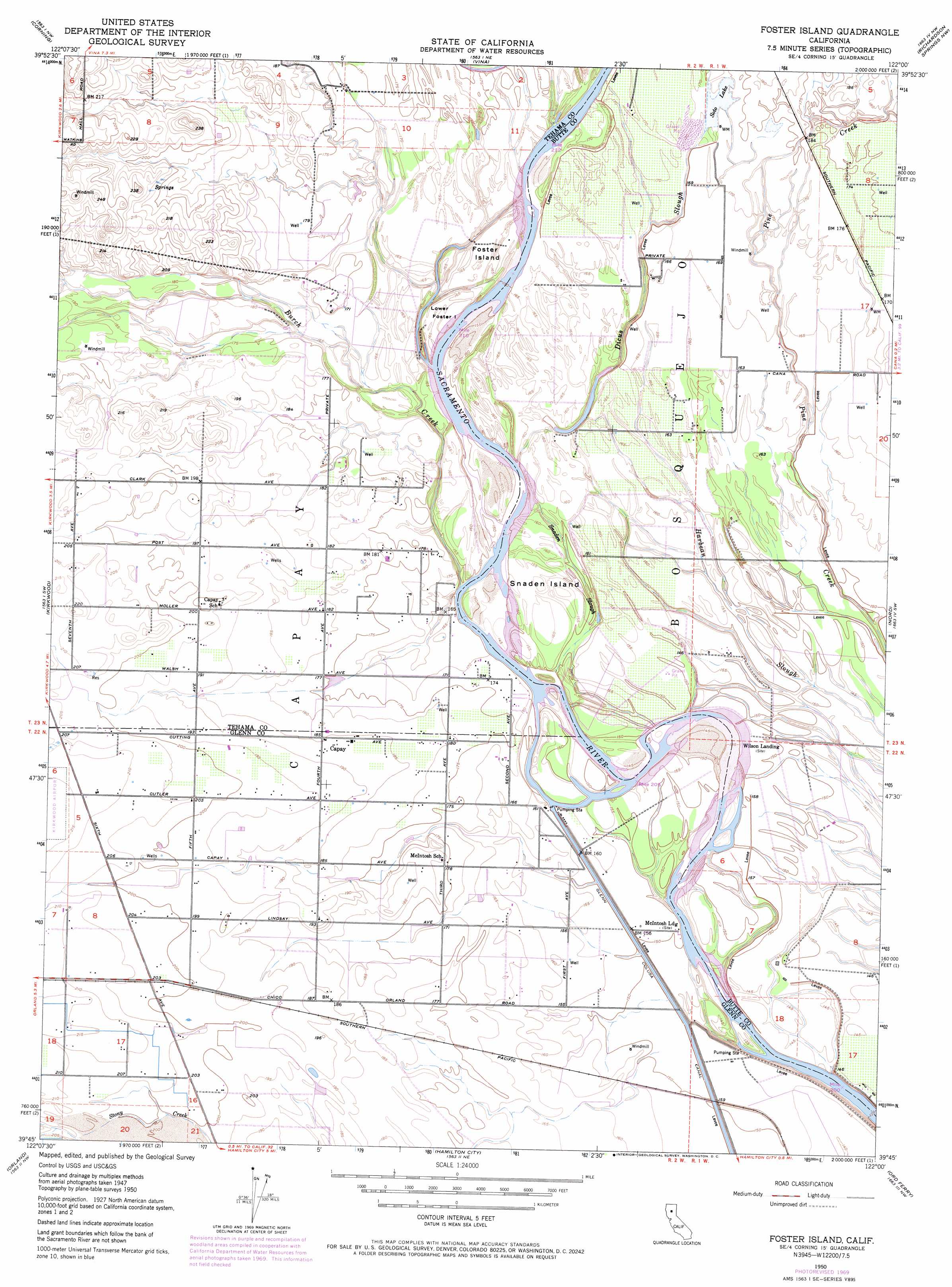
USGS Topo Quad 39122g1 - 1:24,000 scale
| Topo Map Name: | Foster Island |
| USGS Topo Quad ID: | 39122g1 |
| Print Size: | ca. 21 1/4" wide x 27" high |
| Southeast Coordinates: | 39.75° N latitude / 122° W longitude |
| Map Center Coordinates: | 39.8125° N latitude / 122.0625° W longitude |
| U.S. State: | CA |
| Filename: | o39122g1.jpg |
| Download Map JPG Image: | Foster Island topo map 1:24,000 scale |
| Map Type: | Topographic |
| Topo Series: | 7.5´ |
| Map Scale: | 1:24,000 |
| Source of Map Images: | United States Geological Survey (USGS) |
| Alternate Map Versions: |
Foster Island CA 1950, updated 1963 Download PDF Buy paper map Foster Island CA 1950, updated 1969 Download PDF Buy paper map Foster Island CA 1950, updated 1971 Download PDF Buy paper map Foster Island CA 1950, updated 1971 Download PDF Buy paper map Foster Island CA 1951, updated 1951 Download PDF Buy paper map Foster Island CA 2012 Download PDF Buy paper map Foster Island CA 2015 Download PDF Buy paper map |
1:24,000 Topo Quads surrounding Foster Island
West Of Gerber |
Gerber |
Los Molinos |
Acorn Hollow |
Ishi Caves |
Henleyville |
Corning |
Vina |
Richardson Springs Nw |
Campbell Mound |
Black Butte Dam |
Kirkwood |
Foster Island |
Nord |
Richardson Springs |
Fruto Ne |
Orland |
Hamilton City |
Ord Ferry |
Chico |
Stone Valley |
Willows |
Glenn |
Llano Seco |
Nelson |
> Back to 39122e1 at 1:100,000 scale
> Back to 39122a1 at 1:250,000 scale
> Back to U.S. Topo Maps home
Foster Island topo map: Gazetteer
Foster Island: Bends
Jackstaff Bend elevation 51m 167′Missouri Bend elevation 50m 164′
Foster Island: Channels
Hoodlum Chute elevation 49m 160′Foster Island: Islands
Emery and Mitchell Island elevation 47m 154′Foster Island elevation 51m 167′
Lower Foster Island elevation 45m 147′
McIntosh Island elevation 47m 154′
Snaden Island elevation 49m 160′
Wilson Island elevation 49m 160′
Foster Island: Lakes
Goose Lake (historical) elevation 54m 177′Foster Island: Populated Places
Capay elevation 57m 187′Foster Island: Reservoirs
Soto Lake elevation 53m 173′Foster Island: Streams
Burch Creek elevation 43m 141′Dicus Slough elevation 50m 164′
Snaden Slough elevation 42m 137′
Sour Grass Creek elevation 53m 173′
Foster Island digital topo map on disk
Buy this Foster Island topo map showing relief, roads, GPS coordinates and other geographical features, as a high-resolution digital map file on DVD: