Sehorn Creek Topo Map California
To zoom in, hover over the map of Sehorn Creek
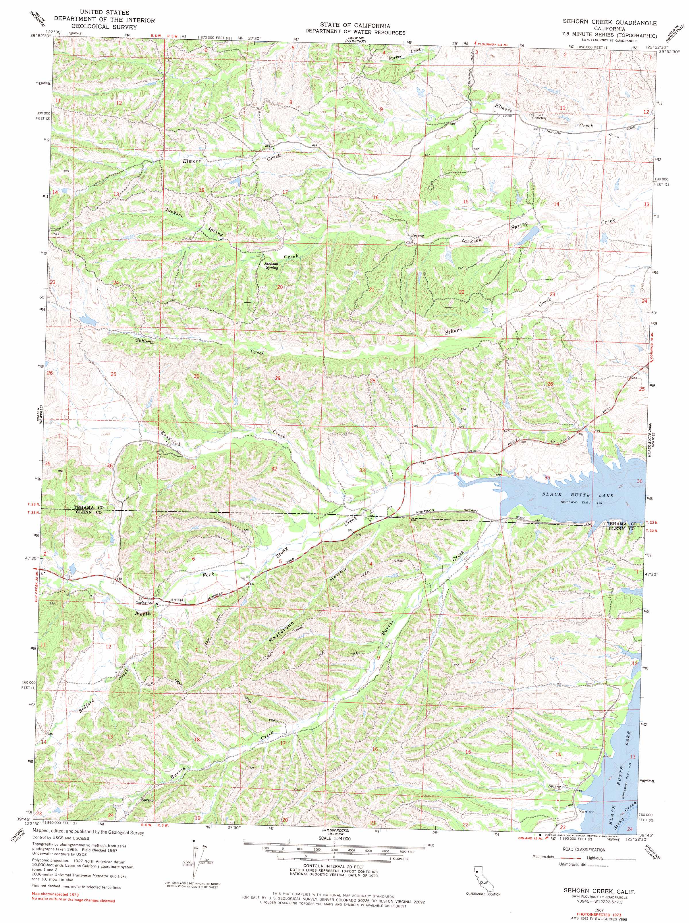
USGS Topo Quad 39122g4 - 1:24,000 scale
| Topo Map Name: | Sehorn Creek |
| USGS Topo Quad ID: | 39122g4 |
| Print Size: | ca. 21 1/4" wide x 27" high |
| Southeast Coordinates: | 39.75° N latitude / 122.375° W longitude |
| Map Center Coordinates: | 39.8125° N latitude / 122.4375° W longitude |
| U.S. State: | CA |
| Filename: | o39122g4.jpg |
| Download Map JPG Image: | Sehorn Creek topo map 1:24,000 scale |
| Map Type: | Topographic |
| Topo Series: | 7.5´ |
| Map Scale: | 1:24,000 |
| Source of Map Images: | United States Geological Survey (USGS) |
| Alternate Map Versions: |
Sehorn Creek CA 1967, updated 1968 Download PDF Buy paper map Sehorn Creek CA 1967, updated 1977 Download PDF Buy paper map Sehorn Creek CA 1967, updated 1977 Download PDF Buy paper map Sehorn Creek CA 2012 Download PDF Buy paper map Sehorn Creek CA 2015 Download PDF Buy paper map |
1:24,000 Topo Quads surrounding Sehorn Creek
Raglin Ridge |
Lowrey |
Red Bank |
West Of Gerber |
Gerber |
Riley Ridge |
Paskenta |
Flournoy |
Henleyville |
Corning |
Hall Ridge |
Newville |
Sehorn Creek |
Black Butte Dam |
Kirkwood |
Alder Springs |
Chrome |
Julian Rocks |
Fruto Ne |
Orland |
Felkner Hill |
Elk Creek |
Fruto |
Stone Valley |
Willows |
> Back to 39122e1 at 1:100,000 scale
> Back to 39122a1 at 1:250,000 scale
> Back to U.S. Topo Maps home
Sehorn Creek topo map: Gazetteer
Sehorn Creek: Parks
Burris Creek Recreation Area elevation 147m 482′Grizzly Flat Recreation Area elevation 152m 498′
Sehorn Creek: Springs
Jackson Spring elevation 208m 682′Sehorn Creek: Streams
Bedford Creek elevation 166m 544′Burris Creek elevation 146m 479′
Kendrick Creek elevation 150m 492′
North Fork Stony Creek elevation 145m 475′
Sehorn Creek: Valleys
Masterson Hollow elevation 153m 501′Sehorn Creek digital topo map on disk
Buy this Sehorn Creek topo map showing relief, roads, GPS coordinates and other geographical features, as a high-resolution digital map file on DVD: