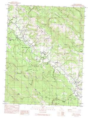
Philo Topo Map California
To zoom in, hover over the map of Philo
USGS Topo Quad 39123a4 - 1:24,000 scale
| Topo Map Name: | Philo |
| USGS Topo Quad ID: | 39123a4 |
| Print Size: | ca. 21 1/4" wide x 27" high |
| Southeast Coordinates: | 39° N latitude / 123.375° W longitude |
| Map Center Coordinates: | 39.0625° N latitude / 123.4375° W longitude |
| U.S. State: | CA |
| Filename: | o39123a4.jpg |
| Download Map JPG Image: | Philo topo map 1:24,000 scale |
| Map Type: | Topographic |
| Topo Series: | 7.5´ |
| Map Scale: | 1:24,000 |
| Source of Map Images: | United States Geological Survey (USGS) |
| Alternate Map Versions: |
Philo CA 1991, updated 1991 Download PDF Buy paper map Philo CA 2012 Download PDF Buy paper map Philo CA 2015 Download PDF Buy paper map |
1:24,000 Topo Quads surrounding Philo
> Back to 39123a1 at 1:100,000 scale
> Back to 39122a1 at 1:250,000 scale
> Back to U.S. Topo Maps home
Philo topo map: Gazetteer
Philo: Airports
Boonville Airport elevation 122m 400′Philo: Bends
The Big Bend elevation 194m 636′Philo: Flats
Murray Opening elevation 324m 1062′Philo: Parks
Faulkner County Park elevation 338m 1108′Hendy Woods State Park elevation 62m 203′
Indian Creek County Park elevation 71m 232′
Philo: Populated Places
Hendy Grove elevation 58m 190′Philbrick Mill elevation 146m 479′
Philo elevation 101m 331′
Philo: Ridges
Clow Ridge elevation 721m 2365′Lambert Ridge elevation 480m 1574′
Peterson Ridge elevation 351m 1151′
Whipple Ridge elevation 519m 1702′
Philo: Streams
Anderson Creek elevation 63m 206′Bullock Creek elevation 270m 885′
Cold Springs Creek elevation 108m 354′
Con Creek elevation 96m 314′
Creek Italian elevation 97m 318′
Dago Creek elevation 94m 308′
Gowan Creek elevation 48m 157′
Graveyard Creek elevation 99m 324′
Gschwend Creek elevation 329m 1079′
Honey Creek elevation 224m 734′
Horse Creek elevation 128m 419′
Indian Creek elevation 55m 180′
Ornbaun Creek elevation 94m 308′
Rancheria Creek elevation 57m 187′
West Branch Indian Creek elevation 128m 419′
West Branch North Fork Indian Creek elevation 295m 967′
Witherell Creek elevation 98m 321′
Philo: Summits
Clow Mountain elevation 635m 2083′Philo: Valleys
Anderson Valley elevation 51m 167′Big Canyon elevation 131m 429′
Clow Canyon elevation 71m 232′
Ham Canyon elevation 73m 239′
Parkinson Gulch elevation 138m 452′
Red Hill Gulch elevation 133m 436′
Saint John Canyon elevation 247m 810′
Sherman Gulch elevation 259m 849′
Township Gulch elevation 89m 291′
Philo: Woods
Big Hendy Grove elevation 54m 177′Little Hendy Grove elevation 48m 157′
Philo digital topo map on disk
Buy this Philo topo map showing relief, roads, GPS coordinates and other geographical features, as a high-resolution digital map file on DVD:


