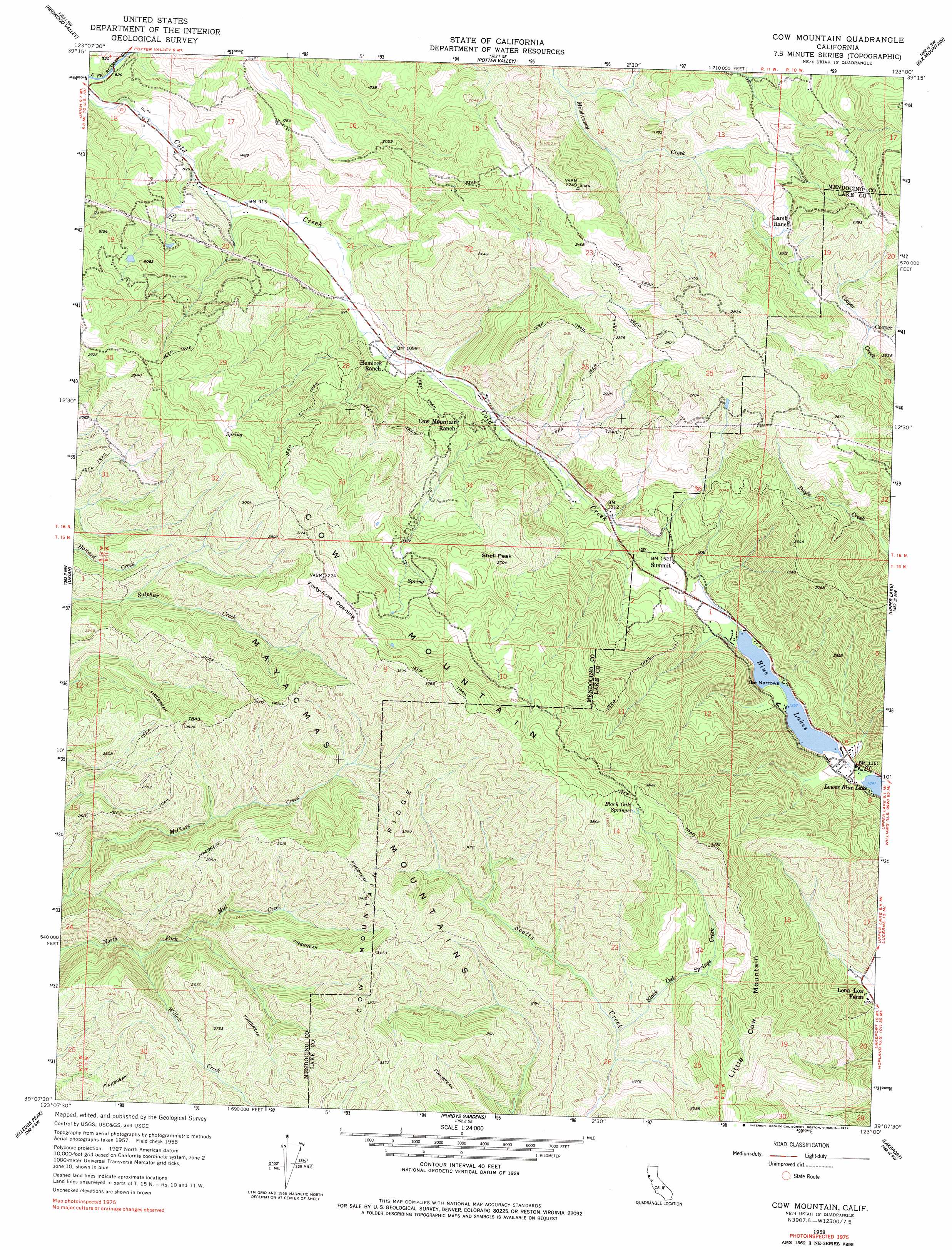
Cow Mountain Topo Map California
To zoom in, hover over the map of Cow Mountain
USGS Topo Quad 39123b1 - 1:24,000 scale
| Topo Map Name: | Cow Mountain |
| USGS Topo Quad ID: | 39123b1 |
| Print Size: | ca. 21 1/4" wide x 27" high |
| Southeast Coordinates: | 39.125° N latitude / 123° W longitude |
| Map Center Coordinates: | 39.1875° N latitude / 123.0625° W longitude |
| U.S. State: | CA |
| Filename: | o39123b1.jpg |
| Download Map JPG Image: | Cow Mountain topo map 1:24,000 scale |
| Map Type: | Topographic |
| Topo Series: | 7.5´ |
| Map Scale: | 1:24,000 |
| Source of Map Images: | United States Geological Survey (USGS) |
| Alternate Map Versions: |
Cow Mountain CA 1958, updated 1960 Download PDF Buy paper map Cow Mountain CA 1958, updated 1977 Download PDF Buy paper map Cow Mountain CA 2012 Download PDF Buy paper map Cow Mountain CA 2015 Download PDF Buy paper map |
1:24,000 Topo Quads surrounding Cow Mountain
Willits |
Foster Mountain |
Van Arsdale Reservoir |
Lake Pillsbury |
Crockett Peak |
Laughlin Range |
Redwood Valley |
Potter Valley |
Elk Mountain |
Potato Hill |
Orrs Springs |
Ukiah |
Cow Mountain |
Upper Lake |
Bartlett Mountain |
Boonville |
Elledge Peak |
Purdys Gardens |
Lakeport |
Lucerne |
Ornbaun Valley |
Yorkville |
Hopland |
Highland Springs |
Kelseyville |
> Back to 39123a1 at 1:100,000 scale
> Back to 39122a1 at 1:250,000 scale
> Back to U.S. Topo Maps home
Cow Mountain topo map: Gazetteer
Cow Mountain: Channels
The Narrows elevation 414m 1358′Cow Mountain: Flats
Forty-Acre Opening elevation 957m 3139′Cow Mountain: Lakes
Blue Lakes elevation 414m 1358′Cow Mountain: Populated Places
Cooper elevation 609m 1998′Cow Mountain: Ridges
Cow Mountain elevation 1193m 3914′Cow Mountain Ridge elevation 1088m 3569′
Cow Mountain: Springs
Black Oak Springs elevation 1029m 3375′Cow Mountain: Streams
Black Oak Springs Creek elevation 621m 2037′Hanson Creek elevation 404m 1325′
Willow Creek elevation 507m 1663′
Cow Mountain: Summits
Little Cow Mountain elevation 894m 2933′Shell Peak elevation 814m 2670′
Cow Mountain digital topo map on disk
Buy this Cow Mountain topo map showing relief, roads, GPS coordinates and other geographical features, as a high-resolution digital map file on DVD: