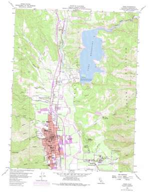
Ukiah Topo Map California
To zoom in, hover over the map of Ukiah
USGS Topo Quad 39123b2 - 1:24,000 scale
| Topo Map Name: | Ukiah |
| USGS Topo Quad ID: | 39123b2 |
| Print Size: | ca. 21 1/4" wide x 27" high |
| Southeast Coordinates: | 39.125° N latitude / 123.125° W longitude |
| Map Center Coordinates: | 39.1875° N latitude / 123.1875° W longitude |
| U.S. State: | CA |
| Filename: | o39123b2.jpg |
| Download Map JPG Image: | Ukiah topo map 1:24,000 scale |
| Map Type: | Topographic |
| Topo Series: | 7.5´ |
| Map Scale: | 1:24,000 |
| Source of Map Images: | United States Geological Survey (USGS) |
| Alternate Map Versions: |
Ukiah CA 1958, updated 1960 Download PDF Buy paper map Ukiah CA 1958, updated 1972 Download PDF Buy paper map Ukiah CA 1958, updated 1978 Download PDF Buy paper map Ukiah CA 2012 Download PDF Buy paper map Ukiah CA 2015 Download PDF Buy paper map |
1:24,000 Topo Quads surrounding Ukiah
> Back to 39123a1 at 1:100,000 scale
> Back to 39122a1 at 1:250,000 scale
> Back to U.S. Topo Maps home
Ukiah topo map: Gazetteer
Ukiah: Airports
Ukiah Municipal Airport elevation 187m 613′Ukiah: Dams
Coyote Dam elevation 217m 711′Mendocino Middle 1089-000 Dam elevation 303m 994′
Mendocino Upper 1089-002 Dam elevation 328m 1076′
Round Mountain 1382 Dam elevation 229m 751′
Ukiah: Islands
Sho-Da-Kai elevation 242m 793′Ukiah: Parks
Anton Stadium elevation 216m 708′Hudson-Carpenter Park elevation 189m 620′
Lake Mendocino Recreation Area elevation 226m 741′
Low Gap Regional Park elevation 229m 751′
McGarvey Park elevation 199m 652′
Nokomis Park elevation 197m 646′
Oak Manor Park elevation 182m 597′
Todd Grove Park elevation 213m 698′
Twelfth District Fairgrounds elevation 189m 620′
Vinewood Park elevation 198m 649′
Ukiah: Populated Places
Asylum elevation 185m 606′Calpella elevation 208m 682′
Caravan Mobile Home Park elevation 200m 656′
Coyote Valley Rancheria (historical) elevation 229m 751′
Presswood elevation 189m 620′
Regina Heights elevation 282m 925′
Talmage elevation 191m 626′
The Forks elevation 195m 639′
Ukiah elevation 193m 633′
Vichy Springs elevation 244m 800′
Ukiah: Post Offices
Calpella Post Office elevation 207m 679′Ukiah Post Office elevation 196m 643′
Vichy Springs Post Office (historical) elevation 244m 800′
Ukiah: Reservoirs
Lake Mendocino elevation 217m 711′Russian River Reservoir elevation 226m 741′
Ukiah: Streams
Ackerman Creek elevation 184m 603′Cold Creek elevation 254m 833′
Doolin Creek elevation 178m 583′
East Fork Russian River elevation 190m 623′
Forsythe Creek elevation 223m 731′
Gibson Creek elevation 179m 587′
Hensley Creek elevation 188m 616′
Howard Creek elevation 184m 603′
McClure Creek elevation 181m 593′
Mill Creek elevation 178m 583′
North Fork Mill Creek elevation 197m 646′
Orrs Creek elevation 181m 593′
Sulphur Creek elevation 182m 597′
York Creek elevation 191m 626′
Ukiah: Summits
Lookout Peak elevation 831m 2726′Ukiah digital topo map on disk
Buy this Ukiah topo map showing relief, roads, GPS coordinates and other geographical features, as a high-resolution digital map file on DVD:


