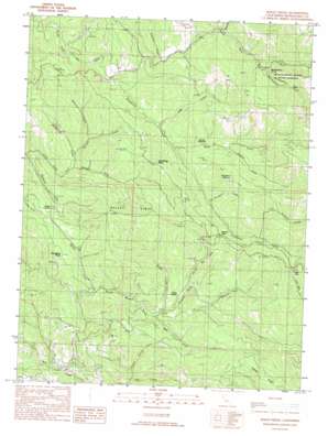
Bailey Ridge Topo Map California
To zoom in, hover over the map of Bailey Ridge
USGS Topo Quad 39123b4 - 1:24,000 scale
| Topo Map Name: | Bailey Ridge |
| USGS Topo Quad ID: | 39123b4 |
| Print Size: | ca. 21 1/4" wide x 27" high |
| Southeast Coordinates: | 39.125° N latitude / 123.375° W longitude |
| Map Center Coordinates: | 39.1875° N latitude / 123.4375° W longitude |
| U.S. State: | CA |
| Filename: | o39123b4.jpg |
| Download Map JPG Image: | Bailey Ridge topo map 1:24,000 scale |
| Map Type: | Topographic |
| Topo Series: | 7.5´ |
| Map Scale: | 1:24,000 |
| Source of Map Images: | United States Geological Survey (USGS) |
| Alternate Map Versions: |
Bailey Ridge CA 1991, updated 1991 Download PDF Buy paper map Bailey Ridge CA 2012 Download PDF Buy paper map Bailey Ridge CA 2015 Download PDF Buy paper map |
1:24,000 Topo Quads surrounding Bailey Ridge
> Back to 39123a1 at 1:100,000 scale
> Back to 39122a1 at 1:250,000 scale
> Back to U.S. Topo Maps home
Bailey Ridge topo map: Gazetteer
Bailey Ridge: Flats
Castle Garden elevation 171m 561′Horsethief Opening elevation 422m 1384′
Montgomery Flat elevation 234m 767′
Squaw Opening elevation 269m 882′
Bailey Ridge: Gaps
Bailey Summit elevation 267m 875′Low Gap elevation 406m 1332′
Wohlys Pass elevation 366m 1200′
Bailey Ridge: Populated Places
Montgomery elevation 433m 1420′Old Bailey Place elevation 289m 948′
Bailey Ridge: Ridges
Bailey Ridge elevation 536m 1758′Bailey Ridge: Streams
Bailey Creek elevation 127m 416′Bear Creek elevation 154m 505′
Bottom Creek elevation 156m 511′
Bridge Creek elevation 157m 515′
Daugherty Creek elevation 154m 505′
Gates Creek elevation 180m 590′
Horsethief Creek elevation 228m 748′
Hungry Hollow Creek elevation 172m 564′
Johnson Creek elevation 236m 774′
Johnson Creek elevation 171m 561′
Low Gap Creek elevation 281m 921′
McCarvey Creek elevation 196m 643′
Montgomery Creek elevation 246m 807′
Rose Creek elevation 278m 912′
Sawyer Creek elevation 154m 505′
Shingle Mill Creek elevation 173m 567′
Snuffins Creek elevation 291m 954′
Soda Creek elevation 189m 620′
Spooner Creek elevation 163m 534′
Bailey Ridge: Valleys
Dark Gulch elevation 207m 679′Bailey Ridge digital topo map on disk
Buy this Bailey Ridge topo map showing relief, roads, GPS coordinates and other geographical features, as a high-resolution digital map file on DVD:


