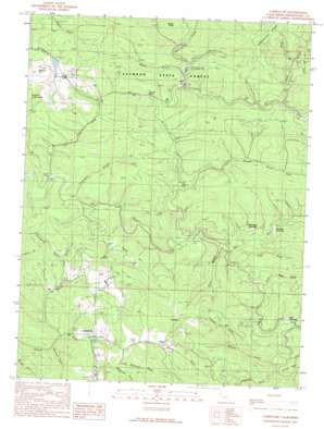
Comptche Topo Map California
To zoom in, hover over the map of Comptche
USGS Topo Quad 39123c5 - 1:24,000 scale
| Topo Map Name: | Comptche |
| USGS Topo Quad ID: | 39123c5 |
| Print Size: | ca. 21 1/4" wide x 27" high |
| Southeast Coordinates: | 39.25° N latitude / 123.5° W longitude |
| Map Center Coordinates: | 39.3125° N latitude / 123.5625° W longitude |
| U.S. State: | CA |
| Filename: | o39123c5.jpg |
| Download Map JPG Image: | Comptche topo map 1:24,000 scale |
| Map Type: | Topographic |
| Topo Series: | 7.5´ |
| Map Scale: | 1:24,000 |
| Source of Map Images: | United States Geological Survey (USGS) |
| Alternate Map Versions: |
Comptche CA 1991, updated 1991 Download PDF Buy paper map Comptche CA 2012 Download PDF Buy paper map Comptche CA 2015 Download PDF Buy paper map |
1:24,000 Topo Quads surrounding Comptche
> Back to 39123a1 at 1:100,000 scale
> Back to 39122a1 at 1:250,000 scale
> Back to U.S. Topo Maps home
Comptche topo map: Gazetteer
Comptche: Dams
McGuire 1386 Dam elevation 94m 308′Comptche: Flats
Clark Opening elevation 115m 377′McDuffy Opening elevation 95m 311′
Nathaniel Smith Opening elevation 84m 275′
Wild Horse Opening elevation 89m 291′
Comptche: Gaps
Dunlap Pass elevation 129m 423′Comptche: Populated Places
Cameron elevation 437m 1433′Comptche elevation 57m 187′
Dunlap (historical) elevation 107m 351′
Comptche: Ridges
Chamberlain Ridge elevation 526m 1725′Comptche: Springs
Soda Spring elevation 77m 252′Comptche: Streams
Chamberlain Creek elevation 98m 321′East Branch North Fork Big River elevation 68m 223′
Freathy Creek elevation 97m 318′
James Creek elevation 132m 433′
Marsh Creek elevation 49m 160′
Mettick Creek elevation 107m 351′
North Fork Albion River elevation 49m 160′
North Fork Big River elevation 63m 206′
Ramon Creek elevation 98m 321′
Russell Brook elevation 88m 288′
Soda Spring Creek elevation 54m 177′
South Fork Big River elevation 60m 196′
Two Log Creek elevation 44m 144′
Comptche: Summits
Docker Hill elevation 319m 1046′McGuire Hill elevation 205m 672′
Comptche: Valleys
Anderson Gulch elevation 110m 360′Biggs Gulch elevation 74m 242′
Bowman Gulch elevation 139m 456′
Dietz Gulch elevation 67m 219′
Kelly Gulch elevation 71m 232′
Little McDonald Gulch elevation 60m 196′
McDonald Gulch elevation 57m 187′
Morrison Gulch elevation 45m 147′
Park Gulch elevation 114m 374′
Portuguese Gulch elevation 92m 301′
Poverty Gulch elevation 168m 551′
Sindel Gulch elevation 164m 538′
Tramway Gulch elevation 30m 98′
Water Gulch elevation 133m 436′
Comptche digital topo map on disk
Buy this Comptche topo map showing relief, roads, GPS coordinates and other geographical features, as a high-resolution digital map file on DVD:


