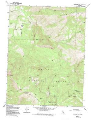
Sanhedrin Mountain Topo Map California
To zoom in, hover over the map of Sanhedrin Mountain
USGS Topo Quad 39123e1 - 1:24,000 scale
| Topo Map Name: | Sanhedrin Mountain |
| USGS Topo Quad ID: | 39123e1 |
| Print Size: | ca. 21 1/4" wide x 27" high |
| Southeast Coordinates: | 39.5° N latitude / 123° W longitude |
| Map Center Coordinates: | 39.5625° N latitude / 123.0625° W longitude |
| U.S. State: | CA |
| Filename: | o39123e1.jpg |
| Download Map JPG Image: | Sanhedrin Mountain topo map 1:24,000 scale |
| Map Type: | Topographic |
| Topo Series: | 7.5´ |
| Map Scale: | 1:24,000 |
| Source of Map Images: | United States Geological Survey (USGS) |
| Alternate Map Versions: |
Sanhedrin Mtn CA 1966, updated 1969 Download PDF Buy paper map Sanhedrin Mtn CA 1966, updated 1980 Download PDF Buy paper map Sanhedrin Mtn CA 1966, updated 1994 Download PDF Buy paper map Sanhedrin Mountain CA 1996, updated 2001 Download PDF Buy paper map Sanhedrin Mountain CA 2012 Download PDF Buy paper map Sanhedrin Mountain CA 2015 Download PDF Buy paper map |
| FStopo: | US Forest Service topo Sanhedrin Mountain is available: Download FStopo PDF Download FStopo TIF |
1:24,000 Topo Quads surrounding Sanhedrin Mountain
> Back to 39123e1 at 1:100,000 scale
> Back to 39122a1 at 1:250,000 scale
> Back to U.S. Topo Maps home
Sanhedrin Mountain topo map: Gazetteer
Sanhedrin Mountain: Basins
Bennett Valley elevation 531m 1742′Sanhedrin Mountain: Flats
Cow Flat elevation 1360m 4461′Sportsman Glade elevation 1015m 3330′
Sanhedrin Mountain: Lakes
Lily Pad Lake elevation 1655m 5429′Summit Lake elevation 1118m 3667′
Sanhedrin Mountain: Populated Places
Crocker Place elevation 795m 2608′Four Pines elevation 1327m 4353′
Sanhedrin Mountain: Ridges
Long Doe Ridge elevation 1461m 4793′Sanhedrin Mountain elevation 1882m 6174′
Sanhedrin Mountain: Springs
Vulture Spring elevation 1761m 5777′Sanhedrin Mountain: Streams
Bear Creek elevation 463m 1519′Bennett Creek elevation 425m 1394′
Crocker Creek elevation 535m 1755′
Deep Hole Creek elevation 393m 1289′
Ellis Creek elevation 394m 1292′
Forks Creek elevation 476m 1561′
Little Thatcher Creek elevation 407m 1335′
Lookout Creek elevation 741m 2431′
Mendenhall Creek elevation 597m 1958′
Sanhedrin Creek elevation 403m 1322′
Shake Creek elevation 489m 1604′
Sportsman Creek elevation 613m 2011′
Sulphur Springs Creek elevation 544m 1784′
Sanhedrin Mountain: Summits
Big Signal Peak elevation 1882m 6174′Impassable Rock elevation 1743m 5718′
Little Signal Peak elevation 1701m 5580′
The Island elevation 1132m 3713′
Sanhedrin Mountain digital topo map on disk
Buy this Sanhedrin Mountain topo map showing relief, roads, GPS coordinates and other geographical features, as a high-resolution digital map file on DVD:


