Willis Ridge Topo Map California
To zoom in, hover over the map of Willis Ridge
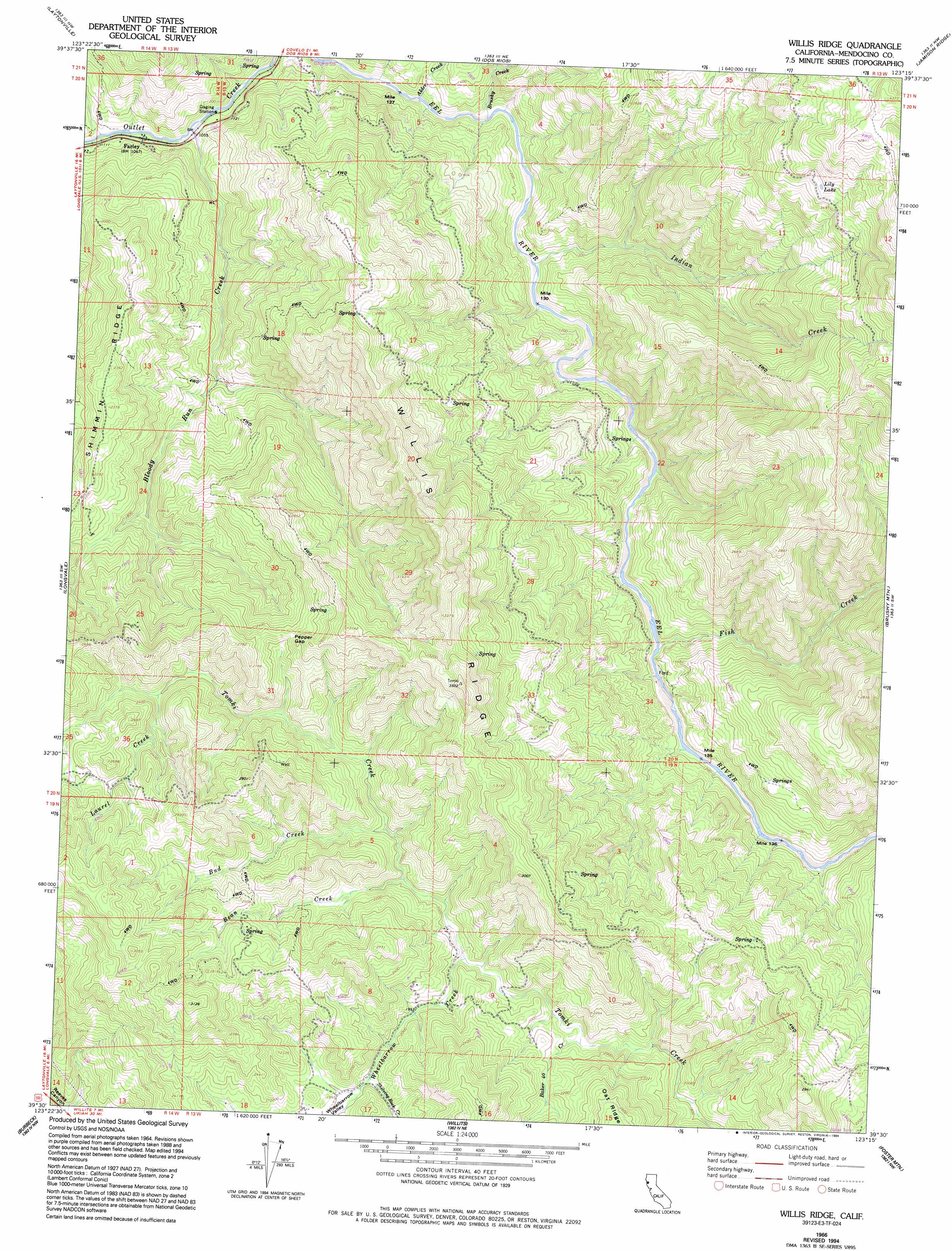
USGS Topo Quad 39123e3 - 1:24,000 scale
| Topo Map Name: | Willis Ridge |
| USGS Topo Quad ID: | 39123e3 |
| Print Size: | ca. 21 1/4" wide x 27" high |
| Southeast Coordinates: | 39.5° N latitude / 123.25° W longitude |
| Map Center Coordinates: | 39.5625° N latitude / 123.3125° W longitude |
| U.S. State: | CA |
| Filename: | o39123e3.jpg |
| Download Map JPG Image: | Willis Ridge topo map 1:24,000 scale |
| Map Type: | Topographic |
| Topo Series: | 7.5´ |
| Map Scale: | 1:24,000 |
| Source of Map Images: | United States Geological Survey (USGS) |
| Alternate Map Versions: |
Willis Ridge CA 1966, updated 1969 Download PDF Buy paper map Willis Ridge CA 1966, updated 1986 Download PDF Buy paper map Willis Ridge CA 1966, updated 1994 Download PDF Buy paper map Willis Ridge CA 2012 Download PDF Buy paper map Willis Ridge CA 2015 Download PDF Buy paper map |
1:24,000 Topo Quads surrounding Willis Ridge
Tan Oak Park |
Iron Peak |
Covelo West |
Covelo East |
Newhouse Ridge |
Cahto Peak |
Laytonville |
Dos Rios |
Jamison Ridge |
Thatcher Ridge |
Sherwood Peak |
Longvale |
Willis Ridge |
Brushy Mountain |
Sanhedrin Mountain |
Northspur |
Burbeck |
Willits |
Foster Mountain |
Van Arsdale Reservoir |
Comptche |
Greenough Ridge |
Laughlin Range |
Redwood Valley |
Potter Valley |
> Back to 39123e1 at 1:100,000 scale
> Back to 39122a1 at 1:250,000 scale
> Back to U.S. Topo Maps home
Willis Ridge topo map: Gazetteer
Willis Ridge: Gaps
Pepper Gap elevation 760m 2493′Willis Ridge: Lakes
Lily Lake elevation 1085m 3559′Willis Ridge: Populated Places
Farley elevation 327m 1072′Willis Ridge: Ridges
Shimmin Ridge elevation 719m 2358′Willis Ridge elevation 1053m 3454′
Willis Ridge: Streams
Alder Creek elevation 322m 1056′Baker Forty Creek elevation 563m 1847′
Bean Creek elevation 597m 1958′
Bloody Run Creek elevation 326m 1069′
Brushy Creek elevation 325m 1066′
Bud Creek elevation 598m 1961′
Fish Creek elevation 343m 1125′
Indian Creek elevation 345m 1131′
Laurel Creek elevation 674m 2211′
Shelving Rock Creek elevation 605m 1984′
Wheelbarrow Creek elevation 586m 1922′
Willis Ridge: Summits
Bald Mountain elevation 700m 2296′Fox Peak elevation 892m 2926′
Willis Ridge: Valleys
Wheelbarrow Valley elevation 612m 2007′Willis Ridge digital topo map on disk
Buy this Willis Ridge topo map showing relief, roads, GPS coordinates and other geographical features, as a high-resolution digital map file on DVD: