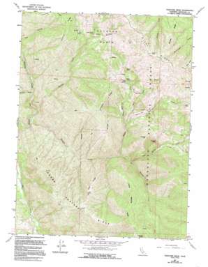
Thatcher Ridge Topo Map California
To zoom in, hover over the map of Thatcher Ridge
USGS Topo Quad 39123f1 - 1:24,000 scale
| Topo Map Name: | Thatcher Ridge |
| USGS Topo Quad ID: | 39123f1 |
| Print Size: | ca. 21 1/4" wide x 27" high |
| Southeast Coordinates: | 39.625° N latitude / 123° W longitude |
| Map Center Coordinates: | 39.6875° N latitude / 123.0625° W longitude |
| U.S. State: | CA |
| Filename: | o39123f1.jpg |
| Download Map JPG Image: | Thatcher Ridge topo map 1:24,000 scale |
| Map Type: | Topographic |
| Topo Series: | 7.5´ |
| Map Scale: | 1:24,000 |
| Source of Map Images: | United States Geological Survey (USGS) |
| Alternate Map Versions: |
Thatcher Ridge CA 1967, updated 1969 Download PDF Buy paper map Thatcher Ridge CA 1967, updated 1980 Download PDF Buy paper map Thatcher Ridge CA 1967, updated 1994 Download PDF Buy paper map Thatcher Ridge CA 1995, updated 2001 Download PDF Buy paper map Thatcher Ridge CA 2012 Download PDF Buy paper map Thatcher Ridge CA 2015 Download PDF Buy paper map |
| FStopo: | US Forest Service topo Thatcher Ridge is available: Download FStopo PDF Download FStopo TIF |
1:24,000 Topo Quads surrounding Thatcher Ridge
> Back to 39123e1 at 1:100,000 scale
> Back to 39122a1 at 1:250,000 scale
> Back to U.S. Topo Maps home
Thatcher Ridge topo map: Gazetteer
Thatcher Ridge: Basins
Hayshed Basin elevation 1058m 3471′Jack Hollow elevation 1320m 4330′
Thatcher Ridge: Flats
Hand Flat elevation 982m 3221′Haynes Flat elevation 982m 3221′
Thatcher Ridge: Lakes
Skunk Lake elevation 1269m 4163′Thatcher Ridge: Ridges
Bentley Ridge elevation 1223m 4012′Camp Meeting Ridge elevation 1165m 3822′
Etsel Ridge elevation 1650m 5413′
Horse Pasture Ridge elevation 1100m 3608′
Old Man Ridge elevation 996m 3267′
Sallady Ridge elevation 1522m 4993′
Thatcher Ridge elevation 1314m 4311′
Thatcher Ridge: Springs
Cold Spring elevation 1255m 4117′Thatcher Ridge: Streams
Haynes Creek elevation 522m 1712′Hayshed Creek elevation 354m 1161′
Jack Hollow Creek elevation 541m 1774′
Red Rock Creek elevation 719m 2358′
Skunk Lake Creek elevation 720m 2362′
Thatcher Creek elevation 355m 1164′
Thatcher Ridge: Summits
Chimney Rock elevation 1191m 3907′Haynes Hill elevation 1220m 4002′
Poison Rock elevation 1688m 5538′
Red Rock elevation 1496m 4908′
Rose Rock elevation 1626m 5334′
Skunk Rock elevation 1525m 5003′
Table Rock elevation 1020m 3346′
Thatcher Butte elevation 1447m 4747′
Thurman Rock elevation 1562m 5124′
Thatcher Ridge: Valleys
Grizzly Gulch elevation 360m 1181′Thatcher Ridge digital topo map on disk
Buy this Thatcher Ridge topo map showing relief, roads, GPS coordinates and other geographical features, as a high-resolution digital map file on DVD:


