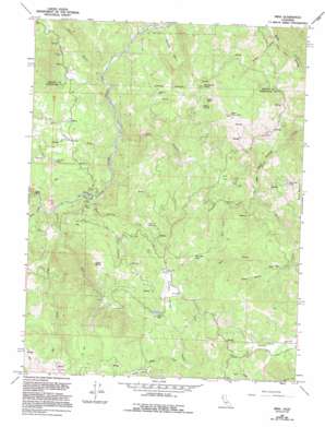
Mina Topo Map California
To zoom in, hover over the map of Mina
USGS Topo Quad 39123h3 - 1:24,000 scale
| Topo Map Name: | Mina |
| USGS Topo Quad ID: | 39123h3 |
| Print Size: | ca. 21 1/4" wide x 27" high |
| Southeast Coordinates: | 39.875° N latitude / 123.25° W longitude |
| Map Center Coordinates: | 39.9375° N latitude / 123.3125° W longitude |
| U.S. State: | CA |
| Filename: | o39123h3.jpg |
| Download Map JPG Image: | Mina topo map 1:24,000 scale |
| Map Type: | Topographic |
| Topo Series: | 7.5´ |
| Map Scale: | 1:24,000 |
| Source of Map Images: | United States Geological Survey (USGS) |
| Alternate Map Versions: |
Mina CA 1967, updated 1969 Download PDF Buy paper map Mina CA 1967, updated 1994 Download PDF Buy paper map Mina CA 2012 Download PDF Buy paper map Mina CA 2015 Download PDF Buy paper map |
1:24,000 Topo Quads surrounding Mina
> Back to 39123e1 at 1:100,000 scale
> Back to 39122a1 at 1:250,000 scale
> Back to U.S. Topo Maps home
Mina topo map: Gazetteer
Mina: Basins
Panther Basin elevation 611m 2004′Mina: Cliffs
Split Rock elevation 357m 1171′Mina: Flats
Little Pine Flat elevation 898m 2946′Pine Flat elevation 884m 2900′
Wylettie Flat elevation 954m 3129′
Mina: Lakes
Buck Mountain Lake elevation 970m 3182′Gravelly Lake elevation 594m 1948′
Lowrey Lake elevation 900m 2952′
Who Who Lake elevation 1046m 3431′
Mina: Populated Places
Delmonico Place elevation 724m 2375′Mina elevation 573m 1879′
Mina: Springs
Ram Spring elevation 806m 2644′Willow Spring elevation 976m 3202′
Mina: Streams
Asbill Creek elevation 302m 990′Diggins Creek elevation 338m 1108′
East Fork Asbill Creek elevation 328m 1076′
Gibson Creek elevation 693m 2273′
Hall Creek elevation 441m 1446′
Horse Creek elevation 300m 984′
Lost Cabin Creek elevation 717m 2352′
Lousy Creek elevation 363m 1190′
North Branch Who Who Creek elevation 851m 2791′
Ram Spring Creek elevation 310m 1017′
South Branch Who Who Creek elevation 851m 2791′
West Fork Asbill Creek elevation 328m 1076′
Who Who Creek elevation 781m 2562′
Mina: Summits
Bald Mountain elevation 1187m 3894′Little Baldy elevation 912m 2992′
Table Rock elevation 1069m 3507′
Wildhorse Peak elevation 1076m 3530′
Mina: Valleys
Bear Canyon elevation 333m 1092′Cedar Canyon elevation 411m 1348′
Crooked Gulch elevation 686m 2250′
Jerry Gulch elevation 352m 1154′
Summit Valley elevation 869m 2851′
Mina digital topo map on disk
Buy this Mina topo map showing relief, roads, GPS coordinates and other geographical features, as a high-resolution digital map file on DVD:


