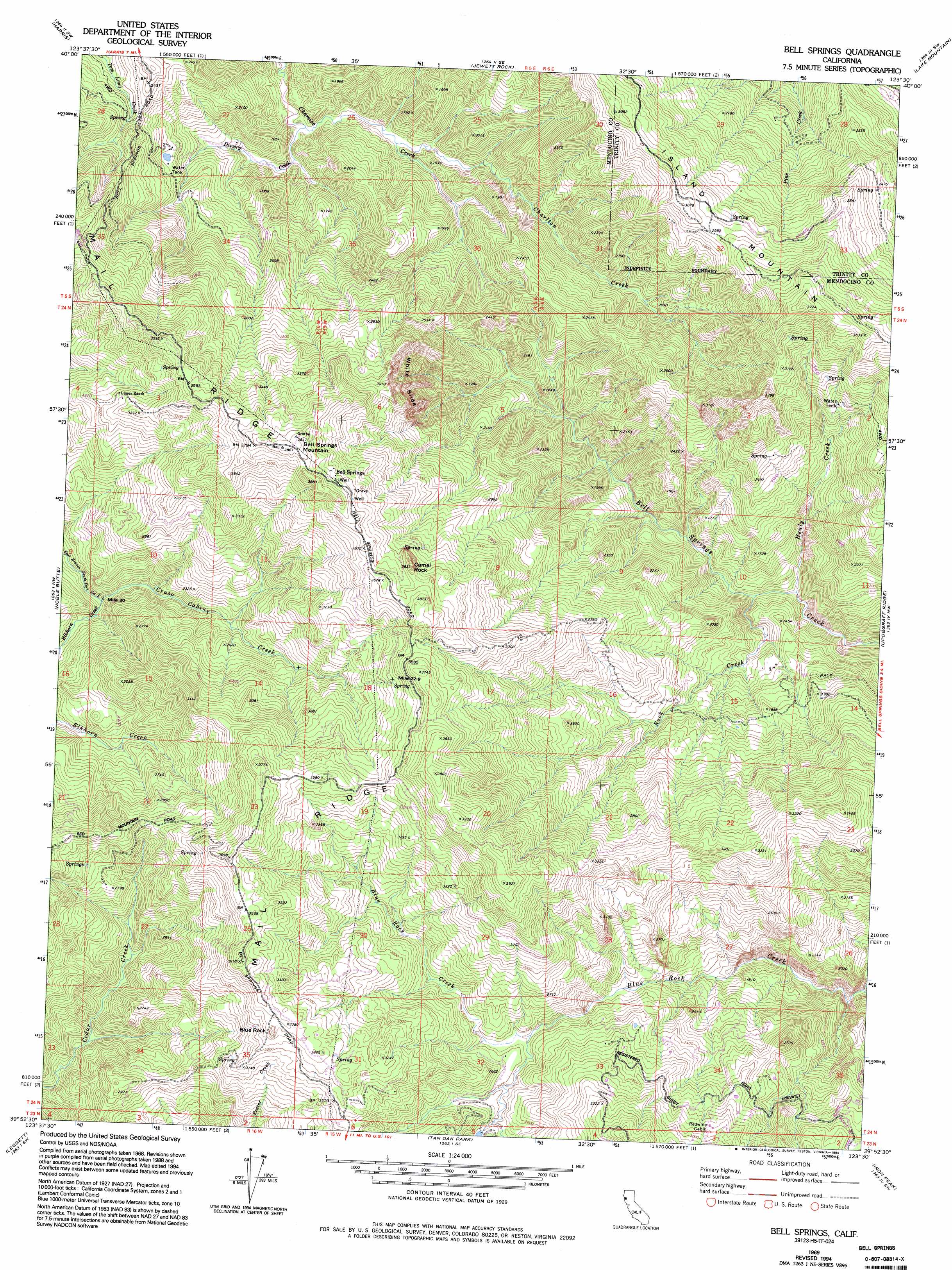
Bell Springs Topo Map California
To zoom in, hover over the map of Bell Springs
USGS Topo Quad 39123h5 - 1:24,000 scale
| Topo Map Name: | Bell Springs |
| USGS Topo Quad ID: | 39123h5 |
| Print Size: | ca. 21 1/4" wide x 27" high |
| Southeast Coordinates: | 39.875° N latitude / 123.5° W longitude |
| Map Center Coordinates: | 39.9375° N latitude / 123.5625° W longitude |
| U.S. State: | CA |
| Filename: | o39123h5.jpg |
| Download Map JPG Image: | Bell Springs topo map 1:24,000 scale |
| Map Type: | Topographic |
| Topo Series: | 7.5´ |
| Map Scale: | 1:24,000 |
| Source of Map Images: | United States Geological Survey (USGS) |
| Alternate Map Versions: |
Bell Springs CA 1969, updated 1974 Download PDF Buy paper map Bell Springs CA 1969, updated 1974 Download PDF Buy paper map Bell Springs CA 1969, updated 1984 Download PDF Buy paper map Bell Springs CA 1969, updated 1994 Download PDF Buy paper map Bell Springs CA 2012 Download PDF Buy paper map Bell Springs CA 2015 Download PDF Buy paper map |
1:24,000 Topo Quads surrounding Bell Springs
Miranda |
Fort Seward |
Alderpoint |
Zenia |
Shannon Butte |
Garberville |
Harris |
Jewett Rock |
Lake Mountain |
Long Ridge |
Piercy |
Noble Butte |
Bell Springs |
Updegraff Ridge |
Mina |
Hales Grove |
Leggett |
Tan Oak Park |
Iron Peak |
Covelo West |
Westport |
Lincoln Ridge |
Cahto Peak |
Laytonville |
Dos Rios |
> Back to 39123e1 at 1:100,000 scale
> Back to 39122a1 at 1:250,000 scale
> Back to U.S. Topo Maps home
Bell Springs topo map: Gazetteer
Bell Springs: Cliffs
White Slide elevation 809m 2654′Bell Springs: Populated Places
Bell Springs elevation 1104m 3622′Bell Springs: Streams
Charlton Creek elevation 396m 1299′Cruso Cabin Creek elevation 570m 1870′
Drewry Creek elevation 392m 1286′
Henly Creek elevation 309m 1013′
Rock Creek elevation 323m 1059′
Bell Springs: Summits
Bell Springs Mountain elevation 1175m 3854′Blue Rock elevation 1023m 3356′
Camel Rock elevation 1147m 3763′
Bell Springs digital topo map on disk
Buy this Bell Springs topo map showing relief, roads, GPS coordinates and other geographical features, as a high-resolution digital map file on DVD: