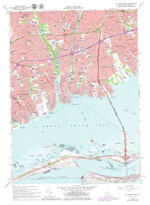
Bay Shore West Topo Map New York
To zoom in, hover over the map of Bay Shore West
USGS Topo Quad 40073f3 - 1:24,000 scale
| Topo Map Name: | Bay Shore West |
| USGS Topo Quad ID: | 40073f3 |
| Print Size: | ca. 21 1/4" wide x 27" high |
| Southeast Coordinates: | 40.625° N latitude / 73.25° W longitude |
| Map Center Coordinates: | 40.6875° N latitude / 73.3125° W longitude |
| U.S. State: | NY |
| Filename: | o40073f3.jpg |
| Download Map JPG Image: | Bay Shore West topo map 1:24,000 scale |
| Map Type: | Topographic |
| Topo Series: | 7.5´ |
| Map Scale: | 1:24,000 |
| Source of Map Images: | United States Geological Survey (USGS) |
| Alternate Map Versions: |
Bay Shore West NY 2011 Download PDF Buy paper map Bay Shore West NY 2013 Download PDF Buy paper map Bay Shore West NY 2016 Download PDF Buy paper map |
1:24,000 Topo Quads surrounding Bay Shore West
> Back to 40073e1 at 1:100,000 scale
> Back to 40072a1 at 1:250,000 scale
> Back to U.S. Topo Maps home
Bay Shore West topo map: Gazetteer
Bay Shore West: Airports
Wagstaff Heliport elevation 0m 0′Bay Shore West: Bays
Babylon Cove elevation 0m 0′Hemlock Cove elevation 0m 0′
Bay Shore West: Beaches
Cedar Beach elevation 1m 3′Cedar Overlook Beach elevation 0m 0′
Venetian Shores Beach elevation 0m 0′
West Islip Beach elevation 0m 0′
Bay Shore West: Canals
Araca Canal elevation 0m 0′Brightwaters Canal elevation 0m 0′
Frederick Canal elevation 0m 0′
Isbrandtsen Canal elevation 3m 9′
Keith Canal elevation 0m 0′
Pamequa Canal elevation 0m 0′
Thorn Canal elevation 0m 0′
Bay Shore West: Capes
Appletree Neck elevation 1m 3′Bergan Point elevation 1m 3′
Conklin Point elevation 0m 0′
Great East Neck elevation 1m 3′
Little East Neck elevation 1m 3′
Little Neck elevation 1m 3′
Okenok Neck elevation 1m 3′
Sampawams Neck elevation 1m 3′
Sampawams Point elevation 1m 3′
Santapogue Neck elevation 1m 3′
Santapogue Point elevation 0m 0′
Sequatogue Neck elevation 2m 6′
Strongs Point elevation 1m 3′
Willetts Point elevation 1m 3′
Bay Shore West: Channels
East Fox Creek elevation 0m 0′East West Channel elevation 0m 0′
Fire Island Inlet elevation 0m 0′
Fox Creek Channel elevation 0m 0′
Little Swift Creek elevation 0m 0′
Oak Island Channel elevation 0m 0′
West Fox Creek elevation 0m 0′
Bay Shore West: Crossings
Interchange 36 elevation 17m 55′Interchange 37 elevation 11m 36′
Interchange 38 elevation 13m 42′
Interchange 39 elevation 10m 32′
Interchange 40 elevation 13m 42′
Interchange 41 elevation 14m 45′
Interchange 41 A elevation 18m 59′
Interchange 42 elevation 15m 49′
Interchange Rm 1 elevation 12m 39′
Interchange Rm 2 elevation 6m 19′
Interchange S 4 elevation 18m 59′
Bay Shore West: Islands
Captree Island elevation 0m 0′Cedar Island elevation 0m 0′
Grass Island elevation 3m 9′
Indian Island elevation 1m 3′
Nezeras Island elevation 0m 0′
Oak Island elevation 0m 0′
Seganus Thatch elevation 0m 0′
Bay Shore West: Lakes
Argyle Lake elevation 1m 3′Belmont Lake elevation 9m 29′
Elda Lake elevation 7m 22′
Guggenheim Lakes elevation 9m 29′
Hawleys Lake elevation 0m 0′
Lake Capri elevation 1m 3′
Mirror Lake elevation 4m 13′
O-co-nee Lake elevation 3m 9′
Southards Pond elevation 3m 9′
Bay Shore West: Parks
Belmont Lake State Park elevation 5m 16′Captree State Park elevation 1m 3′
Gardiner Park elevation 1m 3′
Gilgo State Park elevation 1m 3′
Green Park elevation 2m 6′
Indian Island County Park elevation 1m 3′
Neguntatogue Park elevation 2m 6′
Phelps Lane Memorial Park elevation 8m 26′
Walker Park elevation 1m 3′
Wohseepee Park elevation 9m 29′
Bay Shore West: Populated Places
Babylon elevation 2m 6′Brightwaters elevation 7m 22′
Lindenhurst elevation 0m 0′
North Babylon elevation 7m 22′
North Bay Shore elevation 11m 36′
Oak Beach elevation 1m 3′
West Babylon elevation 12m 39′
West Bay Shore elevation 4m 13′
West Islip elevation 6m 19′
Bay Shore West: Post Offices
Babylon Post Office elevation 3m 9′Bay Shore Post Office elevation 10m 32′
Brightwaters Post Office elevation 6m 19′
Bay Shore West: Reservoirs
Cascade Lakes elevation 2m 6′Lawrence Lake elevation 2m 6′
Lower Cascade Lake elevation 3m 9′
Nosreka Lake elevation 3m 9′
Upper Cascade Lake elevation 2m 6′
Bay Shore West: Streams
Carlls River elevation 0m 0′Fosters Creek elevation 0m 0′
Neguntatogue Creek elevation 0m 0′
Sampawams Creek elevation 0m 0′
Santapogue Creek elevation 0m 0′
Skookwams Creek elevation 0m 0′
Strongs Creek elevation 0m 0′
Thompsons Creek elevation 0m 0′
Trues Creek elevation 3m 9′
West Babylon Creek elevation 1m 3′
Willetts Creek elevation 0m 0′
Bay Shore West digital topo map on disk
Buy this Bay Shore West topo map showing relief, roads, GPS coordinates and other geographical features, as a high-resolution digital map file on DVD:
Atlantic Coast (NY, NJ, PA, DE, MD, VA, NC)
Buy digital topo maps: Atlantic Coast (NY, NJ, PA, DE, MD, VA, NC)


