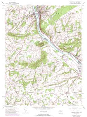
Lambertville Topo Map Pennsylvania
To zoom in, hover over the map of Lambertville
USGS Topo Quad 40074c8 - 1:24,000 scale
| Topo Map Name: | Lambertville |
| USGS Topo Quad ID: | 40074c8 |
| Print Size: | ca. 21 1/4" wide x 27" high |
| Southeast Coordinates: | 40.25° N latitude / 74.875° W longitude |
| Map Center Coordinates: | 40.3125° N latitude / 74.9375° W longitude |
| U.S. States: | PA, NJ |
| Filename: | o40074c8.jpg |
| Download Map JPG Image: | Lambertville topo map 1:24,000 scale |
| Map Type: | Topographic |
| Topo Series: | 7.5´ |
| Map Scale: | 1:24,000 |
| Source of Map Images: | United States Geological Survey (USGS) |
| Alternate Map Versions: |
Lambertville NJ 1953, updated 1955 Download PDF Buy paper map Lambertville NJ 1953, updated 1960 Download PDF Buy paper map Lambertville NJ 1953, updated 1960 Download PDF Buy paper map Lambertville NJ 1953, updated 1969 Download PDF Buy paper map Lambertville NJ 1953, updated 1974 Download PDF Buy paper map Lambertville NJ 1953, updated 1974 Download PDF Buy paper map Lambertville NJ 1995, updated 1998 Download PDF Buy paper map Lambertville NJ 2011 Download PDF Buy paper map Lambertville NJ 2014 Download PDF Buy paper map Lambertville NJ 2016 Download PDF Buy paper map |
1:24,000 Topo Quads surrounding Lambertville
> Back to 40074a1 at 1:100,000 scale
> Back to 40074a1 at 1:250,000 scale
> Back to U.S. Topo Maps home
Lambertville topo map: Gazetteer
Lambertville: Airports
Goat Hill Airport elevation 94m 308′Holiday Inn of New Hope Airport elevation 36m 118′
Hunters Hill Farm Airport elevation 30m 98′
Jarman Airport elevation 70m 229′
Lambertville: Bridges
Van Sant Covered Bridge elevation 24m 78′Lambertville: Dams
Ingham Creek Dam elevation 46m 150′Solebury Farm Dam elevation 44m 144′
Village Two Dam elevation 66m 216′
Washington Crossing Dam elevation 15m 49′
Lambertville: Islands
Holcombe Island elevation 18m 59′Lambertville: Parks
Mercer County Park elevation 30m 98′Washington Crossing Historic Park elevation 13m 42′
Lambertville: Populated Places
Brownsburg elevation 22m 72′Buckmanville elevation 48m 157′
Deer Park elevation 68m 223′
Dolington elevation 79m 259′
Highton elevation 67m 219′
Hood elevation 32m 104′
Huffnagle elevation 36m 118′
Lambertville elevation 22m 72′
Moore elevation 29m 95′
New Hope elevation 21m 68′
Newtown Grant elevation 88m 288′
Penns Park elevation 106m 347′
Reeder elevation 41m 134′
Ryans Corner elevation 106m 347′
Stoopville elevation 93m 305′
Taylorsville elevation 21m 68′
Titusville elevation 28m 91′
Woodhill elevation 65m 213′
Wrightstown elevation 110m 360′
Lambertville: Post Offices
Brownsburg Post Office (historical) elevation 22m 72′Dolington Post Office (historical) elevation 79m 259′
New Hope Boro Post Office elevation 23m 75′
Wrightstown Post Office (historical) elevation 110m 360′
Lambertville: Reservoirs
Aquetong Lake elevation 45m 147′Honey Hollow Pond elevation 44m 144′
Village Two Pond elevation 66m 216′
Lambertville: Springs
Aquetong Spring elevation 51m 167′Lambertville: Streams
Aquetong Creek elevation 18m 59′Curls Run elevation 32m 104′
Dark Hollow Run elevation 19m 62′
Fiddlers Creek elevation 14m 45′
Jericho Creek elevation 11m 36′
Moores Creek elevation 8m 26′
Pidcock Creek elevation 11m 36′
Swan Creek elevation 14m 45′
Lambertville: Summits
Belle Mountain elevation 91m 298′Bowman Hill elevation 121m 396′
Corn Hill elevation 134m 439′
Goat Hill elevation 138m 452′
Jericho Mountain elevation 129m 423′
Solebury Mountain elevation 142m 465′
Strawberry Hill elevation 143m 469′
Lambertville digital topo map on disk
Buy this Lambertville topo map showing relief, roads, GPS coordinates and other geographical features, as a high-resolution digital map file on DVD:
Atlantic Coast (NY, NJ, PA, DE, MD, VA, NC)
Buy digital topo maps: Atlantic Coast (NY, NJ, PA, DE, MD, VA, NC)


