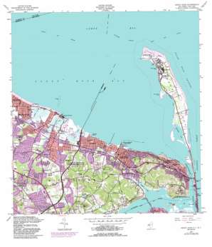
Sandy Hook Topo Map New Jersey
To zoom in, hover over the map of Sandy Hook
USGS Topo Quad 40074d1 - 1:24,000 scale
| Topo Map Name: | Sandy Hook |
| USGS Topo Quad ID: | 40074d1 |
| Print Size: | ca. 21 1/4" wide x 27" high |
| Southeast Coordinates: | 40.375° N latitude / 74° W longitude |
| Map Center Coordinates: | 40.4375° N latitude / 74.0625° W longitude |
| U.S. States: | NJ, NY |
| Filename: | o40074d1.jpg |
| Download Map JPG Image: | Sandy Hook topo map 1:24,000 scale |
| Map Type: | Topographic |
| Topo Series: | 7.5´ |
| Map Scale: | 1:24,000 |
| Source of Map Images: | United States Geological Survey (USGS) |
| Alternate Map Versions: |
Sandy Hook West NJ 2011 Download PDF Buy paper map Sandy Hook West NJ 2014 Download PDF Buy paper map Sandy Hook West NJ 2016 Download PDF Buy paper map |
1:24,000 Topo Quads surrounding Sandy Hook
> Back to 40074a1 at 1:100,000 scale
> Back to 40074a1 at 1:250,000 scale
> Back to U.S. Topo Maps home
Sandy Hook topo map: Gazetteer
Sandy Hook: Airports
Belford Airport (historical) elevation 3m 9′Middletown Township Police Heliport elevation 17m 55′
Werner Heliport elevation 3m 9′
Sandy Hook: Bars
Flynns Knoll elevation 0m 0′Sandy Hook: Bays
Atlantic Highlands Yacht Harbor elevation 0m 0′Belford Harbor elevation 0m 0′
Leonardo Harbor elevation 0m 0′
Sandy Hook Bay elevation 0m 0′
Sandy Hook: Beaches
Ideal Beach elevation 3m 9′Sandy Hook: Bridges
Oceanic Bridge elevation 0m 0′Sandy Hook: Capes
Locust Point elevation 3m 9′Sandy Hook Point elevation 0m 0′
Sandy Hook: Channels
Barley Point Reach elevation 0m 0′Haven Reach elevation 0m 0′
Raritan Bay Channel elevation 0m 0′
Terminal Channel elevation 0m 0′
Sandy Hook: Lakes
Haskell Pond elevation 7m 22′Sandy Hook: Parks
Bayshore Waterfront County Park elevation 0m 0′Bicentennial Park elevation 11m 36′
Board of Proprietors State Historic Site elevation 3m 9′
Gordon Court Park elevation 3m 9′
Greeley Park elevation 3m 9′
Henry Hudson Trail County Park elevation 3m 9′
Huber Woods County Park elevation 43m 141′
Lenape Woods Greenway Municipally Open Space elevation 31m 101′
Leonardo State Marina elevation 5m 16′
Mount Mitchell Scenic Overlook County Park elevation 67m 219′
Navesink Park elevation 33m 108′
Tindall Park elevation 19m 62′
Sandy Hook: Populated Places
Atlantic Highlands elevation 11m 36′Belford elevation 5m 16′
Chapel Hill elevation 61m 200′
East Keansburg elevation 3m 9′
Fort Hancock elevation 4m 13′
Harmony elevation 11m 36′
Hilton elevation 57m 187′
Leonardo elevation 12m 39′
Leonardville elevation 15m 49′
Locust elevation 7m 22′
Middletown elevation 36m 118′
Monmouth Hills elevation 47m 154′
Navesink elevation 20m 65′
New Monmouth elevation 11m 36′
North Middletown elevation 3m 9′
Oak Hill elevation 29m 95′
Oceanic elevation 3m 9′
Port Monmouth elevation 3m 9′
Stone Church elevation 17m 55′
Town Brook elevation 13m 42′
Sandy Hook: Streams
Claypit Creek elevation 0m 0′Compton Creek elevation 0m 0′
Many Mind Creek elevation 2m 6′
Mill Brook elevation 3m 9′
Pews Creek elevation 3m 9′
Shrewsbury River elevation 0m 0′
Town Brook elevation 3m 9′
Wagner Creek elevation 1m 3′
Ware Creek elevation 1m 3′
Sandy Hook: Summits
Garrett Hill elevation 55m 180′Sandy Hook digital topo map on disk
Buy this Sandy Hook topo map showing relief, roads, GPS coordinates and other geographical features, as a high-resolution digital map file on DVD:
Atlantic Coast (NY, NJ, PA, DE, MD, VA, NC)
Buy digital topo maps: Atlantic Coast (NY, NJ, PA, DE, MD, VA, NC)


