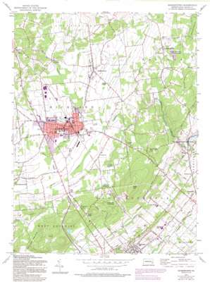
Quakertown Topo Map Pennsylvania
To zoom in, hover over the map of Quakertown
USGS Topo Quad 40075d3 - 1:24,000 scale
| Topo Map Name: | Quakertown |
| USGS Topo Quad ID: | 40075d3 |
| Print Size: | ca. 21 1/4" wide x 27" high |
| Southeast Coordinates: | 40.375° N latitude / 75.25° W longitude |
| Map Center Coordinates: | 40.4375° N latitude / 75.3125° W longitude |
| U.S. State: | PA |
| Filename: | o40075d3.jpg |
| Download Map JPG Image: | Quakertown topo map 1:24,000 scale |
| Map Type: | Topographic |
| Topo Series: | 7.5´ |
| Map Scale: | 1:24,000 |
| Source of Map Images: | United States Geological Survey (USGS) |
| Alternate Map Versions: |
Quakertown PA 1957, updated 1958 Download PDF Buy paper map Quakertown PA 1957, updated 1965 Download PDF Buy paper map Quakertown PA 1957, updated 1969 Download PDF Buy paper map Quakertown PA 1957, updated 1974 Download PDF Buy paper map Quakertown PA 1957, updated 1984 Download PDF Buy paper map Quakertown PA 1957, updated 1994 Download PDF Buy paper map Quakertown PA 1957, updated 1994 Download PDF Buy paper map Quakertown PA 1999, updated 2001 Download PDF Buy paper map Quakertown PA 2010 Download PDF Buy paper map Quakertown PA 2013 Download PDF Buy paper map Quakertown PA 2016 Download PDF Buy paper map |
1:24,000 Topo Quads surrounding Quakertown
> Back to 40075a1 at 1:100,000 scale
> Back to 40074a1 at 1:250,000 scale
> Back to U.S. Topo Maps home
Quakertown topo map: Gazetteer
Quakertown: Airports
Beaver Run Airport elevation 158m 518′Kelly Heliport elevation 152m 498′
Pennridge Airport elevation 160m 524′
Quakertown: Bridges
Moods Covered Bridge elevation 97m 318′Sheards Mill Covered Bridge elevation 138m 452′
Quakertown: Dams
Eichner Dam elevation 152m 498′Haskins Dam elevation 125m 410′
Lake Towhee Dam elevation 149m 488′
Old Detweiler Dam elevation 152m 498′
Tohickon Dam elevation 152m 498′
Quakertown: Mines
Tohickon Quarry elevation 127m 416′Quakertown: Parks
Lake Towhee Park elevation 150m 492′Memorial Park elevation 153m 501′
Nockamixon State Park elevation 134m 439′
Quakertown Memorial Park elevation 154m 505′
State Game Lands Number 139 elevation 196m 643′
Quakertown: Populated Places
Applebachsville elevation 165m 541′California elevation 158m 518′
Hagersville elevation 129m 423′
Keelersville elevation 166m 544′
Louxs Corner elevation 152m 498′
Paletown elevation 159m 521′
Pullen elevation 166m 544′
Quakertown elevation 152m 498′
Rich Hill elevation 173m 567′
Richland Center elevation 153m 501′
Richlandtown elevation 160m 524′
Rock Hill elevation 182m 597′
Rockhill Station elevation 167m 547′
Rocky Ridge elevation 185m 606′
Shelly elevation 173m 567′
Smoketown elevation 176m 577′
Strawntown elevation 154m 505′
Weisel elevation 124m 406′
Quakertown: Post Offices
Richlandtown Post Office (historical) elevation 160m 524′Shelly Post Office (historical) elevation 173m 567′
Quakertown: Reservoirs
Lake Towhee elevation 149m 488′Quakertown: Streams
Beaver Run elevation 152m 498′Dimple Creek elevation 138m 452′
Morgan Creek elevation 152m 498′
Morris Run elevation 102m 334′
Threemile Run elevation 121m 396′
Quakertown: Summits
Hunsberger Knoll elevation 110m 360′Rock Hill elevation 256m 839′
Quakertown: Valleys
Rocky Valley elevation 153m 501′Quakertown digital topo map on disk
Buy this Quakertown topo map showing relief, roads, GPS coordinates and other geographical features, as a high-resolution digital map file on DVD:
Atlantic Coast (NY, NJ, PA, DE, MD, VA, NC)
Buy digital topo maps: Atlantic Coast (NY, NJ, PA, DE, MD, VA, NC)


