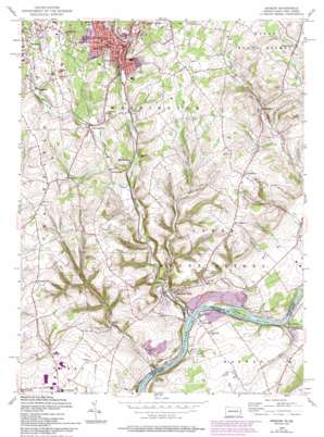
Bangor Topo Map Pennsylvania
To zoom in, hover over the map of Bangor
USGS Topo Quad 40075g2 - 1:24,000 scale
| Topo Map Name: | Bangor |
| USGS Topo Quad ID: | 40075g2 |
| Print Size: | ca. 21 1/4" wide x 27" high |
| Southeast Coordinates: | 40.75° N latitude / 75.125° W longitude |
| Map Center Coordinates: | 40.8125° N latitude / 75.1875° W longitude |
| U.S. States: | PA, NJ |
| Filename: | o40075g2.jpg |
| Download Map JPG Image: | Bangor topo map 1:24,000 scale |
| Map Type: | Topographic |
| Topo Series: | 7.5´ |
| Map Scale: | 1:24,000 |
| Source of Map Images: | United States Geological Survey (USGS) |
| Alternate Map Versions: |
Bangor PA 1953, updated 1953 Download PDF Buy paper map Bangor PA 1956, updated 1958 Download PDF Buy paper map Bangor PA 1956, updated 1966 Download PDF Buy paper map Bangor PA 1956, updated 1969 Download PDF Buy paper map Bangor PA 1956, updated 1974 Download PDF Buy paper map Bangor PA 1956, updated 1988 Download PDF Buy paper map Bangor PA 1956, updated 1994 Download PDF Buy paper map Bangor PA 1997, updated 1999 Download PDF Buy paper map Bangor PA 2011 Download PDF Buy paper map Bangor PA 2013 Download PDF Buy paper map Bangor PA 2016 Download PDF Buy paper map |
1:24,000 Topo Quads surrounding Bangor
> Back to 40075e1 at 1:100,000 scale
> Back to 40074a1 at 1:250,000 scale
> Back to U.S. Topo Maps home
Bangor topo map: Gazetteer
Bangor: Airports
Gap View Airport elevation 235m 770′Markle Airport elevation 101m 331′
Bangor: Dams
Mill Dam elevation 86m 282′Mill Dam elevation 157m 515′
Bangor: Islands
Keifer Island elevation 61m 200′Bangor: Parks
Memorial Park elevation 228m 748′Weona Park elevation 236m 774′
Bangor: Populated Places
Ackermanville elevation 148m 485′Bangor elevation 158m 518′
Brainards elevation 81m 265′
Delabole elevation 183m 600′
Factoryville elevation 130m 426′
Flicksville elevation 127m 416′
Gruvertown elevation 204m 669′
Hutchinson elevation 67m 219′
Kesslersville elevation 207m 679′
Martins Creek elevation 83m 272′
Martins Creek Junction elevation 115m 377′
Mount Pleasant elevation 205m 672′
New Village elevation 150m 492′
Richmond elevation 159m 521′
Sandts Eddy elevation 54m 177′
Shimerville elevation 127m 416′
Stone Church elevation 202m 662′
Uhlers Crossing elevation 115m 377′
Uttsville elevation 183m 600′
Bangor: Ridges
Old Hound Ridge elevation 199m 652′Bangor: Streams
Buckhorn Creek elevation 60m 196′Greenwalk Creek elevation 162m 531′
Little Martins Creek elevation 73m 239′
Martins Creek elevation 55m 180′
Mud Run elevation 53m 173′
Waltz Creek elevation 113m 370′
Bangor: Summits
Church Hill elevation 176m 577′Bangor digital topo map on disk
Buy this Bangor topo map showing relief, roads, GPS coordinates and other geographical features, as a high-resolution digital map file on DVD:
Atlantic Coast (NY, NJ, PA, DE, MD, VA, NC)
Buy digital topo maps: Atlantic Coast (NY, NJ, PA, DE, MD, VA, NC)


