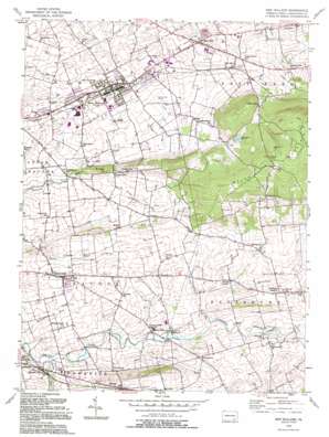
New Holland Topo Map Pennsylvania
To zoom in, hover over the map of New Holland
USGS Topo Quad 40076a1 - 1:24,000 scale
| Topo Map Name: | New Holland |
| USGS Topo Quad ID: | 40076a1 |
| Print Size: | ca. 21 1/4" wide x 27" high |
| Southeast Coordinates: | 40° N latitude / 76° W longitude |
| Map Center Coordinates: | 40.0625° N latitude / 76.0625° W longitude |
| U.S. State: | PA |
| Filename: | o40076a1.jpg |
| Download Map JPG Image: | New Holland topo map 1:24,000 scale |
| Map Type: | Topographic |
| Topo Series: | 7.5´ |
| Map Scale: | 1:24,000 |
| Source of Map Images: | United States Geological Survey (USGS) |
| Alternate Map Versions: |
New Holland PA 1956, updated 1957 Download PDF Buy paper map New Holland PA 1956, updated 1965 Download PDF Buy paper map New Holland PA 1956, updated 1971 Download PDF Buy paper map New Holland PA 1956, updated 1977 Download PDF Buy paper map New Holland PA 1956, updated 1991 Download PDF Buy paper map New Holland PA 1992, updated 1994 Download PDF Buy paper map New Holland PA 1999, updated 2001 Download PDF Buy paper map New Holland PA 2010 Download PDF Buy paper map New Holland PA 2013 Download PDF Buy paper map New Holland PA 2016 Download PDF Buy paper map |
1:24,000 Topo Quads surrounding New Holland
> Back to 40076a1 at 1:100,000 scale
> Back to 40076a1 at 1:250,000 scale
> Back to U.S. Topo Maps home
New Holland topo map: Gazetteer
New Holland: Airports
New Holland Heliport elevation 142m 465′New Holland: Dams
New Holland Reservoir Dam elevation 195m 639′New Holland: Populated Places
Blue Ball elevation 134m 439′Buyerstown elevation 136m 446′
East Earl elevation 155m 508′
Fetterville elevation 158m 518′
Green Bank elevation 186m 610′
Harristown elevation 136m 446′
Hatville elevation 133m 436′
Intercourse elevation 133m 436′
Laurel Hill elevation 138m 452′
Leaman Place elevation 121m 396′
Mount Airy elevation 237m 777′
New Holland elevation 150m 492′
New Milltown elevation 124m 406′
Salisbury Heights elevation 155m 508′
Springville elevation 151m 495′
Vintage elevation 133m 436′
Vintage Station elevation 133m 436′
New Holland: Post Offices
Blue Ball Post Office (historical) elevation 134m 439′Green Bank Post Office (historical) elevation 186m 610′
Intercourse Post Office (historical) elevation 133m 436′
New Holland Post Office (historical) elevation 150m 492′
New Milltown Post Office (historical) elevation 124m 406′
Salisbury Post Office (historical) elevation 149m 488′
New Holland: Reservoirs
New Holland Reservoir elevation 195m 639′New Holland: Streams
Eshleman Run elevation 106m 347′Groff Run elevation 126m 413′
Houston Run elevation 111m 364′
Richardson Run elevation 120m 393′
Umbles Run elevation 113m 370′
White Horse Run elevation 125m 410′
New Holland: Summits
Dry Hill elevation 166m 544′New Holland digital topo map on disk
Buy this New Holland topo map showing relief, roads, GPS coordinates and other geographical features, as a high-resolution digital map file on DVD:
Atlantic Coast (NY, NJ, PA, DE, MD, VA, NC)
Buy digital topo maps: Atlantic Coast (NY, NJ, PA, DE, MD, VA, NC)


