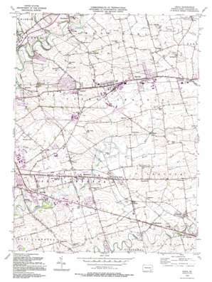
Leola Topo Map Pennsylvania
To zoom in, hover over the map of Leola
USGS Topo Quad 40076a2 - 1:24,000 scale
| Topo Map Name: | Leola |
| USGS Topo Quad ID: | 40076a2 |
| Print Size: | ca. 21 1/4" wide x 27" high |
| Southeast Coordinates: | 40° N latitude / 76.125° W longitude |
| Map Center Coordinates: | 40.0625° N latitude / 76.1875° W longitude |
| U.S. State: | PA |
| Filename: | o40076a2.jpg |
| Download Map JPG Image: | Leola topo map 1:24,000 scale |
| Map Type: | Topographic |
| Topo Series: | 7.5´ |
| Map Scale: | 1:24,000 |
| Source of Map Images: | United States Geological Survey (USGS) |
| Alternate Map Versions: |
Leola PA 1956, updated 1957 Download PDF Buy paper map Leola PA 1956, updated 1967 Download PDF Buy paper map Leola PA 1956, updated 1970 Download PDF Buy paper map Leola PA 1956, updated 1977 Download PDF Buy paper map Leola PA 1956, updated 1987 Download PDF Buy paper map Leola PA 1992, updated 1994 Download PDF Buy paper map Leola PA 1992, updated 1994 Download PDF Buy paper map Leola PA 1999, updated 2001 Download PDF Buy paper map Leola PA 2010 Download PDF Buy paper map Leola PA 2013 Download PDF Buy paper map Leola PA 2016 Download PDF Buy paper map |
1:24,000 Topo Quads surrounding Leola
> Back to 40076a1 at 1:100,000 scale
> Back to 40076a1 at 1:250,000 scale
> Back to U.S. Topo Maps home
Leola topo map: Gazetteer
Leola: Airports
Smoketown Airport elevation 110m 360′Leola: Dams
Graffa Mill Dam elevation 92m 301′Leola: Parks
Dutch Wonderland Amusement Park elevation 101m 331′East Lampeter Township Community Park elevation 113m 370′
Leola Community Park elevation 132m 433′
West Earl Community Park elevation 89m 291′
Leola: Populated Places
Bareville elevation 143m 469′Bird in Hand elevation 109m 357′
Brownstown elevation 107m 351′
Center Square elevation 104m 341′
Concord elevation 124m 406′
Fertility elevation 94m 308′
Gordonville elevation 122m 400′
Greenland elevation 109m 357′
Groffdale elevation 153m 501′
Hornig elevation 109m 357′
Hunsecker elevation 95m 311′
Irishtown elevation 124m 406′
Leacock elevation 129m 423′
Leola elevation 131m 429′
Mascot elevation 119m 390′
Monterey elevation 121m 396′
Oregon elevation 125m 410′
Paradise elevation 111m 364′
Ronks elevation 115m 377′
Smoketown elevation 109m 357′
Soudersburg elevation 115m 377′
Stumptown elevation 118m 387′
Talmage elevation 112m 367′
Vogansville elevation 125m 410′
Weavertown elevation 126m 413′
Witmer elevation 122m 400′
Leola: Post Offices
Bareville Post Office (historical) elevation 143m 469′Enterprise Post Office (historical) elevation 109m 357′
Fertility Post Office (historical) elevation 94m 308′
Gordonville Post Office (historical) elevation 122m 400′
Greenland Post Office (historical) elevation 109m 357′
Oregon Post Office (historical) elevation 125m 410′
Paradise Post Office (historical) elevation 111m 364′
Soudersburg Post Office (historical) elevation 115m 377′
Vogansville Post Office (historical) elevation 125m 410′
West Earl Post Office (historical) elevation 112m 367′
Leola: Reservoirs
Graffa Pond elevation 92m 301′Leola: Streams
Cocalico Creek elevation 85m 278′Groff Creek elevation 120m 393′
Lititz Run elevation 122m 400′
Muddy Run elevation 103m 337′
Watson Run elevation 104m 341′
Leola digital topo map on disk
Buy this Leola topo map showing relief, roads, GPS coordinates and other geographical features, as a high-resolution digital map file on DVD:
Atlantic Coast (NY, NJ, PA, DE, MD, VA, NC)
Buy digital topo maps: Atlantic Coast (NY, NJ, PA, DE, MD, VA, NC)


