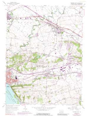
Columbia East Topo Map Pennsylvania
To zoom in, hover over the map of Columbia East
USGS Topo Quad 40076a4 - 1:24,000 scale
| Topo Map Name: | Columbia East |
| USGS Topo Quad ID: | 40076a4 |
| Print Size: | ca. 21 1/4" wide x 27" high |
| Southeast Coordinates: | 40° N latitude / 76.375° W longitude |
| Map Center Coordinates: | 40.0625° N latitude / 76.4375° W longitude |
| U.S. State: | PA |
| Filename: | o40076a4.jpg |
| Download Map JPG Image: | Columbia East topo map 1:24,000 scale |
| Map Type: | Topographic |
| Topo Series: | 7.5´ |
| Map Scale: | 1:24,000 |
| Source of Map Images: | United States Geological Survey (USGS) |
| Alternate Map Versions: |
Columbia East PA 1956, updated 1957 Download PDF Buy paper map Columbia East PA 1956, updated 1968 Download PDF Buy paper map Columbia East PA 1956, updated 1971 Download PDF Buy paper map Columbia East PA 1956, updated 1977 Download PDF Buy paper map Columbia East PA 1956, updated 1989 Download PDF Buy paper map Columbia East PA 1995, updated 1996 Download PDF Buy paper map Columbia East PA 1997, updated 2000 Download PDF Buy paper map Columbia East PA 2010 Download PDF Buy paper map Columbia East PA 2013 Download PDF Buy paper map Columbia East PA 2016 Download PDF Buy paper map |
1:24,000 Topo Quads surrounding Columbia East
> Back to 40076a1 at 1:100,000 scale
> Back to 40076a1 at 1:250,000 scale
> Back to U.S. Topo Maps home
Columbia East topo map: Gazetteer
Columbia East: Airports
Central Manor Airport elevation 126m 413′Garden Spot Air Park (historical) elevation 125m 410′
Manor Knoll Airport elevation 134m 439′
McGinness Airport elevation 99m 324′
Walnut Grove Airport elevation 110m 360′
Wilton Airport elevation 103m 337′
Columbia East: Islands
Shad Island elevation 68m 223′Columbia East: Lakes
Grabb Lake elevation 128m 419′Mud Lake elevation 141m 462′
Columbia East: Parks
Amos Herr Park elevation 120m 393′Glatfelter Memorial Field elevation 103m 337′
Lackard Park elevation 132m 433′
Salunga Park elevation 124m 406′
West Hempfield Township Park elevation 193m 633′
Columbia East: Populated Places
Bamford elevation 109m 357′Centerville elevation 160m 524′
Chestnut Hill elevation 161m 528′
Cordelia elevation 161m 528′
Donerville elevation 121m 396′
Farmdale elevation 109m 357′
Hempfield elevation 148m 485′
Ironville elevation 193m 633′
Kinderhook elevation 179m 587′
Landisville elevation 124m 406′
Mechanicsville elevation 116m 380′
Mountville elevation 135m 442′
Newtown elevation 118m 387′
Oyster Point elevation 149m 488′
Salunga elevation 124m 406′
Silver Spring elevation 121m 396′
Windom elevation 101m 331′
Columbia East: Post Offices
Landisville Post Office (historical) elevation 124m 406′Mountville Post Office (historical) elevation 135m 442′
Newtown Post Office (historical) elevation 118m 387′
Salunga Post Office (historical) elevation 124m 406′
Silver Spring Post Office (historical) elevation 121m 396′
Columbia East: Ranges
Manor Hills elevation 181m 593′Columbia East: Streams
Dellinger Run elevation 109m 357′Strickler Run elevation 68m 223′
Columbia East: Summits
Chestnut Hill elevation 178m 583′Columbia East digital topo map on disk
Buy this Columbia East topo map showing relief, roads, GPS coordinates and other geographical features, as a high-resolution digital map file on DVD:
Atlantic Coast (NY, NJ, PA, DE, MD, VA, NC)
Buy digital topo maps: Atlantic Coast (NY, NJ, PA, DE, MD, VA, NC)


