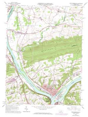
Northumberland Topo Map Pennsylvania
To zoom in, hover over the map of Northumberland
USGS Topo Quad 40076h7 - 1:24,000 scale
| Topo Map Name: | Northumberland |
| USGS Topo Quad ID: | 40076h7 |
| Print Size: | ca. 21 1/4" wide x 27" high |
| Southeast Coordinates: | 40.875° N latitude / 76.75° W longitude |
| Map Center Coordinates: | 40.9375° N latitude / 76.8125° W longitude |
| U.S. State: | PA |
| Filename: | o40076h7.jpg |
| Download Map JPG Image: | Northumberland topo map 1:24,000 scale |
| Map Type: | Topographic |
| Topo Series: | 7.5´ |
| Map Scale: | 1:24,000 |
| Source of Map Images: | United States Geological Survey (USGS) |
| Alternate Map Versions: |
Northumberland PA 1965, updated 1967 Download PDF Buy paper map Northumberland PA 1965, updated 1973 Download PDF Buy paper map Northumberland PA 1965, updated 1984 Download PDF Buy paper map Northumberland PA 1965, updated 1984 Download PDF Buy paper map Northumberland PA 1994, updated 1996 Download PDF Buy paper map Northumberland PA 2010 Download PDF Buy paper map Northumberland PA 2013 Download PDF Buy paper map Northumberland PA 2016 Download PDF Buy paper map |
1:24,000 Topo Quads surrounding Northumberland
> Back to 40076e1 at 1:100,000 scale
> Back to 40076a1 at 1:250,000 scale
> Back to U.S. Topo Maps home
Northumberland topo map: Gazetteer
Northumberland: Airports
Milton Airfield (historical) elevation 145m 475′Snyders Airport elevation 155m 508′
Sunbury Airport elevation 134m 439′
Northumberland: Bridges
Rishel Covered Bridge elevation 138m 452′Northumberland: Islands
Packers Island elevation 134m 439′Northumberland: Parks
Liberty Hollow Park elevation 173m 567′Memorial Park elevation 136m 446′
Pine Knotter Park elevation 135m 442′
Shikellamy State Park elevation 128m 419′
Shikellamy State Park elevation 215m 705′
Northumberland: Populated Places
Chillisquaque elevation 139m 456′East Lewisburg elevation 136m 446′
Kapp elevation 148m 485′
Kapp Heights elevation 176m 577′
Lithia Springs elevation 167m 547′
Montandon elevation 144m 472′
Northumberland elevation 154m 505′
Oak Park elevation 143m 469′
Potts Grove elevation 149m 488′
Turtleville elevation 135m 442′
Winfield elevation 136m 446′
Northumberland: Ridges
Montour Ridge elevation 434m 1423′Northumberland: Streams
Beaver Run elevation 146m 479′Chillisquaque Creek elevation 132m 433′
Johnson Creek elevation 149m 488′
Lithia Springs Creek elevation 131m 429′
Turtle Creek elevation 128m 419′
West Branch Susquehanna River elevation 128m 419′
Winfield Creek elevation 128m 419′
Northumberland: Summits
Acorn Hill elevation 171m 561′Blue Hill elevation 244m 800′
Montandon Sand Dunes elevation 145m 475′
The Knobs elevation 187m 613′
Northumberland digital topo map on disk
Buy this Northumberland topo map showing relief, roads, GPS coordinates and other geographical features, as a high-resolution digital map file on DVD:
Atlantic Coast (NY, NJ, PA, DE, MD, VA, NC)
Buy digital topo maps: Atlantic Coast (NY, NJ, PA, DE, MD, VA, NC)


