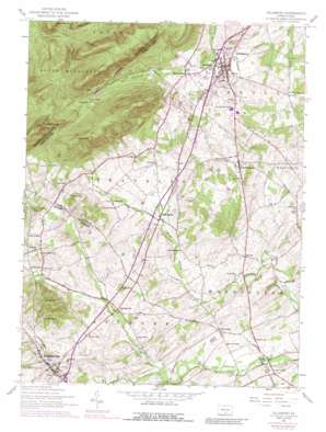
Dillsburg Topo Map Pennsylvania
To zoom in, hover over the map of Dillsburg
USGS Topo Quad 40077a1 - 1:24,000 scale
| Topo Map Name: | Dillsburg |
| USGS Topo Quad ID: | 40077a1 |
| Print Size: | ca. 21 1/4" wide x 27" high |
| Southeast Coordinates: | 40° N latitude / 77° W longitude |
| Map Center Coordinates: | 40.0625° N latitude / 77.0625° W longitude |
| U.S. State: | PA |
| Filename: | o40077a1.jpg |
| Download Map JPG Image: | Dillsburg topo map 1:24,000 scale |
| Map Type: | Topographic |
| Topo Series: | 7.5´ |
| Map Scale: | 1:24,000 |
| Source of Map Images: | United States Geological Survey (USGS) |
| Alternate Map Versions: |
Dillsburg PA 1952, updated 1958 Download PDF Buy paper map Dillsburg PA 1952, updated 1958 Download PDF Buy paper map Dillsburg PA 1952, updated 1969 Download PDF Buy paper map Dillsburg PA 1952, updated 1974 Download PDF Buy paper map Dillsburg PA 1952, updated 1988 Download PDF Buy paper map Dillsburg PA 2010 Download PDF Buy paper map Dillsburg PA 2013 Download PDF Buy paper map Dillsburg PA 2016 Download PDF Buy paper map |
1:24,000 Topo Quads surrounding Dillsburg
> Back to 40077a1 at 1:100,000 scale
> Back to 40076a1 at 1:250,000 scale
> Back to U.S. Topo Maps home
Dillsburg topo map: Gazetteer
Dillsburg: Airports
Bermudian Valley Airpark elevation 141m 462′Dillsburg: Parks
State Game Lands Number 243 elevation 181m 593′State Game Lands Number 305 elevation 270m 885′
Dillsburg: Populated Places
Beavertown elevation 175m 574′Bermudian elevation 152m 498′
Chestnut Hill elevation 178m 583′
Clear Spring elevation 158m 518′
Deardorffs Mill elevation 154m 505′
Dillsburg elevation 173m 567′
Franklintown elevation 211m 692′
Homewood elevation 169m 554′
Latimore elevation 195m 639′
Uniontown elevation 177m 580′
York Springs elevation 187m 613′
Dillsburg: Streams
Latimore Creek elevation 143m 469′Wolf Run elevation 133m 436′
Dillsburg: Summits
Boners Hill elevation 271m 889′Center Point Knob elevation 322m 1056′
Long Mountain elevation 479m 1571′
Stone Head elevation 418m 1371′
White Rocks elevation 325m 1066′
Dillsburg digital topo map on disk
Buy this Dillsburg topo map showing relief, roads, GPS coordinates and other geographical features, as a high-resolution digital map file on DVD:
Atlantic Coast (NY, NJ, PA, DE, MD, VA, NC)
Buy digital topo maps: Atlantic Coast (NY, NJ, PA, DE, MD, VA, NC)


