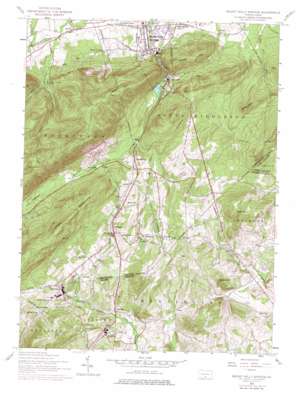
Mount Holly Springs Topo Map Pennsylvania
To zoom in, hover over the map of Mount Holly Springs
USGS Topo Quad 40077a2 - 1:24,000 scale
| Topo Map Name: | Mount Holly Springs |
| USGS Topo Quad ID: | 40077a2 |
| Print Size: | ca. 21 1/4" wide x 27" high |
| Southeast Coordinates: | 40° N latitude / 77.125° W longitude |
| Map Center Coordinates: | 40.0625° N latitude / 77.1875° W longitude |
| U.S. State: | PA |
| Filename: | o40077a2.jpg |
| Download Map JPG Image: | Mount Holly Springs topo map 1:24,000 scale |
| Map Type: | Topographic |
| Topo Series: | 7.5´ |
| Map Scale: | 1:24,000 |
| Source of Map Images: | United States Geological Survey (USGS) |
| Alternate Map Versions: |
Mount Holly Springs PA 1952, updated 1958 Download PDF Buy paper map Mount Holly Springs PA 1952, updated 1967 Download PDF Buy paper map Mount Holly Springs PA 1952, updated 1969 Download PDF Buy paper map Mount Holly Springs PA 1952, updated 1974 Download PDF Buy paper map Mount Holly Springs PA 1952, updated 1979 Download PDF Buy paper map Mount Holly Springs PA 1952, updated 1984 Download PDF Buy paper map Mount Holly Springs PA 2010 Download PDF Buy paper map Mount Holly Springs PA 2013 Download PDF Buy paper map Mount Holly Springs PA 2016 Download PDF Buy paper map |
1:24,000 Topo Quads surrounding Mount Holly Springs
> Back to 40077a1 at 1:100,000 scale
> Back to 40076a1 at 1:250,000 scale
> Back to U.S. Topo Maps home
Mount Holly Springs topo map: Gazetteer
Mount Holly Springs: Dams
Highlands Farm Dam elevation 273m 895′Upper Mount Holly Dam elevation 180m 590′
Wolff Farm Dam elevation 241m 790′
Mount Holly Springs: Populated Places
Barnitz elevation 167m 547′Carlisle Junction elevation 165m 541′
Gardners elevation 264m 866′
Gargol elevation 235m 770′
Goodyear elevation 264m 866′
Hunters Run elevation 215m 705′
Idaville elevation 245m 803′
Mount Holly Springs elevation 168m 551′
Mount Tabor elevation 329m 1079′
Myerstown elevation 278m 912′
Peach Glen elevation 300m 984′
Starners elevation 300m 984′
Toland elevation 203m 666′
Upper Mill elevation 180m 590′
Uriah elevation 299m 980′
Mount Holly Springs: Reservoirs
Mount Holly Springs Lake elevation 180m 590′Mount Holly Springs Reservoir elevation 211m 692′
Mount Holly Springs: Ridges
Rocky Ridge elevation 356m 1167′Mount Holly Springs: Springs
Whiskey Spring elevation 280m 918′Whisky Spring elevation 246m 807′
Mount Holly Springs: Streams
Cold Spring Run elevation 164m 538′Hunters Run elevation 187m 613′
Spruce Run elevation 213m 698′
Tagg Run elevation 201m 659′
Mount Holly Springs: Summits
Big Hill elevation 398m 1305′Fickels Hill elevation 383m 1256′
Hammonds Rocks elevation 462m 1515′
Keller Hill elevation 389m 1276′
Mount Holly elevation 459m 1505′
Snyders Hill elevation 318m 1043′
The Peak elevation 383m 1256′
Mount Holly Springs digital topo map on disk
Buy this Mount Holly Springs topo map showing relief, roads, GPS coordinates and other geographical features, as a high-resolution digital map file on DVD:
Atlantic Coast (NY, NJ, PA, DE, MD, VA, NC)
Buy digital topo maps: Atlantic Coast (NY, NJ, PA, DE, MD, VA, NC)


