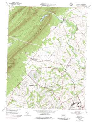
Roxbury Topo Map Pennsylvania
To zoom in, hover over the map of Roxbury
USGS Topo Quad 40077a6 - 1:24,000 scale
| Topo Map Name: | Roxbury |
| USGS Topo Quad ID: | 40077a6 |
| Print Size: | ca. 21 1/4" wide x 27" high |
| Southeast Coordinates: | 40° N latitude / 77.625° W longitude |
| Map Center Coordinates: | 40.0625° N latitude / 77.6875° W longitude |
| U.S. State: | PA |
| Filename: | o40077a6.jpg |
| Download Map JPG Image: | Roxbury topo map 1:24,000 scale |
| Map Type: | Topographic |
| Topo Series: | 7.5´ |
| Map Scale: | 1:24,000 |
| Source of Map Images: | United States Geological Survey (USGS) |
| Alternate Map Versions: |
Roxbury PA 1966, updated 1968 Download PDF Buy paper map Roxbury PA 1966, updated 1973 Download PDF Buy paper map Roxbury PA 1966, updated 1986 Download PDF Buy paper map Roxbury PA 1966, updated 1986 Download PDF Buy paper map Roxbury PA 2010 Download PDF Buy paper map Roxbury PA 2013 Download PDF Buy paper map Roxbury PA 2016 Download PDF Buy paper map |
1:24,000 Topo Quads surrounding Roxbury
> Back to 40077a1 at 1:100,000 scale
> Back to 40076a1 at 1:250,000 scale
> Back to U.S. Topo Maps home
Roxbury topo map: Gazetteer
Roxbury: Lakes
Cedar Lake elevation 294m 964′Roxbury: Parks
Benders Park elevation 199m 652′State Game Lands Number 76 elevation 300m 984′
Roxbury: Populated Places
Keefers elevation 215m 705′Lurgan elevation 224m 734′
Maple Grove elevation 238m 780′
Pleasant Hall elevation 214m 702′
Roxbury elevation 226m 741′
Upper Strasburg elevation 221m 725′
Roxbury: Ranges
Blue Mountain elevation 346m 1135′Roxbury: Reservoirs
Letterkenny Reservoir elevation 254m 833′Roxbury: Streams
Dothan Run elevation 312m 1023′Keasey Run elevation 194m 636′
Lehman Run elevation 189m 620′
Pine Run elevation 273m 895′
Trout Run elevation 272m 892′
Roxbury: Summits
Clarks Knob elevation 709m 2326′Timmons Mountain elevation 594m 1948′
Roxbury: Valleys
Gunter Valley elevation 271m 889′Horse Valley elevation 269m 882′
Roxbury digital topo map on disk
Buy this Roxbury topo map showing relief, roads, GPS coordinates and other geographical features, as a high-resolution digital map file on DVD:
Atlantic Coast (NY, NJ, PA, DE, MD, VA, NC)
Buy digital topo maps: Atlantic Coast (NY, NJ, PA, DE, MD, VA, NC)


