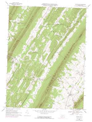
Shade Gap Topo Map Pennsylvania
To zoom in, hover over the map of Shade Gap
USGS Topo Quad 40077b7 - 1:24,000 scale
| Topo Map Name: | Shade Gap |
| USGS Topo Quad ID: | 40077b7 |
| Print Size: | ca. 21 1/4" wide x 27" high |
| Southeast Coordinates: | 40.125° N latitude / 77.75° W longitude |
| Map Center Coordinates: | 40.1875° N latitude / 77.8125° W longitude |
| U.S. State: | PA |
| Filename: | o40077b7.jpg |
| Download Map JPG Image: | Shade Gap topo map 1:24,000 scale |
| Map Type: | Topographic |
| Topo Series: | 7.5´ |
| Map Scale: | 1:24,000 |
| Source of Map Images: | United States Geological Survey (USGS) |
| Alternate Map Versions: |
Shade Gap PA 1966, updated 1969 Download PDF Buy paper map Shade Gap PA 1966, updated 1973 Download PDF Buy paper map Shade Gap PA 1966, updated 1990 Download PDF Buy paper map Shade Gap PA 1966, updated 1990 Download PDF Buy paper map Shade Gap PA 2010 Download PDF Buy paper map Shade Gap PA 2013 Download PDF Buy paper map Shade Gap PA 2016 Download PDF Buy paper map |
1:24,000 Topo Quads surrounding Shade Gap
> Back to 40077a1 at 1:100,000 scale
> Back to 40076a1 at 1:250,000 scale
> Back to U.S. Topo Maps home
Shade Gap topo map: Gazetteer
Shade Gap: Parks
Harpers Memorial Park elevation 303m 994′State Game Lands Number 251 elevation 384m 1259′
Shade Gap: Populated Places
Dry Run elevation 274m 898′Neelyton elevation 299m 980′
Nossville elevation 259m 849′
Shade Gap elevation 302m 990′
Spring Run elevation 251m 823′
Stony Point elevation 330m 1082′
Shade Gap: Ridges
Hunting Ridge elevation 359m 1177′Jerrys Ridge elevation 350m 1148′
Pine Ridge elevation 356m 1167′
Shade Gap: Streams
Beech Lick elevation 261m 856′Dry Run elevation 241m 790′
Felix Run elevation 273m 895′
Parsons Run elevation 275m 902′
Shade Creek elevation 209m 685′
Shade Gap digital topo map on disk
Buy this Shade Gap topo map showing relief, roads, GPS coordinates and other geographical features, as a high-resolution digital map file on DVD:
Atlantic Coast (NY, NJ, PA, DE, MD, VA, NC)
Buy digital topo maps: Atlantic Coast (NY, NJ, PA, DE, MD, VA, NC)


